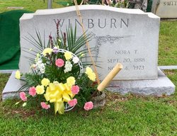
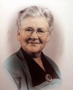
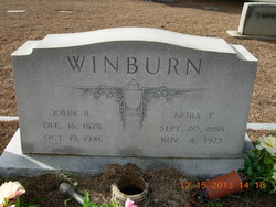
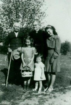
Nora Leo Treacy Winburn
| Birth | : | 20 Sep 1888 Cheraw, Chesterfield County, South Carolina, USA |
| Death | : | 4 Nov 1973 Cheraw, Chesterfield County, South Carolina, USA |
| Burial | : | Patrick Cemetery, Patrick, Chesterfield County, USA |
| Coordinate | : | 34.5746994, -80.0567017 |
| Plot | : | Old Part Section OP |
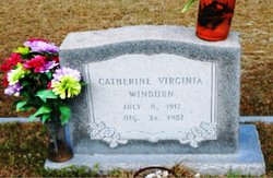
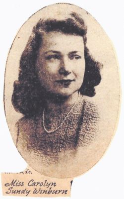
| Description | : | Children: in order of oldest to youngest: Ellen Turnage Winburn (Huggins) "Ellen" Edward Treacy Winburn "Treacy" Catherine Virginia Winburn " Catherine" John William Winburn "John William" James Noel Winburn " Buck" Cornelius Sundy Winburn " Bean" Carolyn Sundy Winburn "Creek" SOURCE: THE STATE Columbia, S. C., Monday, November 5, 1973 MRS. NORA T. WINBURN Cheraw--Mrs. Nora Treacy Winburn, 85, died Sunday in a Chesterfield County hospital after a long illness. Born in Cheraw, she was a daughter of Catherine Virginia Sundy and Patrick Edward Treacy. Surviving are three daughters; Mrs. Ellen W. Huggins and Miss Catherine V. Winburn of Patrick and Mrs.... Read More |
frequently asked questions (FAQ):
-
Where is Nora Leo Treacy Winburn's memorial?
Nora Leo Treacy Winburn's memorial is located at: Patrick Cemetery, Patrick, Chesterfield County, USA.
-
When did Nora Leo Treacy Winburn death?
Nora Leo Treacy Winburn death on 4 Nov 1973 in Cheraw, Chesterfield County, South Carolina, USA
-
Where are the coordinates of the Nora Leo Treacy Winburn's memorial?
Latitude: 34.5746994
Longitude: -80.0567017
Family Members:
Parent
Spouse
Siblings
Children
Flowers:
Nearby Cemetories:
1. Patrick Cemetery
Patrick, Chesterfield County, USA
Coordinate: 34.5746994, -80.0567017
2. Polson Cemetery
Patrick, Chesterfield County, USA
Coordinate: 34.5778480, -80.0467570
3. Morning Star Baptist Church Cemetery
Patrick, Chesterfield County, USA
Coordinate: 34.5772100, -80.0437200
4. Mount Olive Church Cemetery
Patrick, Chesterfield County, USA
Coordinate: 34.5808400, -80.0330600
5. Ainsley Polson Cemetery
Patrick, Chesterfield County, USA
Coordinate: 34.5858600, -80.0204810
6. Huggins-McLain Cemetery
Patrick, Chesterfield County, USA
Coordinate: 34.5917015, -80.0924988
7. Brown Springs Baptist Church Cemetery
Patrick, Chesterfield County, USA
Coordinate: 34.5373690, -80.0374550
8. Pierce Cemetery
Patrick, Chesterfield County, USA
Coordinate: 34.6184529, -80.0608026
9. Griggs Cemetery
Patrick, Chesterfield County, USA
Coordinate: 34.5602630, -80.0050000
10. Bear Creek Cemetery
Patrick, Chesterfield County, USA
Coordinate: 34.6122300, -80.0918340
11. Campbell Cemetery
Patrick, Chesterfield County, USA
Coordinate: 34.5346410, -80.0946370
12. Ganey Cemetery
Patrick, Chesterfield County, USA
Coordinate: 34.5346410, -80.0946370
13. Saint Marys Presbyterian Church Cemetery Old
Patrick, Chesterfield County, USA
Coordinate: 34.5989460, -80.0001400
14. Saint John Freewill Baptist Church Cemetery
Chesterfield County, USA
Coordinate: 34.6128000, -80.1111000
15. Wilkes Chapel United Methodist Church Cemetery
Patrick, Chesterfield County, USA
Coordinate: 34.5296200, -80.1030400
16. Bethlehem Church Cemetery
Middendorf, Chesterfield County, USA
Coordinate: 34.5605030, -80.1267820
17. Fannie Cemetery
Chesterfield County, USA
Coordinate: 34.6352997, -80.0541992
18. Cross Branch Cemetery
Chesterfield County, USA
Coordinate: 34.6324997, -80.0836029
19. Campbell Cemetery
Chesterfield County, USA
Coordinate: 34.5115010, -80.0696270
20. Dixon Family Cemetery
Chesterfield County, USA
Coordinate: 34.5317050, -80.1199300
21. Bethesda United Methodist Church Cemetery
Chesterfield, Chesterfield County, USA
Coordinate: 34.6422005, -80.0468979
22. Cedar Creek Baptist Church Cemetery
Chesterfield County, USA
Coordinate: 34.5063360, -80.0593630
23. Middendorf Church of God
Chesterfield County, USA
Coordinate: 34.5138040, -80.1016560
24. Piney Grove Cemetery
Cheraw, Chesterfield County, USA
Coordinate: 34.5825000, -79.9705600

