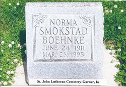
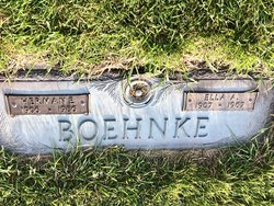
Norma Anna Boehnke Smokstad Boehnke
| Birth | : | 24 Jun 1911 Garner, Hancock County, Iowa, USA |
| Death | : | 28 Mar 1995 Richfield, Hennepin County, Minnesota, USA |
| Burial | : | Leatherwood Cemetery, Leatherwood, Clarion County, USA |
| Coordinate | : | 41.0623000, -79.3534000 |
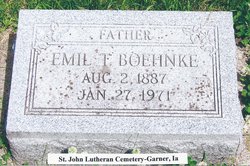
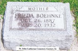
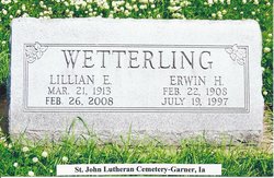
| Description | : | Norma Boehnke was born June 24, 1911,daughter of Emil (E. T.) and Frieda Louisa (Lade) Boehnke and raised in Garner, Iowa. Norma was married to Paul Smokstad, after Paul's death she moved to Richfield in 1953, then returned to Iowa in 1969 for another 17 years. At that time she married Herman Boehnke. After Herman's death she moved to Richfield for the duration of her life. Survivers include her sons, Tom and Douglas,"Sandy", Smokstad; a brother, Raymond (Ruby) Boehnke of Garner, Iowa; and a sister Lillian (Erwin) Wetterling of Mason City, Iowa. ... Read More |
frequently asked questions (FAQ):
-
Where is Norma Anna Boehnke Smokstad Boehnke's memorial?
Norma Anna Boehnke Smokstad Boehnke's memorial is located at: Leatherwood Cemetery, Leatherwood, Clarion County, USA.
-
When did Norma Anna Boehnke Smokstad Boehnke death?
Norma Anna Boehnke Smokstad Boehnke death on 28 Mar 1995 in Richfield, Hennepin County, Minnesota, USA
-
Where are the coordinates of the Norma Anna Boehnke Smokstad Boehnke's memorial?
Latitude: 41.0623000
Longitude: -79.3534000
Family Members:
Parent
Spouse
Siblings
Children
Flowers:
Nearby Cemetories:
1. Leatherwood Cemetery
Leatherwood, Clarion County, USA
Coordinate: 41.0623000, -79.3534000
2. New Bethlehem Mennonite Church Cemetery
Leatherwood, Clarion County, USA
Coordinate: 41.0698000, -79.3725000
3. Salem Cemetery
Frogtown, Clarion County, USA
Coordinate: 41.1060000, -79.3229000
4. Squirrel Hill Cemetery
New Bethlehem, Clarion County, USA
Coordinate: 41.0401000, -79.4128000
5. Middle Run Cemetery
Alcola, Clarion County, USA
Coordinate: 41.0202100, -79.3104600
6. Herman Cemetery
Porter Township, Clarion County, USA
Coordinate: 41.0269000, -79.4059000
7. Frazier Cemetery
Mayport, Clarion County, USA
Coordinate: 41.0720000, -79.2810000
8. New Bethlehem Cemetery
New Bethlehem, Clarion County, USA
Coordinate: 41.0079000, -79.3340000
9. Saint Charles Cemetery
New Bethlehem, Clarion County, USA
Coordinate: 41.0036000, -79.3395000
10. Churchville Cemetery
Curllsville, Clarion County, USA
Coordinate: 41.1017000, -79.4231000
11. Alcola Trinity Cemetery
Alcola, Clarion County, USA
Coordinate: 41.0126419, -79.2946396
12. Limestone Cemetery
Limestone, Clarion County, USA
Coordinate: 41.1265000, -79.3251000
13. Oak Grove Cemetery
Porter Township, Clarion County, USA
Coordinate: 41.0270000, -79.4300000
14. Hawthorn Cemetery
Hawthorn, Clarion County, USA
Coordinate: 41.0225868, -79.2781982
15. Downs Cemetery
Frogtown, Clarion County, USA
Coordinate: 41.1216044, -79.2946898
16. Paradise Cemetery
Shannondale, Clarion County, USA
Coordinate: 41.0842018, -79.2577972
17. Mount Zion Cemetery
Oak Ridge, Armstrong County, USA
Coordinate: 40.9951553, -79.3060226
18. Emmanuel Evangelical Lutheran Cemetery
Redbank Township, Armstrong County, USA
Coordinate: 41.0177850, -79.2715500
19. Living Church Cemetery
Shannondale, Clarion County, USA
Coordinate: 41.0621290, -79.2490830
20. Saint Nicholas Cemetery
Crates, Clarion County, USA
Coordinate: 41.1082993, -79.2675018
21. Curllsville Methodist Episcopal Cemetery
Curllsville, Clarion County, USA
Coordinate: 41.1043000, -79.4511000
22. Associated United Presbyterian Church Cemetery
Toby, Clarion County, USA
Coordinate: 41.0709000, -79.4728000
23. Oakland Cemetery
Distant, Armstrong County, USA
Coordinate: 40.9712296, -79.3455124
24. Shannondale Union Cemetery
Shannondale, Clarion County, USA
Coordinate: 41.0827000, -79.2348000

