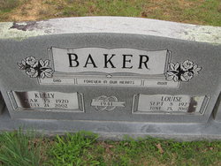
Ola Louise Laxton Baker
| Birth | : | 8 Sep 1923 Golden, McCurtain County, Oklahoma, USA |
| Death | : | 25 Jun 2007 Broken Bow, McCurtain County, Oklahoma, USA |
| Burial | : | Skyview Memorial Lawn, Vallejo, Solano County, USA |
| Coordinate | : | 38.0920460, -122.2080320 |
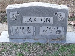
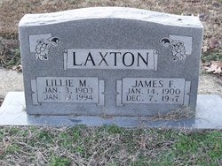
| Description | : | Ola Louise Baker, 83, Broken Bow, OK, passed away Monday, June 25, 2007 at Broken Bow. She was born September 8, 1923 at Golden, OK., the daughter of James and Lilly Mae (Murrell) Laxton. Ola was a member of the First Baptist Church in Wright City. She loved the Lord and served Him as the director of the Young Women's Association with the Frisco Association, Bible School director, Sunday School teacher, Girl's Association teacher. She also enjoyed being a past Matron of Wright City Chapter of the Eastern Star, a Sunbeam teacher, Cub Scout leader, and a Red Cross volunteer. She was... Read More |
frequently asked questions (FAQ):
-
Where is Ola Louise Laxton Baker's memorial?
Ola Louise Laxton Baker's memorial is located at: Skyview Memorial Lawn, Vallejo, Solano County, USA.
-
When did Ola Louise Laxton Baker death?
Ola Louise Laxton Baker death on 25 Jun 2007 in Broken Bow, McCurtain County, Oklahoma, USA
-
Where are the coordinates of the Ola Louise Laxton Baker's memorial?
Latitude: 38.0920460
Longitude: -122.2080320
Family Members:
Parent
Spouse
Siblings
Flowers:
Nearby Cemetories:
1. Skyview Memorial Lawn
Vallejo, Solano County, USA
Coordinate: 38.0920460, -122.2080320
2. Carquinez Cemetery
Vallejo, Solano County, USA
Coordinate: 38.0889015, -122.2108002
3. All Souls Catholic Cemetery
Vallejo, Solano County, USA
Coordinate: 38.0881690, -122.2077890
4. Saint Vincents Cemetery
Vallejo, Solano County, USA
Coordinate: 38.0881004, -122.2089005
5. Glen Cove Sacred Indian Burial Grounds
Vallejo, Solano County, USA
Coordinate: 38.0680620, -122.2064640
6. Good Templar Orphanage Cemetery
Vallejo, Solano County, USA
Coordinate: 38.1177930, -122.2411880
7. Mare Island Cemetery
Vallejo, Solano County, USA
Coordinate: 38.0796738, -122.2527008
8. Rags Gravesite
Crockett, Contra Costa County, USA
Coordinate: 38.0561765, -122.2257217
9. Sunrise Memorial Cemetery
Vallejo, Solano County, USA
Coordinate: 38.1194000, -122.2605972
10. Hillside Cemetery
Vallejo, Solano County, USA
Coordinate: 38.1185989, -122.2647018
11. Benicia City Cemetery
Benicia, Solano County, USA
Coordinate: 38.0576610, -122.1535930
12. Saint Dominics Catholic Cemetery
Benicia, Solano County, USA
Coordinate: 38.0583730, -122.1402900
13. Benicia Army Cemetery
Benicia, Solano County, USA
Coordinate: 38.0510820, -122.1419030
14. Alhambra Cemetery
Martinez, Contra Costa County, USA
Coordinate: 38.0182991, -122.1442032
15. Saint Catherine of Siena Cemetery
Martinez, Contra Costa County, USA
Coordinate: 38.0172005, -122.1446991
16. Muir-Strentzel Hanna Cemetery
Martinez, Contra Costa County, USA
Coordinate: 37.9784393, -122.1232681
17. Gan Shalom Cemetery
Contra Costa County, USA
Coordinate: 37.9528122, -122.1975098
18. Pacheco Cemetery and Crematory
Pacheco, Contra Costa County, USA
Coordinate: 37.9994011, -122.0729980
19. Rolling Hills Memorial Park
Richmond, Contra Costa County, USA
Coordinate: 37.9756012, -122.3146973
20. Port Chicago Naval Magazine National Memorial
Concord, Contra Costa County, USA
Coordinate: 38.0574610, -122.0296950
21. Memory Gardens Cemetery
Concord, Contra Costa County, USA
Coordinate: 38.0093994, -122.0381012
22. Solano Community College
Fairfield, Solano County, USA
Coordinate: 38.2355700, -122.1254500
23. Saint Joseph Catholic Cemetery
San Pablo, Contra Costa County, USA
Coordinate: 37.9612700, -122.3336600
24. Queen of Heaven Cemetery
Lafayette, Contra Costa County, USA
Coordinate: 37.9446983, -122.1057968

