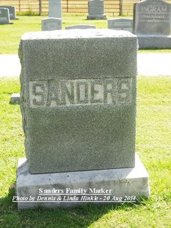
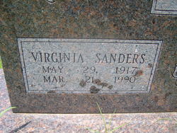
| Birth | : | 4 May 1888 Plumerville, Conway County, Arkansas, USA |
| Death | : | 18 Oct 1977 Springdale, Washington County, Arkansas, USA |
| Burial | : | Park View Cemetery, Medford, Burlington County, USA |
| Coordinate | : | 39.8983955, -74.8207779 |
| Description | : | Henry A Sanders married Olive May Rainwater in Crawford Co on 10 March 1914. Henry was listed as a resident of Springdale; Olive was a resident of Russellville, Pope Co, Arkansas. Her obituary of 19 Oct 1977 in the Northwest Ark Times noted that she was born 04 May 1888 in Plummersville, Conway Co, Arkansas to Jackson and Nancy Howell Rainwater. She was survived by two daughters, Mrs Virginia Lane of Springdale and Mrs Bernelle Bylund of Cypress, California. [Thank you Dennis for the information] |
frequently asked questions (FAQ):
-
Where is Olive May Rainwater Sanders's memorial?
Olive May Rainwater Sanders's memorial is located at: Park View Cemetery, Medford, Burlington County, USA.
-
When did Olive May Rainwater Sanders death?
Olive May Rainwater Sanders death on 18 Oct 1977 in Springdale, Washington County, Arkansas, USA
-
Where are the coordinates of the Olive May Rainwater Sanders's memorial?
Latitude: 39.8983955
Longitude: -74.8207779
Family Members:
Spouse
Children
Flowers:
Nearby Cemetories:
1. Park View Cemetery
Medford, Burlington County, USA
Coordinate: 39.8983955, -74.8207779
2. Medford Friends Hicksite Burial Ground
Medford, Burlington County, USA
Coordinate: 39.8978940, -74.8219260
3. Medford Baptist Cemetery
Medford, Burlington County, USA
Coordinate: 39.8997536, -74.8187943
4. Medford Methodist Cemetery
Medford, Burlington County, USA
Coordinate: 39.9008408, -74.8200302
5. Medford Friends Meeting Cemetery
Medford, Burlington County, USA
Coordinate: 39.8992081, -74.8255463
6. Stratton Burying Ground
Medford, Burlington County, USA
Coordinate: 39.8839836, -74.8203583
7. Saint Peters Episcopal Church Garden
Medford, Burlington County, USA
Coordinate: 39.8849360, -74.8337860
8. Peacock Cemetery
Chairville, Burlington County, USA
Coordinate: 39.8988991, -74.7889023
9. Park View Cemetery at Kirbys Mill
Medford, Burlington County, USA
Coordinate: 39.9222300, -74.8076800
10. Haines Family Farm Cemetery
Medford, Burlington County, USA
Coordinate: 39.9235020, -74.8079980
11. Mount Laurel Friends Burying Ground
Mount Laurel, Burlington County, USA
Coordinate: 39.9286000, -74.8853920
12. Jacob's Chapel Cemetery
Mount Laurel, Burlington County, USA
Coordinate: 39.9297670, -74.8852350
13. Evergreen Cemetery
Lumberton, Burlington County, USA
Coordinate: 39.9562988, -74.8094025
14. Saint Martin in the Fields Memorial Garden
Lumberton, Burlington County, USA
Coordinate: 39.9581480, -74.8081230
15. Vincentown Baptist Cemetery
Vincentown, Burlington County, USA
Coordinate: 39.9395400, -74.7609690
16. Old Lumberton Cemetery
Lumberton, Burlington County, USA
Coordinate: 39.9590988, -74.8058014
17. Eldridge Cemetery
Mount Laurel, Burlington County, USA
Coordinate: 39.9268837, -74.8968887
18. Evesham Friends Cemetery
Mount Laurel, Burlington County, USA
Coordinate: 39.9351130, -74.8915510
19. Mount Laurel Cemetery
Mount Laurel, Burlington County, USA
Coordinate: 39.9272003, -74.8977966
20. Vincentown Friends Cemetery
Vincentown, Burlington County, USA
Coordinate: 39.9352400, -74.7495500
21. Lord of Life Memorial Garden
Tabernacle, Burlington County, USA
Coordinate: 39.8510860, -74.7590690
22. Vincentown Methodist Cemetery
Vincentown, Burlington County, USA
Coordinate: 39.9370900, -74.7488600
23. Marlton Cemetery
Marlton, Burlington County, USA
Coordinate: 39.8767320, -74.9039320
24. Darnell Family Cemetery
Mount Laurel, Burlington County, USA
Coordinate: 39.9535520, -74.8728800


