
| Birth | : | 8 Jan 1902 Davis County, Iowa, USA |
| Death | : | 8 Oct 1984 Davis County, Iowa, USA |
| Burial | : | Mount Peace Cemetery, Akron, Summit County, USA |
| Coordinate | : | 41.0970993, -81.5322037 |
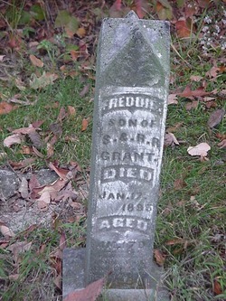
| Description | : | OPAL UTT Bloomfield -- Opal Edith Utt, 84, of Bloomfield Route 1 died October 8, 1984 at the Davis County Hospital in Bloomfield. She was born January 18, 1902, in Davis County to Sherman and Rebecca Christy Grant. She married Ross Utt on December 5, 1925. She was a member of the Locust Ladies Aid Club and Union Star Club. She is survived by her husband; a son, Harold of Bloomfield; three grandchildren and five great grandchildren; two sisters, Ruth Runkle of Bloomfield and Freda Lynch... Read More |
frequently asked questions (FAQ):
-
Where is Opal Edith Grant Utt's memorial?
Opal Edith Grant Utt's memorial is located at: Mount Peace Cemetery, Akron, Summit County, USA.
-
When did Opal Edith Grant Utt death?
Opal Edith Grant Utt death on 8 Oct 1984 in Davis County, Iowa, USA
-
Where are the coordinates of the Opal Edith Grant Utt's memorial?
Latitude: 41.0970993
Longitude: -81.5322037
Family Members:
Parent

Spouse
Siblings
Children
Flowers:


Nearby Cemetories:
1. Mount Peace Cemetery
Akron, Summit County, USA
Coordinate: 41.0970993, -81.5322037
2. Saint Vincents Cemetery
Akron, Summit County, USA
Coordinate: 41.0924988, -81.5361023
3. Saint Bernards Cemetery
Akron, Summit County, USA
Coordinate: 41.0848198, -81.5315170
4. Glendale Cemetery
Akron, Summit County, USA
Coordinate: 41.0847015, -81.5282974
5. Old Dublin Cemetery
Akron, Summit County, USA
Coordinate: 41.0813904, -81.5191727
6. Grace Park Memorial
Akron, Summit County, USA
Coordinate: 41.0838500, -81.5094400
7. Saint Pauls Memorial Gardens
Akron, Summit County, USA
Coordinate: 41.1056137, -81.5606537
8. Infirmary Cemetery
Akron, Summit County, USA
Coordinate: 41.0975370, -81.5634870
9. Spicer Cemetery (Defunct)
Akron, Summit County, USA
Coordinate: 41.0758018, -81.5108032
10. Bettes Cemetery
Akron, Summit County, USA
Coordinate: 41.1029950, -81.4851020
11. South Street Jewish Cemetery
Akron, Summit County, USA
Coordinate: 41.0612790, -81.5401000
12. Chestnut Hill Memorial Park
Cuyahoga Falls, Summit County, USA
Coordinate: 41.1333008, -81.5177994
13. Akron Hebrew Cemetery
Akron, Summit County, USA
Coordinate: 41.0643997, -81.5618973
14. Middlebury Cemetery
Akron, Summit County, USA
Coordinate: 41.0733986, -81.4784012
15. Mount Hope Cemetery
Akron, Summit County, USA
Coordinate: 41.0490990, -81.5266037
16. East Akron Cemetery
Akron, Summit County, USA
Coordinate: 41.0681000, -81.4805984
17. Grace Cathedral Churchyard
Cuyahoga Falls, Summit County, USA
Coordinate: 41.1475890, -81.5091940
18. Saint Johns Episcopal Church Columbarium
Cuyahoga Falls, Summit County, USA
Coordinate: 41.1369110, -81.4845210
19. Oakwood Cemetery
Cuyahoga Falls, Summit County, USA
Coordinate: 41.1425018, -81.4878006
20. Watson Park Vietnam Memory Garden
Akron, Summit County, USA
Coordinate: 41.0695100, -81.4627300
21. Infirmary Cemetery
Tallmadge, Summit County, USA
Coordinate: 41.1003340, -81.4492790
22. Old Springfield Cemetery
Akron, Summit County, USA
Coordinate: 41.0501780, -81.4722920
23. Harrington Cemetery
Cuyahoga Falls, Summit County, USA
Coordinate: 41.1618996, -81.5083008
24. Greenlawn Memorial Park
Akron, Summit County, USA
Coordinate: 41.0433006, -81.5860977