


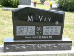
Orval D McVay
| Birth | : | 26 Oct 1911 Montgomery County, Iowa, USA |
| Death | : | 13 Feb 1993 Denison, Crawford County, Iowa, USA |
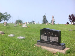
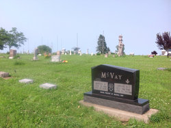
| Burial | : | Farm Creek Cemetery, Henderson, Mills County, USA |
| Coordinate | : | 41.1319008, -95.4186020 |
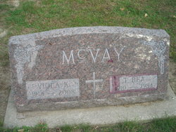
| Inscription | : | Oct. 26, 1944 Loving parents of Russell Dea |
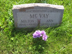
| Description | : | Son of Asa McVay and Emily Ann Guffey McVay. Husband of Myrtle Alice Prine. They were married on October 26, 1944, in Shenondoah, Fremont, Iowa. One son was born to this union: Russell Dea McVay |
frequently asked questions (FAQ):
-
Where is Orval D McVay's memorial?
Orval D McVay's memorial is located at: Farm Creek Cemetery, Henderson, Mills County, USA.
-
When did Orval D McVay death?
Orval D McVay death on 13 Feb 1993 in Denison, Crawford County, Iowa, USA
-
Where are the coordinates of the Orval D McVay's memorial?
Latitude: 41.1319008
Longitude: -95.4186020
Family Members:
Parent

Spouse
Siblings

Children
Flowers:


Nearby Cemetories:
1. Farm Creek Cemetery
Henderson, Mills County, USA
Coordinate: 41.1319008, -95.4186020
2. Saylers Farm Cemetery
Henderson, Mills County, USA
Coordinate: 41.1083300, -95.4919440
3. Macedonia Cemetery
Macedonia, Pottawattamie County, USA
Coordinate: 41.1921997, -95.4167023
4. Buckner Cemetery
Wales, Montgomery County, USA
Coordinate: 41.1595600, -95.3440700
5. Wesley Chapel Cemetery
Henderson, Mills County, USA
Coordinate: 41.1019249, -95.4987793
6. Old Town Cemetery
Macedonia, Pottawattamie County, USA
Coordinate: 41.2030983, -95.4421997
7. Mormon Cemetery
Macedonia, Pottawattamie County, USA
Coordinate: 41.1885986, -95.3557663
8. Gomer Cemetery
Wales, Montgomery County, USA
Coordinate: 41.1171989, -95.3082962
9. Lowens Cemetery
Garfield Township, Montgomery County, USA
Coordinate: 41.0527728, -95.3758292
10. Cotten Cemetery
Mills County, USA
Coordinate: 41.0845000, -95.5167000
11. Bradway Farm Cemetery
Macedonia, Pottawattamie County, USA
Coordinate: 41.2083300, -95.3336500
12. Emerson Cemetery
Emerson, Mills County, USA
Coordinate: 41.0325012, -95.4021988
13. Wheeler Grove Cemetery
Macedonia, Pottawattamie County, USA
Coordinate: 41.2131691, -95.3393631
14. Center Ridge Cemetery
Montgomery County, USA
Coordinate: 41.1452141, -95.2787018
15. Carson Cemetery
Carson, Pottawattamie County, USA
Coordinate: 41.2392006, -95.4044037
16. North Grove Cemetery
Hastings, Mills County, USA
Coordinate: 41.0161018, -95.4618988
17. Wearin Cemetery
Malvern, Mills County, USA
Coordinate: 41.0395000, -95.5313000
18. Hastings Cemetery
Hastings, Mills County, USA
Coordinate: 41.0097008, -95.4993973
19. L Laire Property Cemetery (Defunct)
Sherman Township, Montgomery County, USA
Coordinate: 41.0958257, -95.2224927
20. East Liberty Cemetery
Malvern, Mills County, USA
Coordinate: 41.0592346, -95.6005020
21. Belknap Cemetery
Oakland, Pottawattamie County, USA
Coordinate: 41.2924995, -95.4424973
22. South Grove Cemetery
Mills County, USA
Coordinate: 40.9775009, -95.4931030
23. Silver City Cemetery
Silver City, Mills County, USA
Coordinate: 41.1042442, -95.6380005
24. Saint Marys Cemetery
Red Oak, Montgomery County, USA
Coordinate: 41.0447006, -95.2275009