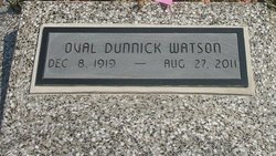
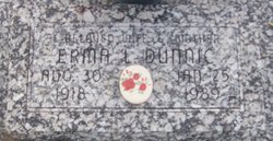
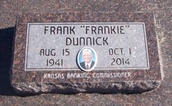
Oval Kennedy Watson
| Birth | : | 8 Dec 1919 West Mineral, Cherokee County, Kansas, USA |
| Death | : | 27 Aug 2011 Pittsburg, Crawford County, Kansas, USA |
| Burial | : | McCune Cemetery, McCune, Crawford County, USA |
| Coordinate | : | 37.3555984, -95.0333023 |
| Plot | : | Section 7, Row 14, Lot 154 |
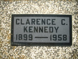
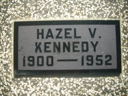
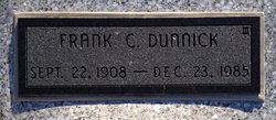
| Description | : | FRONTENAC — Oval (Dunnick) Watson of Frontenac died at 7:45 a.m. Saturday, Aug. 27, 2011, at Via Christi Hospital at Pittsburg. Mrs. Watson was born at West Mineral to Clarence and Hazel West Kennedy. She was raised in West Mineral and graduated from West Mineral High School. She was a homemaker and also worked for McCune Mutual Telephone, later Craw-Kan Telephone Cooperative, as an operator. She also worked at Brodrick's and the Kansas Army Ammunition Plant in Parsons, where she retired. She married Frank C. Dunnick on Sept. 14, 1940, at Fort Scott. He preceded her in death on Dec. 23, 1985. She married... Read More |
frequently asked questions (FAQ):
-
Where is Oval Kennedy Watson's memorial?
Oval Kennedy Watson's memorial is located at: McCune Cemetery, McCune, Crawford County, USA.
-
When did Oval Kennedy Watson death?
Oval Kennedy Watson death on 27 Aug 2011 in Pittsburg, Crawford County, Kansas, USA
-
Where are the coordinates of the Oval Kennedy Watson's memorial?
Latitude: 37.3555984
Longitude: -95.0333023
Family Members:
Parent
Spouse
Siblings
Children
Flowers:
Nearby Cemetories:
1. McCune Cemetery
McCune, Crawford County, USA
Coordinate: 37.3555984, -95.0333023
2. Harley Cemetery
Sherman, Cherokee County, USA
Coordinate: 37.3260994, -95.0550003
3. Rigney Cemetery
Cherokee County, USA
Coordinate: 37.3394012, -94.9944000
4. Jacksonville Cemetery
Strauss, Labette County, USA
Coordinate: 37.3704000, -95.0974600
5. Monmouth Cemetery
Monmouth, Crawford County, USA
Coordinate: 37.3539009, -94.9492035
6. Dumbauld Cemetery
Crawford County, USA
Coordinate: 37.4207993, -95.0792007
7. Mount Carmel Cemetery
McCune, Crawford County, USA
Coordinate: 37.4272003, -94.9966965
8. Osage Brethren Cemetery
Crawford County, USA
Coordinate: 37.4039001, -94.9452972
9. Richland Cemetery
Neosho County, USA
Coordinate: 37.4024162, -95.1253357
10. Frogge Cemetery
McCune, Crawford County, USA
Coordinate: 37.4352989, -95.0777969
11. Hinman Cemetery
Labette County, USA
Coordinate: 37.2812790, -95.0935470
12. Star Cemetery
West Mineral, Cherokee County, USA
Coordinate: 37.2771988, -94.9606018
13. Center Cemetery
Labette County, USA
Coordinate: 37.3396730, -95.1576630
14. Sherman City Cemetery
Sherman, Cherokee County, USA
Coordinate: 37.2555400, -95.0566300
15. Fairview Cemetery
Parsons, Labette County, USA
Coordinate: 37.2963700, -95.1408800
16. Borland Cemetery
Columbus, Cherokee County, USA
Coordinate: 37.2599983, -94.9772034
17. Valley Cemetery
Saint Paul, Neosho County, USA
Coordinate: 37.4420013, -95.1149979
18. Old Oak Grove Cemetery
Neosho County, USA
Coordinate: 37.4050751, -95.1635742
19. Oak Grove Cemetery
Neosho County, USA
Coordinate: 37.3968925, -95.1700974
20. Franklin Cemetery
Montana, Labette County, USA
Coordinate: 37.3182983, -95.1746979
21. Montana Cemetery
Montana, Labette County, USA
Coordinate: 37.2661157, -95.1315282
22. Mitchell Cemetery
Oswego, Labette County, USA
Coordinate: 37.2517014, -95.1213989
23. Brown Cemetery
Neosho County, USA
Coordinate: 37.4244003, -95.1725006
24. Friendship Friends Church Cemetery
Hallowell, Cherokee County, USA
Coordinate: 37.2228300, -95.0264600

