
| Birth | : | 1 Apr 1693 Hanover, Region Hannover, Lower Saxony (Niedersachsen), Germany |
| Death | : | 16 Sep 1778 Isleworth, London Borough of Hounslow, Greater London, England |
| Burial | : | Grosvenor Chapel, Mayfair, City of Westminster, England |
| Coordinate | : | 51.5089780, -0.1512960 |
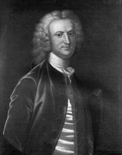
| Description | : | Her titles, Baroness Aldborough and Countess of Walsingham, were created as a life peerage in 1722. After her marriage to Philip Dormer Stanhope in 1733 at Isleworth, she was styled Countess of Chesterfield. |
frequently asked questions (FAQ):
-
Where is Petronilla Melusina von der Schulenburg Stanhope's memorial?
Petronilla Melusina von der Schulenburg Stanhope's memorial is located at: Grosvenor Chapel, Mayfair, City of Westminster, England.
-
When did Petronilla Melusina von der Schulenburg Stanhope death?
Petronilla Melusina von der Schulenburg Stanhope death on 16 Sep 1778 in Isleworth, London Borough of Hounslow, Greater London, England
-
Where are the coordinates of the Petronilla Melusina von der Schulenburg Stanhope's memorial?
Latitude: 51.5089780
Longitude: -0.1512960
Family Members:
Parent

Spouse
Children


Nearby Cemetories:
1. Grosvenor Chapel
Mayfair, City of Westminster, England
Coordinate: 51.5089780, -0.1512960
2. St. George's Mount Street Burial Ground
Mayfair, City of Westminster, England
Coordinate: 51.5092230, -0.1504790
3. St. George Churchyard
Mayfair, City of Westminster, England
Coordinate: 51.5125140, -0.1429070
4. Hyde Park Memorials
Westminster, City of Westminster, England
Coordinate: 51.5087160, -0.1634220
5. London Palladium
Soho, City of Westminster, England
Coordinate: 51.5146000, -0.1404500
6. St. James Churchyard
Piccadilly, City of Westminster, England
Coordinate: 51.5085907, -0.1367360
7. St. George's Fields Burial Ground
Bayswater, City of Westminster, England
Coordinate: 51.5136400, -0.1654610
8. Marlborough House
City of Westminster, England
Coordinate: 51.5049710, -0.1363050
9. St. Bartholomew-by-the-Exchange
London, City of London, England
Coordinate: 51.5082830, -0.1333593
10. St George Hanover Square Burial Ground
Hyde Park, City of Westminster, England
Coordinate: 51.5132380, -0.1683300
11. St. Mary-le-bone and St. Georges Burying Ground
Marylebone, City of Westminster, England
Coordinate: 51.5206240, -0.1545440
12. St Anne Churchyard
Soho, City of Westminster, England
Coordinate: 51.5123910, -0.1322610
13. St. Anne's Church
London, City of London, England
Coordinate: 51.5124321, -0.1318976
14. St. Marylebone Churchyard
Marylebone, City of Westminster, England
Coordinate: 51.5224470, -0.1516930
15. Westminster Cathedral
Westminster, City of Westminster, England
Coordinate: 51.4957870, -0.1394630
16. St. Martin-in-the-Fields Churchyard
Westminster, City of Westminster, England
Coordinate: 51.5087624, -0.1269620
17. Christchurch Gardens
Westminster, City of Westminster, England
Coordinate: 51.4980100, -0.1344370
18. St Giles in the Fields Churchyard
Holborn, London Borough of Camden, England
Coordinate: 51.5153070, -0.1285300
19. Whitefield’s Tabernacle and Burial Ground
London Borough of Camden, England
Coordinate: 51.5208990, -0.1350780
20. Holy Trinity Brompton Churchyard
Knightsbridge, Royal Borough of Kensington and Chelsea, England
Coordinate: 51.4978570, -0.1699870
21. Whitehall
Westminster, City of Westminster, England
Coordinate: 51.5035300, -0.1262190
22. St Marys Roman Catholic Church
Royal Borough of Kensington and Chelsea, England
Coordinate: 51.4932840, -0.1613680
23. St. Paul's Churchyard
Covent Garden, London Borough of Camden, England
Coordinate: 51.5114594, -0.1239310
24. All Soul's Churchyard
Chelsea, Royal Borough of Kensington and Chelsea, England
Coordinate: 51.4926500, -0.1618090