
| Birth | : | 17 Nov 1953 Mount Airy, Surry County, North Carolina, USA |
| Death | : | 10 Jan 2021 |
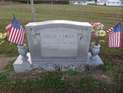
| Burial | : | Blue Ridge Chapel Baptist Church Cemetery, Carroll County, USA |
| Coordinate | : | 36.6073517, -80.8056282 |
| Description | : | Phillip Calvin Smith 1953 - 2021 Phillip Calvin Smith, 67, of Troutville, VA went to be with our Lord on Sunday, January 10, 2021, after succumbing to the effects of a massive stroke. Phillip was born in Mt. Airy, NC to the late Calvin Joseph Smith and the late Barbara Jo Hawks Smith Gray. He moved to Roanoke VA in 1969 with his parents and graduated from Northside High School in 1972. He married his high school sweetheart, Carla Fleming, in 1974. He loved his church, Glade Creek Baptist Church, and his church family where... Read More |
frequently asked questions (FAQ):
-
Where is Phillip Calvin Smith's memorial?
Phillip Calvin Smith's memorial is located at: Blue Ridge Chapel Baptist Church Cemetery, Carroll County, USA.
-
When did Phillip Calvin Smith death?
Phillip Calvin Smith death on 10 Jan 2021 in
-
Where are the coordinates of the Phillip Calvin Smith's memorial?
Latitude: 36.6073517
Longitude: -80.8056282
Family Members:
Parent

Flowers:


Nearby Cemetories:
1. Blue Ridge Chapel Baptist Church Cemetery
Carroll County, USA
Coordinate: 36.6073517, -80.8056282
2. W H Stantliff Cemetery
Lambsburg, Carroll County, USA
Coordinate: 36.5807290, -80.7794670
3. Hawks Family Cemetery
Lambsburg, Carroll County, USA
Coordinate: 36.5960780, -80.7620250
4. Edwards-Upchurch Cemetery
Lambsburg, Carroll County, USA
Coordinate: 36.5750140, -80.7788060
5. Chestnut Grove Primitive Baptist Church Cemetery
Lambsburg, Carroll County, USA
Coordinate: 36.5800740, -80.7686640
6. Fellowship Tabernacle Cemetery
Lambsburg, Carroll County, USA
Coordinate: 36.5769680, -80.7723510
7. Holly Grove Baptist Church Cemetery
Lambsburg, Carroll County, USA
Coordinate: 36.5712840, -80.7810790
8. Stewart Cemetery
Lambsburg, Carroll County, USA
Coordinate: 36.5681860, -80.7855490
9. Cooley Cemetery
Carroll County, USA
Coordinate: 36.6226230, -80.8658980
10. Phillip Haywood McBride Family Cemetery
Lowgap, Surry County, USA
Coordinate: 36.5602950, -80.7678630
11. Good Hope Baptist Church Cemetery
Fancy Gap, Carroll County, USA
Coordinate: 36.6485520, -80.7581560
12. George Jeremiah Edwards Family Cemetery
Cana, Carroll County, USA
Coordinate: 36.5937600, -80.7370100
13. Dillard Family Cemetery
Lowgap, Surry County, USA
Coordinate: 36.5500298, -80.8002243
14. Goodson Cemetery
Grayson County, USA
Coordinate: 36.5688900, -80.8611200
15. Cedar Lane-Easter Cemetery
Cana, Carroll County, USA
Coordinate: 36.5898610, -80.7356070
16. Easter Family Cemetery
Carroll County, USA
Coordinate: 36.5900270, -80.7354860
17. New Hope Cemetery
Fancy Gap, Carroll County, USA
Coordinate: 36.6566800, -80.7632880
18. Johnson-Leftwich Cemetery
Fancy Gap, Carroll County, USA
Coordinate: 36.6331620, -80.7381820
19. Surratt Cemetery
Lambsburg, Carroll County, USA
Coordinate: 36.5790920, -80.7396730
20. Stockner Family Cemetery
Fancy Gap, Carroll County, USA
Coordinate: 36.6409450, -80.7429890
21. Low Family Cemetery
Lowgap, Surry County, USA
Coordinate: 36.5461430, -80.7985910
22. Marion Cemetery
Cana, Carroll County, USA
Coordinate: 36.6055090, -80.7284550
23. Blue Ridge Baptist Church Cemetery
Crooked Oak, Surry County, USA
Coordinate: 36.5490440, -80.7727400
24. Flower Gap Primitive Baptist Church Cemetery
Cana, Carroll County, USA
Coordinate: 36.5900510, -80.7286500