

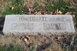
Polena Jane E “Lena” Price Liggett
| Birth | : | 16 Aug 1865 Bedford, Taylor County, Iowa, USA |
| Death | : | 4 Jan 1946 Lawrence, Douglas County, Kansas, USA |
| Burial | : | Greenwood Cemetery, West Point, Clay County, USA |
| Coordinate | : | 33.5946999, -88.6438980 |
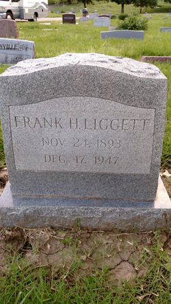
| Description | : | Lawrence Journal World (Lawrence, KS) 04 JAN 1946 Page 2, Column 4 "Mrs. George Liggett "Mrs. George Liggett aged 80 years, died early this morning at the home of her daughter, Mrs. Jacob Reusch at Vinland. Funeral services will be held Monday at 2 p.m. at the Rumsey funeral home, conducted by the Rev. Duncan MacGregor. Burial will be in Oak Hill cemetery. She is survived by three daughters. Mrs. James A. Messer of Lawrence, Mrs. Jacob Reusch, Vinland, Mrs. A. W. Smith, Leavenworth, two sons, Frank Liggett and George Liggett of Lawrence, 12 grandchildren, 14 great grandchildren,... Read More |
frequently asked questions (FAQ):
-
Where is Polena Jane E “Lena” Price Liggett's memorial?
Polena Jane E “Lena” Price Liggett's memorial is located at: Greenwood Cemetery, West Point, Clay County, USA.
-
When did Polena Jane E “Lena” Price Liggett death?
Polena Jane E “Lena” Price Liggett death on 4 Jan 1946 in Lawrence, Douglas County, Kansas, USA
-
Where are the coordinates of the Polena Jane E “Lena” Price Liggett's memorial?
Latitude: 33.5946999
Longitude: -88.6438980
Family Members:
Parent
Spouse
Siblings

Children
Flowers:


Nearby Cemetories:
1. Greenwood Cemetery
West Point, Clay County, USA
Coordinate: 33.5946999, -88.6438980
2. Episcopal Church of the Incarnation
West Point, Clay County, USA
Coordinate: 33.6052250, -88.6506360
3. Westbrook Cemetery
West Point, Clay County, USA
Coordinate: 33.6213989, -88.6572037
4. Pool's Memorial Gardens Cemetery
West Point, Clay County, USA
Coordinate: 33.5785680, -88.6083400
5. New Hope Missionary Baptist Church Cemetery
West Point, Clay County, USA
Coordinate: 33.6228190, -88.6765390
6. Harrell Family Cemetery at God's Acre
West Point, Clay County, USA
Coordinate: 33.5724200, -88.6028500
7. Strong Hill Cemetery
West Point, Clay County, USA
Coordinate: 33.6113930, -88.5981930
8. Davis Family Cemetery
West Point, Clay County, USA
Coordinate: 33.6021810, -88.6940650
9. Gospel Temple Cemetery
West Point, Clay County, USA
Coordinate: 33.6221085, -88.6837006
10. West Point Memorial Gardens Cemetery
West Point, Clay County, USA
Coordinate: 33.6500015, -88.6667023
11. Mayhew Mission Cemetery
Oktibbeha County, USA
Coordinate: 33.5461006, -88.6844025
12. Hampton Cemetery
Clay County, USA
Coordinate: 33.6519012, -88.6113968
13. Strong Cemetery
Clay County, USA
Coordinate: 33.6556015, -88.6196976
14. Moore Family Cemetery
Osborn, Oktibbeha County, USA
Coordinate: 33.5508650, -88.7070800
15. Jones Chapel United Methodist Church Cemetery
Clay County, USA
Coordinate: 33.5250180, -88.6141700
16. Mount Zion Missionary Baptist Church Cemetery
Pheba, Clay County, USA
Coordinate: 33.6663910, -88.6135510
17. Tibbee Community Cemetery
Tibbee, Clay County, USA
Coordinate: 33.5228004, -88.6141968
18. Mount Zion White Cemetery
Clay County, USA
Coordinate: 33.6664950, -88.6135290
19. McPherson Cemetery
Clay County, USA
Coordinate: 33.6219020, -88.7457600
20. Peterson Cemetery
Siloam, Clay County, USA
Coordinate: 33.6323960, -88.7414200
21. Strong Cemetery
Strong, Monroe County, USA
Coordinate: 33.6817017, -88.6117020
22. Greenwood MB Church Cemetery
Monroe County, USA
Coordinate: 33.6837730, -88.6667380
23. Towncreek M.B. Church Cemetery
Vinton, Clay County, USA
Coordinate: 33.6366900, -88.5452300
24. Paine Chapel Cemetery
Prairie, Monroe County, USA
Coordinate: 33.6875000, -88.6316986