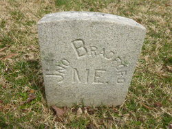
Pvt John Bradford
| Birth | : | 1844 Alton, Penobscot County, Maine, USA |
| Death | : | 20 May 1864 Fredericksburg, Fredericksburg City, Virginia, USA |
| Burial | : | Crowle Cemetery, Crowle, North Lincolnshire Unitary Authority, England |
| Coordinate | : | 53.6090660, -0.8285680 |
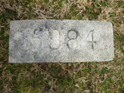
| Plot | : | Grave 5984 |
| Description | : | Source: in book "Civil War Burials Fredericksburg, Virginia" compiled and edited by Maude E. Mercer Sellman 1979 p 75. 1st Maine Heavy Art. Find A Grave contributor Phd sent: Could you pls change his regiment to Co E 1st Maine Heavy Artillery, not Mass Artillery(ME State Archives, Civil War Database, Fredericksburg Roster Of Known Union Soldiers) and link his father Lewis #53948016 and mother Sarah #53948042? Thanks Phd |
frequently asked questions (FAQ):
-
Where is Pvt John Bradford's memorial?
Pvt John Bradford's memorial is located at: Crowle Cemetery, Crowle, North Lincolnshire Unitary Authority, England.
-
When did Pvt John Bradford death?
Pvt John Bradford death on 20 May 1864 in Fredericksburg, Fredericksburg City, Virginia, USA
-
Where are the coordinates of the Pvt John Bradford's memorial?
Latitude: 53.6090660
Longitude: -0.8285680
Family Members:
Parent
Flowers:
Left by Anonymous on 11 Jan 2007
Pvt John Bradford was b. 1844 Alton, Penobscot, ME. Enlisted at Alton Aug 21, 1862 t age 18 into Co E 18th aine Infantry Regiment. Transferred Dec 19, 1862 into Co E 1st Maine Heavy Artillery. Wounded May 19, 1864 at battle of Spotsylvania Court House, VA. He died of his wounds the next day. Read less
Left by Anonymous on 26 Mar 2014

Rest In Peace
Left by Anonymous on 24 Jan 2016
Nearby Cemetories:
1. Crowle Cemetery
Crowle, North Lincolnshire Unitary Authority, England
Coordinate: 53.6090660, -0.8285680
2. Crowle Baptist Church
Crowle, North Lincolnshire Unitary Authority, England
Coordinate: 53.6093970, -0.8317350
3. St Oswald Churchyard
Crowle, North Lincolnshire Unitary Authority, England
Coordinate: 53.6077330, -0.8353940
4. St Bartholomews Churchyard
Eastoft, North Lincolnshire Unitary Authority, England
Coordinate: 53.6397700, -0.7823500
5. St Oswald Churchyard
Althorpe, North Lincolnshire Unitary Authority, England
Coordinate: 53.5765570, -0.7408910
6. All Saints Churchyard
Belton, North Lincolnshire Unitary Authority, England
Coordinate: 53.5478600, -0.8199200
7. St John The Baptist Churchyard Extension
Burringham, North Lincolnshire Unitary Authority, England
Coordinate: 53.5708230, -0.7439800
8. St Oswald Church
Luddington, North Lincolnshire Unitary Authority, England
Coordinate: 53.6448740, -0.7387490
9. St Marks Church
Amcotts, North Lincolnshire Unitary Authority, England
Coordinate: 53.6166950, -0.7088900
10. St. Wilfrith's Churchyard
Moorends, Metropolitan Borough of Doncaster, England
Coordinate: 53.6306940, -0.9502050
11. Thorne Cemetery
Thorne, Metropolitan Borough of Doncaster, England
Coordinate: 53.6084100, -0.9572000
12. St. Nicholas Churchyard
Thorne, Metropolitan Borough of Doncaster, England
Coordinate: 53.6116500, -0.9580000
13. Baptist Burial Ground
West Butterwick, North Lincolnshire Unitary Authority, England
Coordinate: 53.5432720, -0.7423210
14. St Andrew Churchyard
Epworth, North Lincolnshire Unitary Authority, England
Coordinate: 53.5256450, -0.8231740
15. St Mary the Virgin Churchyard
West Butterwick, North Lincolnshire Unitary Authority, England
Coordinate: 53.5426407, -0.7412120
16. St Mary the Virgin Church
Fockerby, North Lincolnshire Unitary Authority, England
Coordinate: 53.6613050, -0.7138730
17. All Saints' Churchyard
Flixborough, North Lincolnshire Unitary Authority, England
Coordinate: 53.6247100, -0.6819480
18. Epworth Municipal Cemetery
Epworth, North Lincolnshire Unitary Authority, England
Coordinate: 53.5206600, -0.8239000
19. All Saints Churchyard Old
Flixborough, North Lincolnshire Unitary Authority, England
Coordinate: 53.6178950, -0.6754930
20. All Saints Churchyard
Adlingfleet, East Riding of Yorkshire Unitary Authority, England
Coordinate: 53.6786760, -0.7238110
21. St Andrew's Church
Burton upon Stather, North Lincolnshire Unitary Authority, England
Coordinate: 53.6501180, -0.6850550
22. Woodlands Cemetery and Crematorium
Scunthorpe, North Lincolnshire Unitary Authority, England
Coordinate: 53.5810900, -0.6744900
23. St. John the Evangelist Churchyard
Goole, East Riding of Yorkshire Unitary Authority, England
Coordinate: 53.7024600, -0.8719260
24. Crosby Cemetery
Scunthorpe, North Lincolnshire Unitary Authority, England
Coordinate: 53.5978800, -0.6639600


