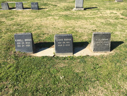
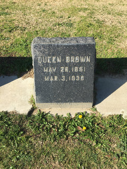
Rachel Cornelia “Queen” Glass Brown
| Birth | : | 1852 Paris, Lamar County, Texas, USA |
| Death | : | 10 Mar 1930 Kern County, California, USA |
| Burial | : | Union Cemetery, Bakersfield, Kern County, USA |
| Coordinate | : | 35.3646500, -118.9948700 |
| Plot | : | Haven of Rest 928 - 6 |
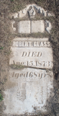
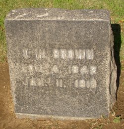
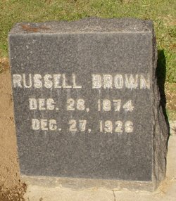
| Description | : | Note: California Death Index says she died 10 May 1930 but her marker says 3 May 1930. The marriage of Thomas Wiley Brown and Miss Cornelia Glass was solemnized March 11, 1867, and was blessed with two children. The sole survivor, Russell, of Maricopa, married Miss Stella Dunlap of Bakersfield and they have one child, Thomas Calvin Brown. Mrs. Brown was a daughter of Robert and Jane (Miller) Glass, natives respectively of Virginia and Alabama, but residents of Texas from childhood. The Glass family originally came from Ireland, while the Millers were of German ancestry.... Read More |
frequently asked questions (FAQ):
-
Where is Rachel Cornelia “Queen” Glass Brown's memorial?
Rachel Cornelia “Queen” Glass Brown's memorial is located at: Union Cemetery, Bakersfield, Kern County, USA.
-
When did Rachel Cornelia “Queen” Glass Brown death?
Rachel Cornelia “Queen” Glass Brown death on 10 Mar 1930 in Kern County, California, USA
-
Where are the coordinates of the Rachel Cornelia “Queen” Glass Brown's memorial?
Latitude: 35.3646500
Longitude: -118.9948700
Family Members:
Parent
Spouse
Siblings
Children
Flowers:
Nearby Cemetories:
1. Union Cemetery
Bakersfield, Kern County, USA
Coordinate: 35.3646500, -118.9948700
2. Home of Peace Jewish Cemetery
Bakersfield, Kern County, USA
Coordinate: 35.3631500, -118.9987400
3. Saint Pauls Episcopal Church Columbarium
Bakersfield, Kern County, USA
Coordinate: 35.3746120, -119.0277940
4. Chinese Cemetery
Bakersfield, Kern County, USA
Coordinate: 35.3510550, -119.0273380
5. Greenlawn Cemetery and Mortuary
Bakersfield, Kern County, USA
Coordinate: 35.4067001, -118.9856033
6. Greenlawn Southwest Mortuary and Cemetery
Bakersfield, Kern County, USA
Coordinate: 35.2948990, -119.0330810
7. Hillcrest Memorial Park
Bakersfield, Kern County, USA
Coordinate: 35.3814316, -118.9012527
8. Kuntz Ranch Cemetery
Bakersfield, Kern County, USA
Coordinate: 35.4373560, -118.9390180
9. Arvin Cemetery
Arvin, Kern County, USA
Coordinate: 35.2132300, -118.8952700
10. Shafter Memorial Park
Shafter, Kern County, USA
Coordinate: 35.4728012, -119.2341995
11. Long Tom Mine Cemetery
Woody, Kern County, USA
Coordinate: 35.5495600, -118.8308700
12. Engle Family Cemetery
Bakersfield, Kern County, USA
Coordinate: 35.6392060, -118.9231180
13. Bakersfield National Cemetery
Arvin, Kern County, USA
Coordinate: 35.2559600, -118.6693480
14. Pomfret Memorial Cemetery
Famoso, Kern County, USA
Coordinate: 35.6313580, -119.2064460
15. Fickert Family Cemetery
Bear Valley Springs, Kern County, USA
Coordinate: 35.1697260, -118.6443350
16. Weringer Cemetery
Woody, Kern County, USA
Coordinate: 35.7062100, -118.8320800
17. Blue Mountain Cemetery
Woody, Kern County, USA
Coordinate: 35.7065500, -118.8322400
18. Rankin Cemetery
Walker Basin, Kern County, USA
Coordinate: 35.3844560, -118.5388890
19. Cesar E. Chavez National Monument
Keene, Kern County, USA
Coordinate: 35.2236000, -118.5592400
20. Wasco Memorial Park
Wasco, Kern County, USA
Coordinate: 35.6034740, -119.3845260
21. Saint Joseph Cemetery
Havilah, Kern County, USA
Coordinate: 35.5147500, -118.5177700
22. West Side District Cemetery
Taft, Kern County, USA
Coordinate: 35.1559160, -119.4368360
23. Tehachapi Cove Cemetery
Tehachapi, Kern County, USA
Coordinate: 35.1190000, -118.5724600
24. Williams Burial Site
Walker Basin, Kern County, USA
Coordinate: 35.4320950, -118.4815680

