
| Birth | : | 17 Oct 1867 Rockland, Venango County, Pennsylvania, USA |
| Death | : | 28 Apr 1940 Lawrence, Douglas County, Kansas, USA |
| Burial | : | Memorial Park Cemetery, Lawrence, Douglas County, USA |
| Coordinate | : | 38.9552994, -95.2153015 |
| Plot | : | Good Shepherd & Acacia Section B & C |
| Inscription | : | mother |
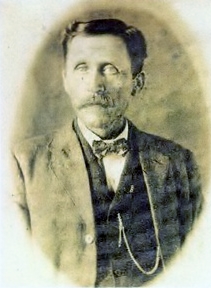
| Description | : | Rachel was married three times: First to Joseph Bolen during 1890 Second to W.A. Chandler on May 4, 1906 Third to Edward McKitrick (sometime between 1910–1920) She appears to have had six children with Joseph. In 1900, Rachel and Joseph live in Alexandira, Rapides, Louisiana with a nephew Eugene Caster; he may not actually be their nephew. His parents do not appear to be siblings of either Joseph or Rachel. In 1906, she marries W.A. Chandler in Lawrence, Kansas, according to the "Lawrence Journal World, in an article published on Saturday, September 26, 1931 on page 4. She divorced Edward during 1925, according to... Read More |
frequently asked questions (FAQ):
-
Where is Rachel Erma Karnes McKitrick's memorial?
Rachel Erma Karnes McKitrick's memorial is located at: Memorial Park Cemetery, Lawrence, Douglas County, USA.
-
When did Rachel Erma Karnes McKitrick death?
Rachel Erma Karnes McKitrick death on 28 Apr 1940 in Lawrence, Douglas County, Kansas, USA
-
Where are the coordinates of the Rachel Erma Karnes McKitrick's memorial?
Latitude: 38.9552994
Longitude: -95.2153015
Family Members:
Parent
Spouse

Siblings
Children
Flowers:


Nearby Cemetories:
1. Memorial Park Cemetery
Lawrence, Douglas County, USA
Coordinate: 38.9552994, -95.2153015
2. Mount Calvary Catholic Cemetery
Lawrence, Douglas County, USA
Coordinate: 38.9580002, -95.2139969
3. Oak Hill Cemetery
Lawrence, Douglas County, USA
Coordinate: 38.9589005, -95.2118988
4. Trinity Episcopal Church Columbarium
Lawrence, Douglas County, USA
Coordinate: 38.9653893, -95.2373886
5. Saint Johns Catholic Cemetery
Douglas County, USA
Coordinate: 38.9437900, -95.1919600
6. Dyche Hall Natural History Museum
Lawrence, Douglas County, USA
Coordinate: 38.9584800, -95.2434800
7. Haskell Cemetery
Lawrence, Douglas County, USA
Coordinate: 38.9353790, -95.2284241
8. Franklin Cemetery
Douglas County, USA
Coordinate: 38.9437523, -95.1869431
9. Pioneer Cemetery
Lawrence, Douglas County, USA
Coordinate: 38.9528008, -95.2611008
10. First Presbyterian Church Memorial Garden
Lawrence, Douglas County, USA
Coordinate: 38.9414900, -95.2641600
11. County Poor Farm Cemetery
Douglas County, USA
Coordinate: 38.9119400, -95.2214600
12. Kennedy Cemetery
Douglas County, USA
Coordinate: 38.9112900, -95.2269200
13. Maple Grove Cemetery
Lawrence, Douglas County, USA
Coordinate: 39.0018997, -95.2316971
14. Adams Cemetery
Douglas County, USA
Coordinate: 38.9955400, -95.2509100
15. Blue Mound Cemetery
Lawrence, Douglas County, USA
Coordinate: 38.9046600, -95.1865400
16. Davis Cemetery
Lawrence, Douglas County, USA
Coordinate: 38.9722500, -95.2831100
17. Marshall Cemetery
Douglas County, USA
Coordinate: 38.9040800, -95.2446700
18. Dutton Cemetery
Douglas County, USA
Coordinate: 38.8989800, -95.2790600
19. Luckan Family Cemetery
Fall Leaf, Leavenworth County, USA
Coordinate: 38.9808500, -95.1128000
20. Corpus Christi Catholic Church Columbarium
Lawrence, Douglas County, USA
Coordinate: 38.9572250, -95.3238450
21. Cemetery Beni Israel
Eudora, Douglas County, USA
Coordinate: 38.9280128, -95.1122208
22. Lyon Family Cemetery
Lawrence, Douglas County, USA
Coordinate: 38.9877440, -95.3166530
23. Richland Cemetery
Lawrence, Douglas County, USA
Coordinate: 38.8768997, -95.2630997
24. Southwest City Cemetery
Eudora, Douglas County, USA
Coordinate: 38.9334800, -95.1070300