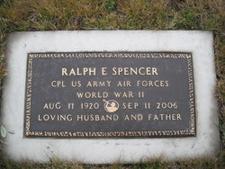
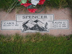
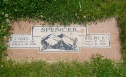
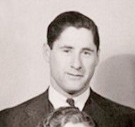
Ralph Emerson Spencer
| Birth | : | 11 Aug 1920 Woodland, Clark County, Washington, USA |
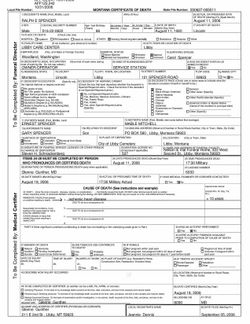
| Death | : | 11 Aug 2006 Libby, Lincoln County, Montana, USA |
| Burial | : | Mount Liberty Church Cemetery, Ottawa County, USA |
| Coordinate | : | 39.2489400, -97.4356200 |
| Description | : | Ralph Spencer Posted: Wednesday, Aug 16, 2006 - 01:47:21 pm MDT Ralph E. Spencer, 86, died Friday, Aug. 11, 2006, at Libby Care Center from natural causes. He was born Aug. 11, 1920, in Woodland, Wash., to Ernest and Mable Mitchell Spencer. The family moved to Libby in 1922 and eventually settled on what is now Spencer Road, where the entire family lived next door to each other. Ralph graduated from Libby High School in 1939. After graduation he went to work for J. Neils Lumber Co. as a woods worker. He entered the U.S. Army Air Corps... Read More |
frequently asked questions (FAQ):
-
Where is Ralph Emerson Spencer's memorial?
Ralph Emerson Spencer's memorial is located at: Mount Liberty Church Cemetery, Ottawa County, USA.
-
When did Ralph Emerson Spencer death?
Ralph Emerson Spencer death on 11 Aug 2006 in Libby, Lincoln County, Montana, USA
-
Where are the coordinates of the Ralph Emerson Spencer's memorial?
Latitude: 39.2489400
Longitude: -97.4356200
Family Members:
Parent
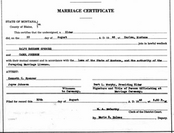
Spouse
Siblings
Nearby Cemetories:
1. Mount Liberty Church Cemetery
Ottawa County, USA
Coordinate: 39.2489400, -97.4356200
2. Rose Meron Cemetery
Oak Hill, Clay County, USA
Coordinate: 39.2194700, -97.3338900
3. Fairview Cemetery
Lamar, Ottawa County, USA
Coordinate: 39.2928009, -97.5299988
4. Miltonvale Cemetery
Miltonvale, Cloud County, USA
Coordinate: 39.3358002, -97.4447021
5. Shields Cemetery
Clay County, USA
Coordinate: 39.3208008, -97.3507996
6. Pleasant Valley Cemetery
Oak Hill, Clay County, USA
Coordinate: 39.2468987, -97.2889023
7. Smith Grave
Miltonvale, Cloud County, USA
Coordinate: 39.3645300, -97.4308700
8. Pleasant Hill Cemetery
Lamar, Ottawa County, USA
Coordinate: 39.2050018, -97.5832977
9. Vine Creek Cemetery
Ottawa County, USA
Coordinate: 39.1194000, -97.4180984
10. Thomas Cemetery
Miltonvale, Cloud County, USA
Coordinate: 39.3300000, -97.5750000
11. Swartwood Cemetery
Longford, Clay County, USA
Coordinate: 39.1323200, -97.3431500
12. Table Mound Cemetery
Idana, Clay County, USA
Coordinate: 39.3141300, -97.2792300
13. Wesleyan Cemetery
Oak Hill, Clay County, USA
Coordinate: 39.2268982, -97.2572021
14. Hall Cemetery
Delphos, Ottawa County, USA
Coordinate: 39.2404970, -97.6302360
15. Hebron Cemetery
Clay County, USA
Coordinate: 39.3213800, -97.2601400
16. Oakland Union Cemetery
Miltonvale, Cloud County, USA
Coordinate: 39.3647003, -97.5824966
17. Ackley Cemetery
Ottawa County, USA
Coordinate: 39.0893160, -97.4797040
18. Sulphur Springs Cemetery
Aurora, Cloud County, USA
Coordinate: 39.4086610, -97.4986840
19. Idana Cemetery
Idana, Clay County, USA
Coordinate: 39.3574500, -97.2693300
20. Keystone Cemetery
Manchester, Dickinson County, USA
Coordinate: 39.1185989, -97.2917023
21. Crosson Cemetery
Minneapolis, Ottawa County, USA
Coordinate: 39.2011940, -97.6544720
22. White Cloud Cemetery
Manchester, Dickinson County, USA
Coordinate: 39.0744019, -97.3525009
23. French Presbyterian Church Cemetery
Cloud County, USA
Coordinate: 39.4395200, -97.4148290
24. Pleasant Ridge Cemetery
Clay County, USA
Coordinate: 39.2789001, -97.1841965

