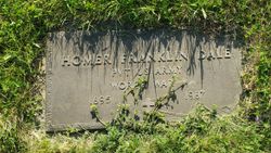
| Birth | : | 28 Oct 1898 Castana, Monona County, Iowa, USA |
| Death | : | 21 Nov 1970 Yankton, Yankton County, South Dakota, USA |
| Burial | : | Mount Pleasant Cemetery, Mattie, Bedford County, USA |
| Coordinate | : | 39.9247437, -78.2919769 |
| Description | : | Iowa birth index - father was John William Dale and mother was Evalena Ham, both born Missouri |
frequently asked questions (FAQ):
-
Where is Ray Ross Dale's memorial?
Ray Ross Dale's memorial is located at: Mount Pleasant Cemetery, Mattie, Bedford County, USA.
-
When did Ray Ross Dale death?
Ray Ross Dale death on 21 Nov 1970 in Yankton, Yankton County, South Dakota, USA
-
Where are the coordinates of the Ray Ross Dale's memorial?
Latitude: 39.9247437
Longitude: -78.2919769
Family Members:
Parent
Spouse
Siblings
Children
Flowers:
Nearby Cemetories:
1. Mount Pleasant Cemetery
Mattie, Bedford County, USA
Coordinate: 39.9247437, -78.2919769
2. Bowman Family Cemetery
Mattie, Bedford County, USA
Coordinate: 39.9321422, -78.2887292
3. Stevens Methodist Chapel Church Cemetery
Mattie, Bedford County, USA
Coordinate: 39.8982000, -78.2921900
4. Old Shaw Farm Cemetery
Mattie, Bedford County, USA
Coordinate: 39.9209280, -78.3272840
5. Union Memorial Cemetery
Mench, Bedford County, USA
Coordinate: 39.9569000, -78.2973000
6. McKendree Methodist Episcopal Church Cemetery
Crystal Spring, Fulton County, USA
Coordinate: 39.9201000, -78.2492000
7. Rockhill Cemetery
Monroe Township, Bedford County, USA
Coordinate: 39.9186000, -78.3391000
8. Kagarise-Burger Farm Cemetery
Monroe Township, Bedford County, USA
Coordinate: 39.9357150, -78.3501890
9. Ensley Cemetery
Crystal Spring, Fulton County, USA
Coordinate: 39.9483000, -78.2340000
10. Rohm Cemetery
Crystal Spring, Fulton County, USA
Coordinate: 39.9483000, -78.2337000
11. Union Christian Cemetery
Crystal Spring, Fulton County, USA
Coordinate: 39.9476891, -78.2319260
12. Cooper Farm Cemetery
Clearville, Bedford County, USA
Coordinate: 39.9323970, -78.3598140
13. Cedar Grove Cemetery
Breezewood, Bedford County, USA
Coordinate: 39.9789000, -78.2850000
14. Mount Union Christian Church Cemetery
Mench, Bedford County, USA
Coordinate: 39.9739000, -78.3230000
15. Blackhart Farm Cemetery
Everett, Bedford County, USA
Coordinate: 39.9818750, -78.2877266
16. Vaughn Williams Farm Cemetery
Mench, Bedford County, USA
Coordinate: 39.9820130, -78.3183590
17. Baughman Union Cemetery
Bedford County, USA
Coordinate: 39.9687670, -78.3465960
18. Williams Farm Cemetery
Mench, Bedford County, USA
Coordinate: 39.9691400, -78.3461500
19. Cherry Lane Brethren Cemetery
Monroe Township, Bedford County, USA
Coordinate: 39.9477768, -78.3663864
20. Dibert Farm Cemetery
Bedford County, USA
Coordinate: 39.9802000, -78.3347000
21. Calhoun Farm Cemetery
Bedford County, USA
Coordinate: 39.9700000, -78.3583000
22. Clearville Union Church Cemetery
Clearville, Bedford County, USA
Coordinate: 39.9228172, -78.3868332
23. Fletcher Cemetery
Clearville, Bedford County, USA
Coordinate: 39.8557016, -78.3283085
24. Pleasant Union Church Cemetery
Clearville, Bedford County, USA
Coordinate: 39.8713670, -78.3691160


