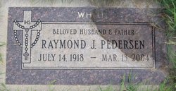
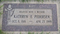
Raymond James “Whitie” Pedersen
| Birth | : | 14 Jul 1918 Howard County, Nebraska, USA |
| Death | : | 13 Mar 2004 Helena, Lewis and Clark County, Montana, USA |
| Burial | : | Saint Mary Churchyard, Gissing, South Norfolk District, England |
| Coordinate | : | 52.4235630, 1.1548260 |
| Description | : | Thanks to contributor #48531678; July 14, 1918 - March 13, 2004 The Good Shepherd has called one of His own to return to the Flock. Raymond James "Whitie" Pedersen, son, brother, husband, father, grandfather and great-grandfather, passed on to be with the Lord on Saturday, March 13, 2004, at his home in Helena. Raymond was born on July 14, 1918, to Carl C. and Anna C. Pedersen in Howard County, Neb. He and his older brother, Stanley C. Pedersen, grew up in the farming communities of Nysted and Dannebrog, Neb. In a time before electricity had been widely... Read More |
frequently asked questions (FAQ):
-
Where is Raymond James “Whitie” Pedersen's memorial?
Raymond James “Whitie” Pedersen's memorial is located at: Saint Mary Churchyard, Gissing, South Norfolk District, England.
-
When did Raymond James “Whitie” Pedersen death?
Raymond James “Whitie” Pedersen death on 13 Mar 2004 in Helena, Lewis and Clark County, Montana, USA
-
Where are the coordinates of the Raymond James “Whitie” Pedersen's memorial?
Latitude: 52.4235630
Longitude: 1.1548260
Family Members:
Spouse
Nearby Cemetories:
1. Saint Mary Churchyard
Gissing, South Norfolk District, England
Coordinate: 52.4235630, 1.1548260
2. Saint Mary the Virgin Churchyard
Burston, South Norfolk District, England
Coordinate: 52.4049300, 1.1402600
3. St. George's Churchyard
Shimpling, Babergh District, England
Coordinate: 52.3994010, 1.1680910
4. Saint George Churchyard
Shimpling, South Norfolk District, England
Coordinate: 52.3993000, 1.1680000
5. All Saints Churchyard
Dickleburgh and Rushall, South Norfolk District, England
Coordinate: 52.3968580, 1.1848010
6. All Saints Churchyard
Shelfanger, South Norfolk District, England
Coordinate: 52.4104780, 1.0969230
7. St Andrew's Frenze Church
Scole, South Norfolk District, England
Coordinate: 52.3802000, 1.1361000
8. Pulham Market Cemetery
Pulham Market, South Norfolk District, England
Coordinate: 52.4281900, 1.2297700
9. Saint Mary Magdalene Churchyard
Pulham Market, South Norfolk District, England
Coordinate: 52.4285200, 1.2301100
10. Diss Cemetery
Diss, South Norfolk District, England
Coordinate: 52.3839060, 1.1115880
11. St Mary Churchyard
Dickleburgh and Rushall, South Norfolk District, England
Coordinate: 52.3978750, 1.2290680
12. St. Michael's Churchyard
Great Moulton, South Norfolk District, England
Coordinate: 52.4718860, 1.1868760
13. St Michael Churchyard
Aslacton, South Norfolk District, England
Coordinate: 52.4750490, 1.1737040
14. Saint Mary Churchyard
Diss, South Norfolk District, England
Coordinate: 52.3772370, 1.1097880
15. Diss War Memorial
Diss, South Norfolk District, England
Coordinate: 52.3773380, 1.1088530
16. Croft Lane Baptist Church Burial Ground
Diss, South Norfolk District, England
Coordinate: 52.3771070, 1.1025490
17. Saint Andrew Churchyard
Scole, South Norfolk District, England
Coordinate: 52.3671670, 1.1579150
18. St Mary the Virgin Churchyard
Pulham St Mary, South Norfolk District, England
Coordinate: 52.4205290, 1.2520380
19. St Leonard Churchyard
Billingford, South Norfolk District, England
Coordinate: 52.3666290, 1.1834260
20. Unitarian Chapel Cemetery
Palgrave, Mid Suffolk District, England
Coordinate: 52.3693130, 1.1086820
21. St. Remigius Churchyard
Roydon, South Norfolk District, England
Coordinate: 52.3815610, 1.0784680
22. St Peter Churchyard
Palgrave, Mid Suffolk District, England
Coordinate: 52.3634190, 1.1059170
23. All Saints Churchyard
Stuston, Mid Suffolk District, England
Coordinate: 52.3571980, 1.1332590
24. St. Michael and All Angels Churchyard
Bunwell, South Norfolk District, England
Coordinate: 52.4914460, 1.1296800


