
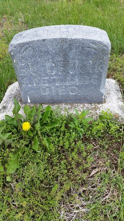
Rev Solomon Devoir
| Birth | : | 1809 Ohio, USA |
| Death | : | 4 Mar 1880 Clinton County, Missouri, USA |
| Burial | : | Stony Point Cemetery, Trimble, Clinton County, USA |
| Coordinate | : | 39.5136108, -94.5336075 |
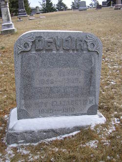
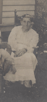
| Description | : | Although the name was also spelled as Devore in some records and two of his sons took that spelling, Solomon signed his name as Devoir. Many people have given Solomon the middle name of Lindsay, but in no record have I ever seen him have a middle name, not even an initial. I am not positive that Solomon is buried in this cemetery, but I believe he may be as his son Solomon L. is buried here. I know from his wife Margaret's memorial that she was buried beside her husband and Margaret lived with her son Solomon... Read More |
frequently asked questions (FAQ):
-
Where is Rev Solomon Devoir's memorial?
Rev Solomon Devoir's memorial is located at: Stony Point Cemetery, Trimble, Clinton County, USA.
-
When did Rev Solomon Devoir death?
Rev Solomon Devoir death on 4 Mar 1880 in Clinton County, Missouri, USA
-
Where are the coordinates of the Rev Solomon Devoir's memorial?
Latitude: 39.5136108
Longitude: -94.5336075
Family Members:
Spouse

Children
Flowers:


Nearby Cemetories:
1. Stony Point Cemetery
Trimble, Clinton County, USA
Coordinate: 39.5136108, -94.5336075
2. Elliott Cemetery
Grayson, Clinton County, USA
Coordinate: 39.5062000, -94.5452000
3. Mecca Cemetery
Mecca, Clinton County, USA
Coordinate: 39.4895200, -94.5105200
4. Grayson Cemetery
Grayson, Clinton County, USA
Coordinate: 39.5266991, -94.5733032
5. Winn family Cemetery
Clinton County, USA
Coordinate: 39.5019500, -94.5845200
6. Reed Cemetery
Trimble, Clinton County, USA
Coordinate: 39.4945908, -94.5832138
7. Pleasant Hill Primitive Baptist Church Cemetery
Trimble, Clinton County, USA
Coordinate: 39.4697495, -94.5203629
8. Grooms Cemetery
Grayson, Clinton County, USA
Coordinate: 39.5563393, -94.5646286
9. Hanks Cemetery
Clinton County, USA
Coordinate: 39.5289001, -94.4625015
10. Poage Cemetery
Clinton County, USA
Coordinate: 39.5850940, -94.5411090
11. Standiford Cemetery
Edgerton, Platte County, USA
Coordinate: 39.4994011, -94.6288986
12. Garner Cemetery
Clay County, USA
Coordinate: 39.4420600, -94.5035700
13. Cook Cemetery
Clinton County, USA
Coordinate: 39.4805984, -94.4452972
14. Davenport Cemetery
Excelsior Springs Junction, Clay County, USA
Coordinate: 39.4375000, -94.5556030
15. Mount Carmel Cemetery
Gower, Clinton County, USA
Coordinate: 39.5877991, -94.5667038
16. Fairview Cemetery
Guyton, Clinton County, USA
Coordinate: 39.4756012, -94.4443970
17. Greenlawn Cemetery
Plattsburg, Clinton County, USA
Coordinate: 39.5586014, -94.4483032
18. Old Gower Town Cemetery
Gower, Clinton County, USA
Coordinate: 39.5829770, -94.5873680
19. Union Mill Cemetery
Edgerton, Platte County, USA
Coordinate: 39.5175018, -94.6391983
20. Calvary Cemetery
Plattsburg, Clinton County, USA
Coordinate: 39.5583000, -94.4436035
21. Old Plattsburg Cemetery
Plattsburg, Clinton County, USA
Coordinate: 39.5635900, -94.4470600
22. Mount Washington Cemetery
Plattsburg, Clinton County, USA
Coordinate: 39.5572014, -94.4411011
23. McKee Grave
Buchanan County, USA
Coordinate: 39.5377200, -94.6378300
24. McMahan Cemetery
Gower, Clinton County, USA
Coordinate: 39.5917000, -94.5741000