
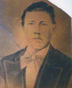
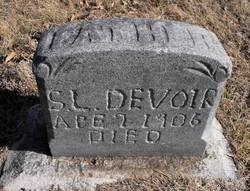
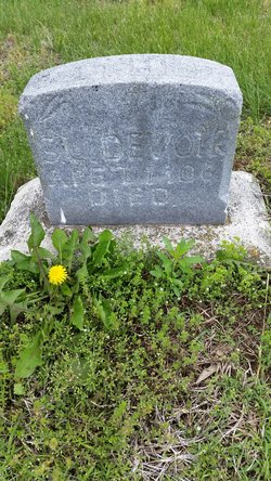
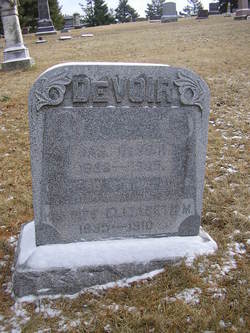
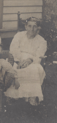
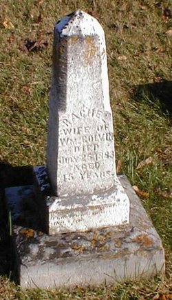
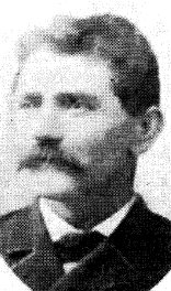
Solomon Lindsay Devoir
| Birth | : | 16 May 1855 Wheeling, Ohio County, West Virginia, USA |
| Death | : | 11 Apr 1906 Saint Joseph, Buchanan County, Missouri, USA |
| Burial | : | Stony Point Cemetery, Trimble, Clinton County, USA |
| Coordinate | : | 39.5136108, -94.5336075 |
| Inscription | : | Father |
frequently asked questions (FAQ):
-
Where is Solomon Lindsay Devoir's memorial?
Solomon Lindsay Devoir's memorial is located at: Stony Point Cemetery, Trimble, Clinton County, USA.
-
When did Solomon Lindsay Devoir death?
Solomon Lindsay Devoir death on 11 Apr 1906 in Saint Joseph, Buchanan County, Missouri, USA
-
Where are the coordinates of the Solomon Lindsay Devoir's memorial?
Latitude: 39.5136108
Longitude: -94.5336075
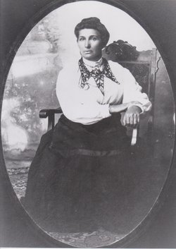
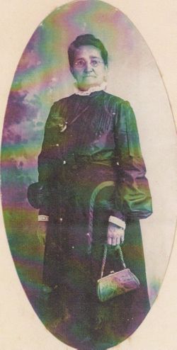
Family Members:
Parent

Spouse
Siblings
Children
Flowers:


Nearby Cemetories:
1. Stony Point Cemetery
Trimble, Clinton County, USA
Coordinate: 39.5136108, -94.5336075
2. Elliott Cemetery
Grayson, Clinton County, USA
Coordinate: 39.5062000, -94.5452000
3. Mecca Cemetery
Mecca, Clinton County, USA
Coordinate: 39.4895200, -94.5105200
4. Grayson Cemetery
Grayson, Clinton County, USA
Coordinate: 39.5266991, -94.5733032
5. Winn family Cemetery
Clinton County, USA
Coordinate: 39.5019500, -94.5845200
6. Reed Cemetery
Trimble, Clinton County, USA
Coordinate: 39.4945908, -94.5832138
7. Pleasant Hill Primitive Baptist Church Cemetery
Trimble, Clinton County, USA
Coordinate: 39.4697495, -94.5203629
8. Grooms Cemetery
Grayson, Clinton County, USA
Coordinate: 39.5563393, -94.5646286
9. Hanks Cemetery
Clinton County, USA
Coordinate: 39.5289001, -94.4625015
10. Poage Cemetery
Clinton County, USA
Coordinate: 39.5850940, -94.5411090
11. Standiford Cemetery
Edgerton, Platte County, USA
Coordinate: 39.4994011, -94.6288986
12. Garner Cemetery
Clay County, USA
Coordinate: 39.4420600, -94.5035700
13. Cook Cemetery
Clinton County, USA
Coordinate: 39.4805984, -94.4452972
14. Davenport Cemetery
Excelsior Springs Junction, Clay County, USA
Coordinate: 39.4375000, -94.5556030
15. Mount Carmel Cemetery
Gower, Clinton County, USA
Coordinate: 39.5877991, -94.5667038
16. Fairview Cemetery
Guyton, Clinton County, USA
Coordinate: 39.4756012, -94.4443970
17. Greenlawn Cemetery
Plattsburg, Clinton County, USA
Coordinate: 39.5586014, -94.4483032
18. Old Gower Town Cemetery
Gower, Clinton County, USA
Coordinate: 39.5829770, -94.5873680
19. Union Mill Cemetery
Edgerton, Platte County, USA
Coordinate: 39.5175018, -94.6391983
20. Calvary Cemetery
Plattsburg, Clinton County, USA
Coordinate: 39.5583000, -94.4436035
21. Old Plattsburg Cemetery
Plattsburg, Clinton County, USA
Coordinate: 39.5635900, -94.4470600
22. Mount Washington Cemetery
Plattsburg, Clinton County, USA
Coordinate: 39.5572014, -94.4411011
23. McKee Grave
Buchanan County, USA
Coordinate: 39.5377200, -94.6378300
24. McMahan Cemetery
Gower, Clinton County, USA
Coordinate: 39.5917000, -94.5741000