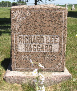
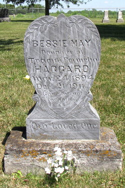
Richard Lee Haggard
| Birth | : | 6 Apr 1892 Saline County, Missouri, USA |
| Death | : | 27 Jan 1923 Sweet Springs, Saline County, Missouri, USA |
| Burial | : | St Andrew Churchyard, Kingswood, Reigate and Banstead Borough, England |
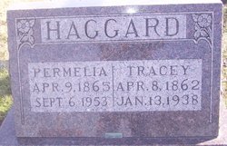
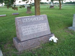
| Description | : | Missouri Death Certificate #3498. Father: Tracy Haggard. Mother: Jemina Martin. Never Married. |
frequently asked questions (FAQ):
-
Where is Richard Lee Haggard's memorial?
Richard Lee Haggard's memorial is located at: St Andrew Churchyard, Kingswood, Reigate and Banstead Borough, England.
-
When did Richard Lee Haggard death?
Richard Lee Haggard death on 27 Jan 1923 in Sweet Springs, Saline County, Missouri, USA
Family Members:
Parent
Siblings
Flowers:
Nearby Cemetories:
1. St Andrew Churchyard
Kingswood, Reigate and Banstead Borough, England
Coordinate: 51.2923980, -0.1602950
2. Quakers Burial Ground
Reigate, Reigate and Banstead Borough, England
3. Reigate Cemetery
Reigate, Reigate and Banstead Borough, England
Coordinate: 51.3246900, -0.1693300
4. Reigate Garden of Remembrance
Reigate, Reigate and Banstead Borough, England
Coordinate: 51.3220583, -0.2008833
5. Gatton Hall, St Andrew's Church
Reigate, Reigate and Banstead Borough, England
Coordinate: 51.3389400, -0.1849100
6. St Mary Magdalene Churchyard
Reigate, Reigate and Banstead Borough, England
Coordinate: 51.3215180, -0.2120434
7. St Katharine's Churchyard
Merstham, Reigate and Banstead Borough, England
8. Everton Saint George
Walton-on-the-Hill, Reigate and Banstead Borough, England
Coordinate: 51.2310910, -0.1601330
9. Saint Peter's Church
Walton-on-the-Hill, Reigate and Banstead Borough, England
10. Netherne Cemetery
Netherne-on-the-Hill, Reigate and Banstead Borough, England
Coordinate: 51.1711120, -0.1747610
11. Sidlow Bridge Emmanuel Churchyard
Sidlow, Reigate and Banstead Borough, England
Coordinate: 51.1698000, -0.1758000
12. St. Margaret's Churchyard
Hooley, Reigate and Banstead Borough, England
Coordinate: 51.2923980, -0.1602950
13. Box Hill
Tadworth, Reigate and Banstead Borough, England
14. St Peter's Churchyard
Woodmansterne, Reigate and Banstead Borough, England
Coordinate: 51.3246900, -0.1693300
15. All Saints Churchyard
Banstead, Reigate and Banstead Borough, England
Coordinate: 51.3220583, -0.2008833
16. Banstead Hospital Cemetery
Banstead, Reigate and Banstead Borough, England
Coordinate: 51.3389400, -0.1849100
17. St Ann's Memorial Garden
Banstead, Reigate and Banstead Borough, England
Coordinate: 51.3215180, -0.2120434
18. Philanthropic Farm School Graveyard
Redhill, Reigate and Banstead Borough, England
19. Redstone Cemetery
Redhill, Reigate and Banstead Borough, England
Coordinate: 51.2310910, -0.1601330
20. St. John the Evangelist Churchyard
Redhill, Reigate and Banstead Borough, England
21. Parish of Horley's New Churchyard
Horley, Reigate and Banstead Borough, England
Coordinate: 51.1711120, -0.1747610
22. St. Bartholomew's Churchyard
Horley, Reigate and Banstead Borough, England
Coordinate: 51.1698000, -0.1758000

