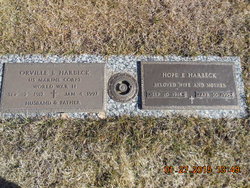
| Birth | : | 13 Jun 1919 Westfield, Plymouth County, Iowa, USA |
| Death | : | 27 Feb 1980 Akron, Plymouth County, Iowa, USA |
| Burial | : | Thompson Hill Cemetery, Thompson Hill, Renfrew County, Canada |
| Coordinate | : | 45.4567900, -76.6710200 |
| Description | : | Robert "Bob" Smith Robert "Bob" Frank Smith, 60, Akron, died Wednesday (Feb. 27,1980) at his home of a long illness. Services were held at 10:30 a.m. Saturday in the Wesley United Methodist church in Akron. Dr. Carrol McLaughlin, Sioux City officiated. Burial was in Riverside cemetery under direction of Schroeder funeral home, Akron. A prayer service was held at 7:30 p.m. Friday at the funeral home. Music was provided by Daryl and Renae Schlumbohm of Ireton, accompanied by organist, Benita Engel, Sioux City. Mr. Smith was born June 13, 1919 at Westfield, Iowa to Mr. and Mrs. Frank Smith. He married Mona Rozell, Feb. 26, 1941 at Akron. They were lifelong farmers retiring in October of 1978. For many years... Read More |
frequently asked questions (FAQ):
-
Where is Robert Frank “Bob” Smith's memorial?
Robert Frank “Bob” Smith's memorial is located at: Thompson Hill Cemetery, Thompson Hill, Renfrew County, Canada.
-
When did Robert Frank “Bob” Smith death?
Robert Frank “Bob” Smith death on 27 Feb 1980 in Akron, Plymouth County, Iowa, USA
-
Where are the coordinates of the Robert Frank “Bob” Smith's memorial?
Latitude: 45.4567900
Longitude: -76.6710200
Family Members:
Parent
Spouse
Siblings
Children
Flowers:
Nearby Cemetories:
1. Thompson Hill Cemetery
Thompson Hill, Renfrew County, Canada
Coordinate: 45.4567900, -76.6710200
2. McLaren Cemetery
Renfrew, Renfrew County, Canada
Coordinate: 45.4553800, -76.6632200
3. Costello Cemetery
Horton, Renfrew County, Canada
Coordinate: 45.4684307, -76.6346983
4. Old Martin Cemetery
Horton, Renfrew County, Canada
Coordinate: 45.4673350, -76.6318680
5. Saint Francis Xavier Cemetery
Renfrew, Renfrew County, Canada
Coordinate: 45.4872100, -76.6921600
6. North Horton Cemetery
Renfrew, Renfrew County, Canada
Coordinate: 45.5177800, -76.6718355
7. Goshen Public Cemetery
Goshen, Renfrew County, Canada
Coordinate: 45.4377130, -76.5794520
8. Admaston Cemetery
Admaston, Renfrew County, Canada
Coordinate: 45.4568750, -76.7694830
9. Fraser Cemetery
Burnstown, Renfrew County, Canada
Coordinate: 45.3903130, -76.6384360
10. Springtown Protestant Cemetery
Springtown, Renfrew County, Canada
Coordinate: 45.3540590, -76.6487820
11. Rosebank Cemetery
Rosebank, Renfrew County, Canada
Coordinate: 45.5251000, -76.7829110
12. Castleford Union Cemetery
Castleford, Renfrew County, Canada
Coordinate: 45.5100900, -76.5395200
13. Saint Gabriel's Roman Catholic Cemetery
Springtown, Renfrew County, Canada
Coordinate: 45.3468860, -76.6621210
14. Gillies Family Cemetery
Braeside, Renfrew County, Canada
Coordinate: 45.4168100, -76.4994000
15. Austin United Cemetery
Clarendon Front, Outaouais Region, Canada
Coordinate: 45.5589610, -76.5529840
16. White Lake Cemetery
White Lake, Renfrew County, Canada
Coordinate: 45.3744950, -76.5166330
17. Protestant Cemetery of Portage du Fort
Portage-du-Fort, Outaouais Region, Canada
Coordinate: 45.5926410, -76.6584030
18. St. James Roman Catholic Cemetery
Portage-du-Fort, Outaouais Region, Canada
Coordinate: 45.5929000, -76.6582800
19. St. George Anglican Church Cemetery
Portage-du-Fort, Outaouais Region, Canada
Coordinate: 45.5934170, -76.6678210
20. Haley Cemetery
Haley Station, Renfrew County, Canada
Coordinate: 45.5722300, -76.7880700
21. Old Clarendon Cemetery
Clarendon, Outaouais Region, Canada
Coordinate: 45.5342450, -76.5005850
22. Flat Rapids Cemetery
Arnprior, Renfrew County, Canada
Coordinate: 45.4150030, -76.4734690
23. St. James the Greater Cemetery
Portage-du-Fort, Outaouais Region, Canada
Coordinate: 45.6091700, -76.6508400
24. Sand Point Public Cemetery
Sand Point, Renfrew County, Canada
Coordinate: 45.4941830, -76.4566060


