
| Birth | : | 24 Oct 1882 Stokes County, North Carolina, USA |
| Death | : | 28 Jul 1971 Germanton, Stokes County, North Carolina, USA |
| Burial | : | St James' Church Cemetery, Hockwold, Kings Lynn and West Norfolk Borough, England |
| Coordinate | : | 52.4625100, 0.5519400 |
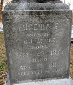
| Description | : | 88years 6mos 9days. Son of Francis Ezekial (Frank) and Frances Rierson Petree. Husband of Janie Johnson Petree. |
frequently asked questions (FAQ):
-
Where is Robert Garfield Petree's memorial?
Robert Garfield Petree's memorial is located at: St James' Church Cemetery, Hockwold, Kings Lynn and West Norfolk Borough, England.
-
When did Robert Garfield Petree death?
Robert Garfield Petree death on 28 Jul 1971 in Germanton, Stokes County, North Carolina, USA
-
Where are the coordinates of the Robert Garfield Petree's memorial?
Latitude: 52.4625100
Longitude: 0.5519400
Family Members:
Parent

Spouse
Siblings
Children
Flowers:


Nearby Cemetories:
1. St James' Church Cemetery
Hockwold, Kings Lynn and West Norfolk Borough, England
Coordinate: 52.4625100, 0.5519400
2. St. Peter Church Cemetery
Hockwold, Kings Lynn and West Norfolk Borough, England
Coordinate: 52.4627780, 0.5376030
3. St. Mary's Churchyard
Feltwell, Kings Lynn and West Norfolk Borough, England
Coordinate: 52.4874580, 0.5245110
4. St Nicholas Churchyard
Feltwell, Kings Lynn and West Norfolk Borough, England
Coordinate: 52.4888000, 0.5209700
5. St. Peter's Churchyard
Brandon, Forest Heath District, England
Coordinate: 52.4445800, 0.6132600
6. Brandon Cemetery
Brandon, Forest Heath District, England
Coordinate: 52.4445140, 0.6149550
7. New Beginnings International Churchyard
Wangford, Forest Heath District, England
Coordinate: 52.4215680, 0.5733170
8. Lakenheath Cemetery
Lakenheath, Forest Heath District, England
Coordinate: 52.4177780, 0.5282760
9. St. George's Churchyard
Methwold, Kings Lynn and West Norfolk Borough, England
Coordinate: 52.5229060, 0.5568700
10. Methwold Cemetery
Methwold, Kings Lynn and West Norfolk Borough, England
Coordinate: 52.5257758, 0.5575197
11. St Mary the Virgin Churchyard
Santon Downham, Forest Heath District, England
Coordinate: 52.4562840, 0.6715820
12. St Mary's Churchyard
Cranwich, Breckland Borough, England
Coordinate: 52.5224040, 0.6262310
13. St Leonard's Churchyard
Mundford, Breckland Borough, England
Coordinate: 52.5125080, 0.6521150
14. St. Andrew's Old Cemetery
Northwold, Kings Lynn and West Norfolk Borough, England
Coordinate: 52.5405523, 0.5864157
15. Northwold Cemetery
Northwold, Kings Lynn and West Norfolk Borough, England
Coordinate: 52.5419000, 0.5820000
16. St Andrew Churchyard
Northwold, Kings Lynn and West Norfolk Borough, England
Coordinate: 52.5425540, 0.5878920
17. All Saints Churchyard
Santon Downham, Forest Heath District, England
Coordinate: 52.4525750, 0.6904240
18. All Saints Churchyard
Santon, St Edmundsbury Borough, England
Coordinate: 52.4525440, 0.6904210
19. St. Laurence and St. Peter Churchyard
Eriswell, Forest Heath District, England
Coordinate: 52.3733400, 0.5306300
20. St Peter's Churchyard
Ickburgh, Breckland Borough, England
Coordinate: 52.5232010, 0.6755200
21. Methodist Chapel
Holywell Row, Forest Heath District, England
Coordinate: 52.3661040, 0.5067880
22. Beck Row Methodist Churchyard
Beck Row, Forest Heath District, England
Coordinate: 52.3701225, 0.4866503
23. All Saints Churchyard
Foulden, Breckland Borough, England
Coordinate: 52.5599040, 0.6021930
24. St. John's Churchyard
Beck Row, Forest Heath District, England
Coordinate: 52.3663830, 0.4947150