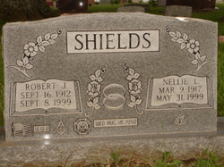
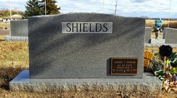
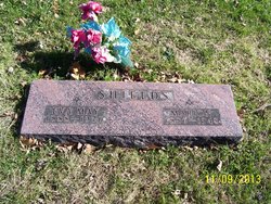
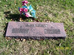
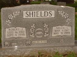
Robert J. “Bob” Shields
| Birth | : | 18 Sep 1912 USA |
| Death | : | 8 Sep 1999 Holton, Jackson County, Kansas, USA |
| Burial | : | Saint John Lutheran Cemetery, Sharon Center, Johnson County, USA |
| Coordinate | : | 41.5542000, -91.6678000 |
| Plot | : | Section H |
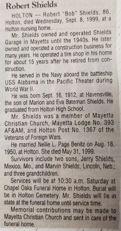
| Description | : | Robert "Bob" Shields has two children and three grandchildren. He was married to Nellie Lucile (Page) Shields, who preceded him in death. He lived most of her life in Mayetta, Kansas. Bob was in the US Navy, and served on the USS Alabama. He had a Boston Terrier named Punky Brewster (after the television show character). |
frequently asked questions (FAQ):
-
Where is Robert J. “Bob” Shields's memorial?
Robert J. “Bob” Shields's memorial is located at: Saint John Lutheran Cemetery, Sharon Center, Johnson County, USA.
-
When did Robert J. “Bob” Shields death?
Robert J. “Bob” Shields death on 8 Sep 1999 in Holton, Jackson County, Kansas, USA
-
Where are the coordinates of the Robert J. “Bob” Shields's memorial?
Latitude: 41.5542000
Longitude: -91.6678000
Family Members:
Parent
Spouse
Siblings
Flowers:
Nearby Cemetories:
1. Saint John Lutheran Cemetery
Sharon Center, Johnson County, USA
Coordinate: 41.5542000, -91.6678000
2. John Helmuth Cemetery
Sharon Center, Johnson County, USA
Coordinate: 41.5583870, -91.6764660
3. Sharon Center Cemetery
Johnson County, USA
Coordinate: 41.5543000, -91.6555000
4. Fairview Mennonite Cemetery
Johnson County, USA
Coordinate: 41.5396000, -91.6751000
5. Yoder Family Cemetery
Sharon Center, Johnson County, USA
Coordinate: 41.5666832, -91.6460017
6. North Gingerich Sharon Cemetery
Johnson County, USA
Coordinate: 41.5553017, -91.7024994
7. Sharon Cemetery
Johnson County, USA
Coordinate: 41.5402000, -91.6370000
8. Eash Cemetery
Johnson County, USA
Coordinate: 41.5800018, -91.6519012
9. Sharon Bethel Cemetery
Williamstown, Johnson County, USA
Coordinate: 41.5558000, -91.7086000
10. Peter Miller Cemetery
Johnson County, USA
Coordinate: 41.5214005, -91.6813965
11. East Union Mennonite Cemetery
Sharon Center, Johnson County, USA
Coordinate: 41.5258179, -91.7049484
12. Hummer Cemetery
Johnson County, USA
Coordinate: 41.5974998, -91.6941986
13. Haven Cemetery
Johnson County, USA
Coordinate: 41.5558080, -91.7320500
14. Frytown Cemetery
Johnson County, USA
Coordinate: 41.5718000, -91.7355000
15. Saint Stanislaus Cemetery
Iowa City, Johnson County, USA
Coordinate: 41.5377000, -91.5960000
16. Mentzer Cemetery
Johnson County, USA
Coordinate: 41.5574989, -91.5888977
17. Graper Farm Cemetery
Iowa City, Johnson County, USA
Coordinate: 41.5904360, -91.7317740
18. South Gingerich Mennonite Cemetery
Kalona, Washington County, USA
Coordinate: 41.5076294, -91.7227936
19. Middleburg Cemetery
Kalona, Washington County, USA
Coordinate: 41.4907990, -91.6613998
20. Moses P Miller Cemetery
Kalona, Washington County, USA
Coordinate: 41.4929610, -91.6960140
21. Snider Cemetery
Kalona, Washington County, USA
Coordinate: 41.4997386, -91.7196131
22. Unity Cemetery
Iowa City, Johnson County, USA
Coordinate: 41.6194599, -91.6473919
23. Sharon Hill Cemetery
Kalona, Washington County, USA
Coordinate: 41.4928017, -91.7071991
24. Saint Vincent Cemetery
Riverside, Washington County, USA
Coordinate: 41.4874992, -91.6188965

