
| Birth | : | 1 Dec 1903 Union Township, Clay County, Kansas, USA |
| Death | : | 2 May 1978 Clay Center, Clay County, Kansas, USA |
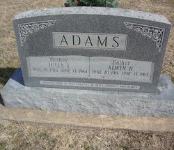
| Burial | : | Saint John's Episcopal Cemetery, Clay County, USA |
| Coordinate | : | 39.2193985, -97.0744019 |
| Description | : | 1910 US Census, Living in Union Township, Clay, Kansas with both parents and brother Benjamin. 1915 Kansas State Census, Living in Union Township, Clay, Kansas with both parents and three brothers. 1920 US Census, same information as above. Married Neddy Louise Katherine Schmale on Dec. 3, 1924 1925 Kansas State Census, Living in Union Township, Clay, Kansas with wife, Neddy. 1930 US Census, Living in Union Township, Clay, Kansas with wife and two daughters. Residence records, living in Union Township, Kansas in 1935 and 1938. 1940 US Census, Living in Union Township, Clay,... Read More |
frequently asked questions (FAQ):
-
Where is Robert William Adams's memorial?
Robert William Adams's memorial is located at: Saint John's Episcopal Cemetery, Clay County, USA.
-
When did Robert William Adams death?
Robert William Adams death on 2 May 1978 in Clay Center, Clay County, Kansas, USA
-
Where are the coordinates of the Robert William Adams's memorial?
Latitude: 39.2193985
Longitude: -97.0744019
Family Members:
Parent

Spouse
Siblings
Children
Flowers:


Nearby Cemetories:
1. Saint John's Episcopal Cemetery
Clay County, USA
Coordinate: 39.2193985, -97.0744019
2. Uniondale Cemetery
Wakefield, Clay County, USA
Coordinate: 39.2382800, -97.0918400
3. Mizpah Cemetery
Clay County, USA
Coordinate: 39.2057800, -97.1238500
4. Highland Cemetery
Wakefield, Clay County, USA
Coordinate: 39.2190247, -97.0133667
5. Madura Cemetery
Wakefield, Clay County, USA
Coordinate: 39.1842003, -97.0117035
6. Gilbert Cemetery
Clay County, USA
Coordinate: 39.2853012, -97.0625000
7. Milo Chapman Gravesite
Broughton, Clay County, USA
Coordinate: 39.2888500, -97.0724400
8. Timber Creek Cemetery
Wakefield, Clay County, USA
Coordinate: 39.2182999, -96.9805984
9. Gatesville Cemetery
Wakefield, Clay County, USA
Coordinate: 39.2721460, -97.0041380
10. Athelstane Cemetery
Athelstane Township, Clay County, USA
Coordinate: 39.1768990, -97.1753006
11. Zion Lutheran Cemetery
Clay County, USA
Coordinate: 39.2928009, -97.1557999
12. Pleasant Ridge Cemetery
Clay County, USA
Coordinate: 39.2789001, -97.1841965
13. Broughton Cemetery
Clay Center, Clay County, USA
Coordinate: 39.3306007, -97.0535965
14. Greenridge Cemetery
Dickinson County, USA
Coordinate: 39.1199989, -97.1433029
15. Barry Cemetery
Milford, Geary County, USA
Coordinate: 39.1889000, -96.9218979
16. Liberty Cemetery
Upland, Dickinson County, USA
Coordinate: 39.0896988, -97.0278015
17. Milford Cemetery
Milford, Geary County, USA
Coordinate: 39.1828003, -96.9047012
18. Bala Cemetery
Bala, Riley County, USA
Coordinate: 39.3053017, -96.9341965
19. Republican City Cemetery
Clay Center, Clay County, USA
Coordinate: 39.3431015, -97.1628036
20. Wesleyan Cemetery
Oak Hill, Clay County, USA
Coordinate: 39.2268982, -97.2572021
21. Alida Cemetery
Geary County, USA
Coordinate: 39.1030998, -96.9618988
22. Jones Cemetery
Dickinson County, USA
Coordinate: 39.0703011, -97.0860977
23. Branscom Cemetery
Milford, Geary County, USA
Coordinate: 39.1627998, -96.8942032
24. Clay County Poor Farm Cemetery
Clay Center, Clay County, USA
Coordinate: 39.3772700, -97.0727000