

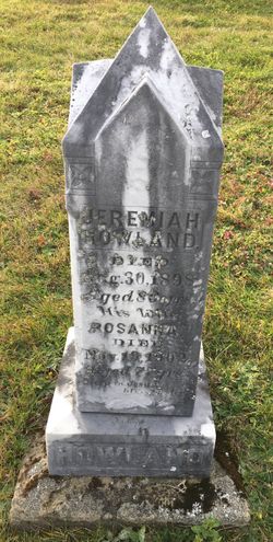
Rosanna A. “Rose” Graham Howland
| Birth | : | 12 Feb 1825 New Brunswick, Canada |
| Death | : | 19 Nov 1902 New Brunswick, Canada |
| Burial | : | All Saints Churchyard, Leigh, East Staffordshire Borough, England |
| Coordinate | : | 52.9199520, -1.9657840 |
frequently asked questions (FAQ):
-
Where is Rosanna A. “Rose” Graham Howland's memorial?
Rosanna A. “Rose” Graham Howland's memorial is located at: All Saints Churchyard, Leigh, East Staffordshire Borough, England.
-
When did Rosanna A. “Rose” Graham Howland death?
Rosanna A. “Rose” Graham Howland death on 19 Nov 1902 in New Brunswick, Canada
-
Where are the coordinates of the Rosanna A. “Rose” Graham Howland's memorial?
Latitude: 52.9199520
Longitude: -1.9657840
Family Members:
Spouse
Children

Flowers:


Nearby Cemetories:
1. All Saints Churchyard
Leigh, East Staffordshire Borough, England
Coordinate: 52.9199520, -1.9657840
2. St. Mary and All Saints Churchyard
Checkley, Staffordshire Moorlands District, England
Coordinate: 52.9384190, -1.9598100
3. Christ Church Churchyard
Upper Tean, Staffordshire Moorlands District, England
Coordinate: 52.9529687, -1.9831798
4. St Lawrence Churchyard
Bramshall, East Staffordshire Borough, England
Coordinate: 52.8963900, -1.9106400
5. St Chad Churchyard
Cheadle, Staffordshire Moorlands District, England
Coordinate: 52.9675320, -1.9729500
6. St Michael and All Angels Churchyard
Stramshall, East Staffordshire Borough, England
Coordinate: 52.9201040, -1.8836100
7. Croxden Abbey
Croxden, East Staffordshire Borough, England
Coordinate: 52.9549890, -1.9042630
8. St. Margaret Churchyard
Draycott, Staffordshire Moorlands District, England
Coordinate: 52.9594640, -2.0297030
9. St Leonard Churchyard
Bradley in the Moors, Staffordshire Moorlands District, England
Coordinate: 52.9693440, -1.9135150
10. All Saints Churchyard
Milwich, Stafford Borough, England
Coordinate: 52.8852590, -2.0443610
11. St. John the Baptist Churchyard
Kingstone, East Staffordshire Borough, England
Coordinate: 52.8630944, -1.9115108
12. Saint Mary the Virgin Churchyard
Uttoxeter, East Staffordshire Borough, England
Coordinate: 52.8987700, -1.8624100
13. Christ Church Churchyard
Hilderstone, Stafford Borough, England
Coordinate: 52.9100990, -2.0755470
14. St Giles ROman Catholic Churchyard
Cheadle, Staffordshire Moorlands District, England
Coordinate: 52.9860280, -1.9889960
15. St Nicholas Churchyard
Fulford, Stafford Borough, England
Coordinate: 52.9428060, -2.0722970
16. St John Churchyard
Alton, Staffordshire Moorlands District, England
Coordinate: 52.9783380, -1.8919190
17. St. Peter's Churchyard
Alton, Staffordshire Moorlands District, England
Coordinate: 52.9783470, -1.8918600
18. St Peter Churchyard
Forsbrook, Staffordshire Moorlands District, England
Coordinate: 52.9675780, -2.0593040
19. St Peter's Church
Gayton, Stafford Borough, England
Coordinate: 52.8540363, -2.0327095
20. St. Cuthbert's Churchyard
Doveridge, Derbyshire Dales District, England
Coordinate: 52.9042368, -1.8317361
21. All Saints Churchyard
Dilhorne, Staffordshire Moorlands District, England
Coordinate: 52.9875710, -2.0452820
22. Holy Trinity Churchyard
Oakamoor, Staffordshire Moorlands District, England
Coordinate: 53.0003870, -1.9236580
23. All Saints Churchyard
Sandon, Stafford Borough, England
Coordinate: 52.8628160, -2.0696270
24. All Saints Churchyard
Moddershall, Stafford Borough, England
Coordinate: 52.9296310, -2.1126940