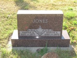
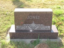
Roscoe Conkling Jones
| Birth | : | 24 Mar 1888 Platte, Charles Mix County, South Dakota, USA |
| Death | : | 9 Jun 1970 Valentine, Cherry County, Nebraska, USA |
| Burial | : | Mosswood Cemetery, Cotuit, Barnstable County, USA |
| Coordinate | : | 41.6279984, -70.4303970 |
| Description | : | Roscoe grew up on his parent's ranch which now lies under the back waters of the Ft. Randall Dam. He was baptized into the Christian faith and was faithful in attendance at First Lutheran Church at Milesville. He married Martha A. Lietzke of Platte and in 1917 they moved to their homestead at Deers Ears, northeast of Newell, South Dakota. In the spring of 1918 they returned to Platte to operate the home ranch. In 1919 they bought land northeast of Milesville, South Dakota and that became their home. |
frequently asked questions (FAQ):
-
Where is Roscoe Conkling Jones's memorial?
Roscoe Conkling Jones's memorial is located at: Mosswood Cemetery, Cotuit, Barnstable County, USA.
-
When did Roscoe Conkling Jones death?
Roscoe Conkling Jones death on 9 Jun 1970 in Valentine, Cherry County, Nebraska, USA
-
Where are the coordinates of the Roscoe Conkling Jones's memorial?
Latitude: 41.6279984
Longitude: -70.4303970
Family Members:
Parent
Spouse
Siblings
Children
Flowers:
Nearby Cemetories:
1. Mosswood Cemetery
Cotuit, Barnstable County, USA
Coordinate: 41.6279984, -70.4303970
2. Coombs Cemetery
Mashpee, Barnstable County, USA
Coordinate: 41.6417370, -70.4570980
3. Mashpee Town Cemetery
Mashpee, Barnstable County, USA
Coordinate: 41.6242981, -70.4787979
4. Marstons Mills Cemetery
Marstons Mills, Barnstable County, USA
Coordinate: 41.6612015, -70.4080963
5. Hillside Cemetery
Osterville, Barnstable County, USA
Coordinate: 41.6316700, -70.3787100
6. Saint Peters Episcopal Church Memorial Garden
Barnstable, Barnstable County, USA
Coordinate: 41.6209700, -70.3735800
7. Lakewood Cemetery
Mashpee, Barnstable County, USA
Coordinate: 41.6530991, -70.4783020
8. Great Neck Woods Cemetery
Mashpee, Barnstable County, USA
Coordinate: 41.6054000, -70.4835600
9. Attaquin Cemetery
Mashpee, Barnstable County, USA
Coordinate: 41.6517296, -70.4883881
10. Wakeby Cemetery
Sandwich, Barnstable County, USA
Coordinate: 41.6725500, -70.4723100
11. Boardley Road Cemetery
Sandwich, Barnstable County, USA
Coordinate: 41.6870003, -70.4559021
12. Percival Cemetery
Sandwich, Barnstable County, USA
Coordinate: 41.6883011, -70.4557037
13. Francis Family Cemetery
Mashpee, Barnstable County, USA
Coordinate: 41.6807900, -70.4816600
14. Congregational Cemetery
Barnstable, Barnstable County, USA
Coordinate: 41.6459007, -70.3461990
15. Beechwood Cemetery
Centerville, Barnstable County, USA
Coordinate: 41.6561012, -70.3491974
16. Centerville Ancient Cemetery
Centerville, Barnstable County, USA
Coordinate: 41.6547012, -70.3429031
17. Animal Inn Pet Cemetery
Forestdale, Barnstable County, USA
Coordinate: 41.6754200, -70.5070100
18. Saint Francis Xavier Cemetery
Centerville, Barnstable County, USA
Coordinate: 41.6516991, -70.3331985
19. Crocker Park Cemetery
Barnstable, Barnstable County, USA
Coordinate: 41.6959000, -70.3780975
20. West Parish Burial Ground
West Barnstable, Barnstable County, USA
Coordinate: 41.6984200, -70.3842920
21. Tobey Cemetery
Forestdale, Barnstable County, USA
Coordinate: 41.6972008, -70.4875031
22. Forestdale Cemetery
Forestdale, Barnstable County, USA
Coordinate: 41.6903000, -70.5024033
23. Bay View Cemetery
Waquoit Village, Barnstable County, USA
Coordinate: 41.5815720, -70.5268460
24. West Barnstable Cemetery
West Barnstable, Barnstable County, USA
Coordinate: 41.7080994, -70.3728027


