
| Birth | : | 23 May 1880 Licking County, Ohio, USA |
| Death | : | 21 Apr 1942 Licking County, Ohio, USA |
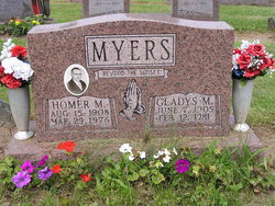
| Burial | : | Worcester County Memorial Park, Paxton, Worcester County, USA |
| Coordinate | : | 42.3245697, -71.9308777 |
| Inscription | : | Warm summer sun shine kindly here. Warm southern wind blow softly here. Green sod above, lie light, lie light. Good night, dear heart. Good night. Good night. |
| Description | : | The Newark Advocate, Monday, June 22, 1942, Pg. 9 Mrs. Harry C. Marmie Mrs. Rosetta Marmie, 62, wife of Harry C. Marmie, died Sunday at 8 a.m. in the home in Rocky Fork of complications following an operation. Born May 23, 1880 in Mary Ann Township, she was the daughter of John and Sarah C. (Coon) Devoll. Surviving are her husband whom she married in 1900; four children, Clyde and Ralph Marmie of Newark, Earl Marmie of Dennison and Mrs. Gladys Hunter of Rocky Fork; also 12 grandchildren'; her mother, Mrs. Sarah Devoll of St. Louisville; four brothers, Clarence... Read More |
frequently asked questions (FAQ):
-
Where is Rosetta DeVoll Marmie's memorial?
Rosetta DeVoll Marmie's memorial is located at: Worcester County Memorial Park, Paxton, Worcester County, USA.
-
When did Rosetta DeVoll Marmie death?
Rosetta DeVoll Marmie death on 21 Apr 1942 in Licking County, Ohio, USA
-
Where are the coordinates of the Rosetta DeVoll Marmie's memorial?
Latitude: 42.3245697
Longitude: -71.9308777
Family Members:
Parent

Spouse
Siblings
Children
Flowers:


Nearby Cemetories:
1. Worcester County Memorial Park
Paxton, Worcester County, USA
Coordinate: 42.3245697, -71.9308777
2. Mooreland Cemetery
Paxton, Worcester County, USA
Coordinate: 42.3280800, -71.9321000
3. Paxton Center Cemetery
Paxton, Worcester County, USA
Coordinate: 42.3128900, -71.9277700
4. Putnam Farm Cemetery
Rutland, Worcester County, USA
Coordinate: 42.3484010, -71.9771420
5. Elliot Hill Burial Ground
Leicester, Worcester County, USA
Coordinate: 42.2802200, -71.9145500
6. West Rutland Cemetery
Rutland, Worcester County, USA
Coordinate: 42.3561970, -71.9897170
7. Saint Mary Cemetery
Holden, Worcester County, USA
Coordinate: 42.3522400, -71.8684200
8. Grove Cemetery
Holden, Worcester County, USA
Coordinate: 42.3520400, -71.8672700
9. Old Burial Ground
Rutland, Worcester County, USA
Coordinate: 42.3756000, -71.9578000
10. Park Avenue Cemetery
Holden, Worcester County, USA
Coordinate: 42.3514200, -71.8656900
11. Rutland Rural Cemetery
Rutland, Worcester County, USA
Coordinate: 42.3790100, -71.9447500
12. Old Burying Ground
Holden, Worcester County, USA
Coordinate: 42.3505800, -71.8626000
13. Saint Joseph's Abbey Grounds
Spencer, Worcester County, USA
Coordinate: 42.2935500, -71.9990800
14. Saint Francis Episcopal Church Memorial Garden
Holden, Worcester County, USA
Coordinate: 42.3522800, -71.8588700
15. Quaker Cemetery
Leicester, Worcester County, USA
Coordinate: 42.2635600, -71.8960300
16. Smith Family Cemetery
Rutland, Worcester County, USA
Coordinate: 42.3946064, -71.9231169
17. Nazareth Home for Boys Cemetery
Leicester, Worcester County, USA
Coordinate: 42.2600000, -71.8892000
18. Green Hollow Cemetery
Oakham, Worcester County, USA
Coordinate: 42.3549995, -72.0243988
19. South Cemetery
Oakham, Worcester County, USA
Coordinate: 42.3382988, -72.0374985
20. Rawson Brook Burial Ground
Leicester, Worcester County, USA
Coordinate: 42.2453900, -71.9152600
21. Saint Josephs Cemetery
Leicester, Worcester County, USA
Coordinate: 42.2467003, -71.8874969
22. Pine Grove Cemetery
Leicester, Worcester County, USA
Coordinate: 42.2402992, -71.9124985
23. Rutland Prison Camp Cemetery
Rutland, Worcester County, USA
Coordinate: 42.3988500, -71.9923800
24. Oakham Center Cemetery
Oakham, Worcester County, USA
Coordinate: 42.3540000, -72.0421400