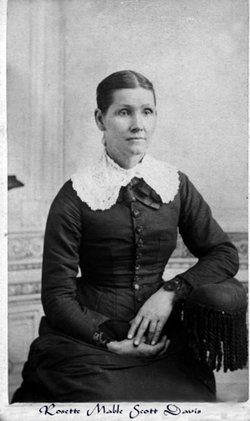
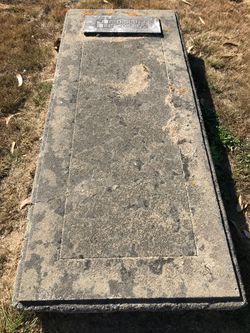
Rosette Mabel Scott Davis
| Birth | : | 8 Jun 1835 Castile, Wyoming County, New York, USA |
| Death | : | 6 Dec 1913 Cherry County, Nebraska, USA |
| Burial | : | St Michael Churchyard, York, York Unitary Authority, England |
| Coordinate | : | 53.9577900, -1.0825600 |
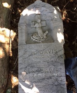
| Inscription | : | Mother. Wyoming County, NY |
frequently asked questions (FAQ):
-
Where is Rosette Mabel Scott Davis's memorial?
Rosette Mabel Scott Davis's memorial is located at: St Michael Churchyard, York, York Unitary Authority, England.
-
When did Rosette Mabel Scott Davis death?
Rosette Mabel Scott Davis death on 6 Dec 1913 in Cherry County, Nebraska, USA
-
Where are the coordinates of the Rosette Mabel Scott Davis's memorial?
Latitude: 53.9577900
Longitude: -1.0825600
Family Members:
Parent
Spouse
Siblings
Children
Flowers:
Nearby Cemetories:
1. St Michael Churchyard
York, York Unitary Authority, England
Coordinate: 53.9577900, -1.0825600
2. Saint Peter's
York, York Unitary Authority, England
Coordinate: 53.9577400, -1.0822600
3. Carmelite Friary of York (Defunct)
York, York Unitary Authority, England
Coordinate: 53.9577020, -1.0822860
4. St Peter the Little (Defunct)
York, York Unitary Authority, England
Coordinate: 53.9585310, -1.0821170
5. All Saints Pavement Churchyard
York, York Unitary Authority, England
Coordinate: 53.9581090, -1.0808820
6. St. Mary Castlegate Churchyard
York, York Unitary Authority, England
Coordinate: 53.9570800, -1.0804370
7. St John Churchyard
York, York Unitary Authority, England
Coordinate: 53.9574440, -1.0854510
8. St Helen Davygate Church Cemetery
York, York Unitary Authority, England
Coordinate: 53.9596460, -1.0830390
9. St Martin le Grand Churchyard
York, York Unitary Authority, England
Coordinate: 53.9593870, -1.0843800
10. St Sampson Churchyard
York, York Unitary Authority, England
Coordinate: 53.9597440, -1.0813060
11. St Crux Churchyard
York, York Unitary Authority, England
Coordinate: 53.9589890, -1.0795460
12. All Saints North Street Churchyard
York, York Unitary Authority, England
Coordinate: 53.9584400, -1.0862400
13. Greyfriars Abbey Church (Defunct)
York, York Unitary Authority, England
Coordinate: 53.9553090, -1.0814240
14. Holy Trinity Kings Court Churchyard
York, York Unitary Authority, England
Coordinate: 53.9599760, -1.0800800
15. St Helen Churchyard
York, York Unitary Authority, England
Coordinate: 53.9603030, -1.0841970
16. Central Methodist Hall
York, York Unitary Authority, England
Coordinate: 53.9594090, -1.0788330
17. St Martin cum Gregory Churchyard
York, York Unitary Authority, England
Coordinate: 53.9572500, -1.0871400
18. St Mary Bishophill Senior Churchyard
York, York Unitary Authority, England
Coordinate: 53.9551780, -1.0849680
19. Friends Burial Ground
York, York Unitary Authority, England
Coordinate: 53.9550140, -1.0846700
20. Augustinian Friary, York (Nonextant)
York, York Unitary Authority, England
Coordinate: 53.9601683, -1.0860521
21. St Mary Bishophill Junior Churchyard
York, York Unitary Authority, England
Coordinate: 53.9558890, -1.0869950
22. St Saviour Churchyard
York, York Unitary Authority, England
Coordinate: 53.9596100, -1.0780000
23. St Crux Hungate Burial Ground
York, York Unitary Authority, England
Coordinate: 53.9593540, -1.0774470
24. Holy Trinity Goodramgate Churchyard
York, York Unitary Authority, England
Coordinate: 53.9609810, -1.0804640

