
| Memorials | : | 2 |
| Location | : | York, York Unitary Authority, England |
| Coordinate | : | 53.9601683, -1.0860521 |
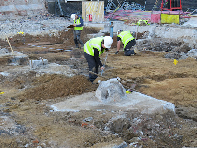
| Description | : | The Augustinians had become established in York by 1272. They were located between the Ouse and what is now Lendal Street in the southwest part of the city. Richard, Duke of Gloucester (later King Richard III) stayed there once on his return to Middleham. The friary was dissolved in 1538 and is not extant today. |
frequently asked questions (FAQ):
-
Where is Augustinian Friary, York (Nonextant)?
Augustinian Friary, York (Nonextant) is located at York, York Unitary Authority ,North Yorkshire ,England.
-
Augustinian Friary, York (Nonextant) cemetery's updated grave count on graveviews.com?
2 memorials
-
Where are the coordinates of the Augustinian Friary, York (Nonextant)?
Latitude: 53.9601683
Longitude: -1.0860521
Nearby Cemetories:
1. Lendal Congregational Chapel
York, York Unitary Authority, England
Coordinate: 53.9606360, -1.0860970
2. St Helen Churchyard
York, York Unitary Authority, England
Coordinate: 53.9603030, -1.0841970
3. St Wilfred Churchyard
York, York Unitary Authority, England
Coordinate: 53.9610550, -1.0848990
4. St Martin le Grand Churchyard
York, York Unitary Authority, England
Coordinate: 53.9593870, -1.0843800
5. Blackfriars Abbey Church (Defunct)
York, York Unitary Authority, England
Coordinate: 53.9594100, -1.0880900
6. All Saints North Street Churchyard
York, York Unitary Authority, England
Coordinate: 53.9584400, -1.0862400
7. St Helen Davygate Church Cemetery
York, York Unitary Authority, England
Coordinate: 53.9596460, -1.0830390
8. Abbey of St Mary (defunct)
York, York Unitary Authority, England
Coordinate: 53.9620290, -1.0883600
9. St Michael le Belfrey Churchyard
York, York Unitary Authority, England
Coordinate: 53.9618620, -1.0829730
10. St John Churchyard
York, York Unitary Authority, England
Coordinate: 53.9574440, -1.0854510
11. St Olave Churchyard
York, York Unitary Authority, England
Coordinate: 53.9622570, -1.0891560
12. St Sampson Churchyard
York, York Unitary Authority, England
Coordinate: 53.9597440, -1.0813060
13. St Peter the Little (Defunct)
York, York Unitary Authority, England
Coordinate: 53.9585310, -1.0821170
14. St Martin cum Gregory Churchyard
York, York Unitary Authority, England
Coordinate: 53.9572500, -1.0871400
15. York Minster
York, York Unitary Authority, England
Coordinate: 53.9619440, -1.0819440
16. St Michael Churchyard
York, York Unitary Authority, England
Coordinate: 53.9577900, -1.0825600
17. York Cholera Burial Ground
York, York Unitary Authority, England
Coordinate: 53.9586930, -1.0908420
18. Saint Peter's
York, York Unitary Authority, England
Coordinate: 53.9577400, -1.0822600
19. Carmelite Friary of York (Defunct)
York, York Unitary Authority, England
Coordinate: 53.9577020, -1.0822860
20. Holy Trinity Goodramgate Churchyard
York, York Unitary Authority, England
Coordinate: 53.9609810, -1.0804640
21. Holy Trinity Kings Court Churchyard
York, York Unitary Authority, England
Coordinate: 53.9599760, -1.0800800
22. All Saints Pavement Churchyard
York, York Unitary Authority, England
Coordinate: 53.9581090, -1.0808820
23. St Giles Churchyard
York, York Unitary Authority, England
Coordinate: 53.9640010, -1.0843930
24. St Crux Churchyard
York, York Unitary Authority, England
Coordinate: 53.9589890, -1.0795460