
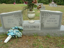
Roy Raymond Holloway
| Birth | : | 1 Sep 1923 Winona, Shannon County, Missouri, USA |
| Death | : | 6 Jul 1988 Springfield, Greene County, Missouri, USA |
| Burial | : | Agecroft Cemetery and Crematorium, Salford, Metropolitan Borough of Salford, England |
| Coordinate | : | 53.5100250, -2.2940500 |
| Description | : | Roy Raymond Holloway was born September 1, 1923 at Winona, MO the son of Nancy Holloway and departed this life on July 6, 1988 at Mt. Vernon Care Center in Springfield, MO at the age of 64 years. He was married on May 26, 1951 to Rosemary Martin at Salem, AR and to this union three children were born. He was preceded in death by his mother; his wife, Rosemary on December 24, 1981; and one brother, Raymond. He is survived by three sons, Pete Holloway of Battlefield, MO; Dean Holloway of Maysville, KY; and Eugene Lee of... Read More |
frequently asked questions (FAQ):
-
Where is Roy Raymond Holloway's memorial?
Roy Raymond Holloway's memorial is located at: Agecroft Cemetery and Crematorium, Salford, Metropolitan Borough of Salford, England.
-
When did Roy Raymond Holloway death?
Roy Raymond Holloway death on 6 Jul 1988 in Springfield, Greene County, Missouri, USA
-
Where are the coordinates of the Roy Raymond Holloway's memorial?
Latitude: 53.5100250
Longitude: -2.2940500
Family Members:
Spouse

Children
Flowers:


Nearby Cemetories:
1. Agecroft Cemetery and Crematorium
Salford, Metropolitan Borough of Salford, England
Coordinate: 53.5100250, -2.2940500
2. Agecroft Jewish Cemetery
Pendlebury, Metropolitan Borough of Salford, England
Coordinate: 53.5110302, -2.2955830
3. Rainsough Jewish Cemetery
Prestwich, Metropolitan Borough of Bury, England
Coordinate: 53.5185530, -2.2906950
4. St John The Evangelist Churchyard
Pendlebury, Metropolitan Borough of Salford, England
Coordinate: 53.5036200, -2.3088500
5. St Paul's Churchyard
Salford, Metropolitan Borough of Salford, England
Coordinate: 53.5148800, -2.2725500
6. Saint Augustine's Churchyard
Pendlebury, Metropolitan Borough of Salford, England
Coordinate: 53.5107070, -2.3223960
7. St. Thomas' Churchyard
Salford, Metropolitan Borough of Salford, England
Coordinate: 53.4921430, -2.2856130
8. St. Mary the Virgin Churchyard
Prestwich, Metropolitan Borough of Bury, England
Coordinate: 53.5294033, -2.2864891
9. Great Synagogue Cemetery
Prestwich, Metropolitan Borough of Bury, England
Coordinate: 53.5315510, -2.2845730
10. St. Paul's Wesleyan Methodist Churchyard
Swinton, Metropolitan Borough of Salford, England
Coordinate: 53.5133900, -2.3397500
11. St. Peter's Churchyard
Swinton, Metropolitan Borough of Salford, England
Coordinate: 53.5119130, -2.3413860
12. St. Marks' Churchyard
Cheetham Hill, Metropolitan Borough of Manchester, England
Coordinate: 53.5113780, -2.2462660
13. Wesleyan Methodist Cemetery
Crumpsall, Metropolitan Borough of Manchester, England
Coordinate: 53.5142870, -2.2447610
14. Weaste Cemetery
Weaste, Metropolitan Borough of Salford, England
Coordinate: 53.4795227, -2.3017540
15. Swinton Cemetery
Swinton, Metropolitan Borough of Salford, England
Coordinate: 53.5183372, -2.3457739
16. St Anne Churchyard
Clifton, Metropolitan Borough of Salford, England
Coordinate: 53.5277070, -2.3391650
17. Strangeways Prison Cemetery (Defunct)
Manchester, Metropolitan Borough of Manchester, England
Coordinate: 53.4925000, -2.2463890
18. Irwell Street Wesleyan Chapel Cemetery
Salford, Metropolitan Borough of Salford, England
Coordinate: 53.4829750, -2.2587540
19. Manchester Reform Jewish Old Cemetery
Whitefield, Metropolitan Borough of Bury, England
Coordinate: 53.5442728, -2.2918894
20. New Jerusalem Temple Cemetery
Salford, Metropolitan Borough of Salford, England
Coordinate: 53.4827720, -2.2571250
21. St Mary the Virgin Churchyard
Eccles, Metropolitan Borough of Salford, England
Coordinate: 53.4843810, -2.3346810
22. St Luke's Churchyard
Cheetham Hill, Metropolitan Borough of Manchester, England
Coordinate: 53.5041660, -2.2354680
23. Christ Church
Salford, Metropolitan Borough of Salford, England
Coordinate: 53.4864284, -2.2497653
24. St Chad's Churchyard
Cheetham Hill, Metropolitan Borough of Manchester, England
Coordinate: 53.4922100, -2.2400500