
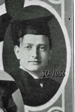
| Birth | : | 30 Oct 1884 Pierce City, Lawrence County, Missouri, USA |
| Death | : | 21 Jun 1971 Lawrence, Douglas County, Kansas, USA |
| Burial | : | Oak Hill Cemetery, Lawrence, Douglas County, USA |
| Coordinate | : | 38.9589005, -95.2118988 |
| Plot | : | Section 14 |
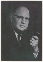
| Description | : | Topeka State Journal Tues. 22 June, 1971, pg. 22: LAWRENCE--Mrs. Ruth Naylor Chandler, 86, Lawrence, died Monday (June 21) in a rest home here. She had been ill several years. She was born Oct. 30, 1884 at Pierce City, MO., and lived at Junction City several years before she moved to Lawrence in 1928. She was a member of Plymouth Congregational Church at Lawrence and Plymouth Women at the church. She was married to Herbert E. Chandler. He survives. Other survivors include a son, John Chandler, Holton, a daughter, Mrs. Ruth M. Harries, WaKeeney; a sister, Mrs. Beulah Bassett, Lawrence; a brother, Richard M.... Read More |
frequently asked questions (FAQ):
-
Where is Ruth Ella Naylor Chandler's memorial?
Ruth Ella Naylor Chandler's memorial is located at: Oak Hill Cemetery, Lawrence, Douglas County, USA.
-
When did Ruth Ella Naylor Chandler death?
Ruth Ella Naylor Chandler death on 21 Jun 1971 in Lawrence, Douglas County, Kansas, USA
-
Where are the coordinates of the Ruth Ella Naylor Chandler's memorial?
Latitude: 38.9589005
Longitude: -95.2118988
Family Members:
Spouse
Children
Flowers:


Nearby Cemetories:
1. Oak Hill Cemetery
Lawrence, Douglas County, USA
Coordinate: 38.9589005, -95.2118988
2. Mount Calvary Catholic Cemetery
Lawrence, Douglas County, USA
Coordinate: 38.9580002, -95.2139969
3. Memorial Park Cemetery
Lawrence, Douglas County, USA
Coordinate: 38.9552994, -95.2153015
4. Trinity Episcopal Church Columbarium
Lawrence, Douglas County, USA
Coordinate: 38.9653893, -95.2373886
5. Saint Johns Catholic Cemetery
Douglas County, USA
Coordinate: 38.9437900, -95.1919600
6. Dyche Hall Natural History Museum
Lawrence, Douglas County, USA
Coordinate: 38.9584800, -95.2434800
7. Franklin Cemetery
Douglas County, USA
Coordinate: 38.9437523, -95.1869431
8. Haskell Cemetery
Lawrence, Douglas County, USA
Coordinate: 38.9353790, -95.2284241
9. Pioneer Cemetery
Lawrence, Douglas County, USA
Coordinate: 38.9528008, -95.2611008
10. First Presbyterian Church Memorial Garden
Lawrence, Douglas County, USA
Coordinate: 38.9414900, -95.2641600
11. Maple Grove Cemetery
Lawrence, Douglas County, USA
Coordinate: 39.0018997, -95.2316971
12. County Poor Farm Cemetery
Douglas County, USA
Coordinate: 38.9119400, -95.2214600
13. Adams Cemetery
Douglas County, USA
Coordinate: 38.9955400, -95.2509100
14. Kennedy Cemetery
Douglas County, USA
Coordinate: 38.9112900, -95.2269200
15. Davis Cemetery
Lawrence, Douglas County, USA
Coordinate: 38.9722500, -95.2831100
16. Blue Mound Cemetery
Lawrence, Douglas County, USA
Coordinate: 38.9046600, -95.1865400
17. Marshall Cemetery
Douglas County, USA
Coordinate: 38.9040800, -95.2446700
18. Dutton Cemetery
Douglas County, USA
Coordinate: 38.8989800, -95.2790600
19. Luckan Family Cemetery
Fall Leaf, Leavenworth County, USA
Coordinate: 38.9808500, -95.1128000
20. Cemetery Beni Israel
Eudora, Douglas County, USA
Coordinate: 38.9280128, -95.1122208
21. Southwest City Cemetery
Eudora, Douglas County, USA
Coordinate: 38.9334800, -95.1070300
22. Lyon Family Cemetery
Lawrence, Douglas County, USA
Coordinate: 38.9877440, -95.3166530
23. Corpus Christi Catholic Church Columbarium
Lawrence, Douglas County, USA
Coordinate: 38.9572250, -95.3238450
24. Richland Cemetery
Lawrence, Douglas County, USA
Coordinate: 38.8768997, -95.2630997