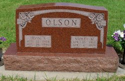
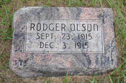
| Birth | : | 20 Jun 1910 Sargent, Custer County, Nebraska, USA |
| Death | : | 9 Nov 1997 Livingston, Park County, Montana, USA |
| Burial | : | Helton Cemetery, Bean Station, Grainger County, USA |
| Coordinate | : | 36.2910995, -83.3993988 |
frequently asked questions (FAQ):
-
Where is Ruth F Olson Sweet's memorial?
Ruth F Olson Sweet's memorial is located at: Helton Cemetery, Bean Station, Grainger County, USA.
-
When did Ruth F Olson Sweet death?
Ruth F Olson Sweet death on 9 Nov 1997 in Livingston, Park County, Montana, USA
-
Where are the coordinates of the Ruth F Olson Sweet's memorial?
Latitude: 36.2910995
Longitude: -83.3993988
Family Members:
Parent
Spouse
Siblings
Flowers:
Nearby Cemetories:
1. Helton Cemetery
Bean Station, Grainger County, USA
Coordinate: 36.2910995, -83.3993988
2. Freedom Chapel Missionary Baptist Church Cemetery
Grainger County, USA
Coordinate: 36.2865410, -83.3948480
3. Hodge Cemetery
Helton, Grainger County, USA
Coordinate: 36.2985360, -83.4077340
4. Lakeshore Missionary Baptist Church Cemetery
Bean Station, Grainger County, USA
Coordinate: 36.2797470, -83.3780200
5. Holston Baptist Church Cemetery
Bean Station, Grainger County, USA
Coordinate: 36.2775002, -83.3796997
6. Heath Chapel Cemetery
Grainger County, USA
Coordinate: 36.2851730, -83.3615220
7. Bowen Cemetery
Grainger County, USA
Coordinate: 36.3093987, -83.4328003
8. Marys Chapel Cemetery
Grainger County, USA
Coordinate: 36.3011017, -83.3569031
9. Cobb Cemetery
Grainger County, USA
Coordinate: 36.3189011, -83.3644028
10. Bean Station Cemetery
Bean Station, Grainger County, USA
Coordinate: 36.3283000, -83.3697000
11. Floyd Cemetery
Grainger County, USA
Coordinate: 36.3328018, -83.4188995
12. Harrell Cemetery
Bean Station, Grainger County, USA
Coordinate: 36.3074989, -83.3463974
13. Grove Cemetery
Grainger County, USA
Coordinate: 36.2661018, -83.4558029
14. Holt's Baptist Church Cemetery
Morristown, Hamblen County, USA
Coordinate: 36.2467220, -83.3626160
15. Noeton Baptist Church Cemetery Original
Bean Station, Grainger County, USA
Coordinate: 36.3012600, -83.3342200
16. Buck Hollow Cemetery
Grainger County, USA
Coordinate: 36.3344120, -83.3589440
17. Kidwells Ridge Baptist Church Cemetery
Morristown, Hamblen County, USA
Coordinate: 36.2359870, -83.3917690
18. Helton Cemetery
Bean Station, Grainger County, USA
Coordinate: 36.3451190, -83.3831290
19. Harris Cemetery
Grainger County, USA
Coordinate: 36.3055992, -83.3308029
20. Macedonia Missionary Baptist Church Cemetery
Morristown, Hamblen County, USA
Coordinate: 36.2696100, -83.3301400
21. Clinch Valley American Christian Church Cemetery
Grainger County, USA
Coordinate: 36.3492300, -83.4171700
22. Atkins Cemetery
Grainger County, USA
Coordinate: 36.3506000, -83.3792000
23. Farmer Cemetery
Grainger County, USA
Coordinate: 36.3381004, -83.4516983
24. Batman Cemetery
Grainger County, USA
Coordinate: 36.3469009, -83.4403000

