
| Birth | : | 19 Jun 1832 Bellefontaine, Logan County, Ohio, USA |
| Death | : | 4 Sep 1915 Wabash, Wabash County, Indiana, USA |
| Burial | : | Waikaraka Cemetery, Ōnehunga, Auckland Council, New Zealand |
| Coordinate | : | -36.9297140, 174.7967170 |
| Plot | : | Sec I, lot 32, sp 3 |
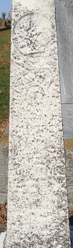
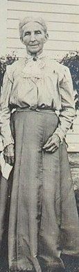
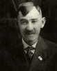
| Description | : | (posted by judychrist1 on Moore-Howard tree on Ancestry.com) Born in Logan Couny, near Bellefonaine, Ohio June 19, 1832, the son of John Moore, he lived 83 years, 7 months, 22 days and died September 2, 1915. He came to Wabash in 1851 and lived there the rest of his life. In the winter 1852 he purchased the photography gallery of A. B. Snavely and was for many years a most successful and the only photogrpher in the city. He married Amanda J. Sweet in 1856 and they had one child, Charles F., Amanda died October 23, 1858. In 1859 he married... Read More |
frequently asked questions (FAQ):
-
Where is Samuel B Moore's memorial?
Samuel B Moore's memorial is located at: Waikaraka Cemetery, Ōnehunga, Auckland Council, New Zealand.
-
When did Samuel B Moore death?
Samuel B Moore death on 4 Sep 1915 in Wabash, Wabash County, Indiana, USA
-
Where are the coordinates of the Samuel B Moore's memorial?
Latitude: -36.9297140
Longitude: 174.7967170
Family Members:
Spouse
Children

Flowers:

Sam , do you know the best thing about God.He belives in you even when you dont belive in him. God Bless.
Left by Anonymous on 18 Jul 2016

Left by Anonymous on 18 Jan 2019
Sam , do you know the best thing about God.He belives in you even when you dont belive in him. God Bless.
Left by Anonymous on 18 Jul 2016
Left by Anonymous on 18 Jan 2019


Nearby Cemetories:
1. Waikaraka Cemetery
Ōnehunga, Auckland Council, New Zealand
Coordinate: -36.9297140, 174.7967170
2. Onehunga Catholic Cemetery
Ōnehunga, Auckland Council, New Zealand
Coordinate: -36.9224360, 174.7884560
3. Our Lady of the Assumption Catholic Church
Ōnehunga, Auckland Council, New Zealand
Coordinate: -36.9223690, 174.7884530
4. St. Peter's Anglican Cemetery
Ōnehunga, Auckland Council, New Zealand
Coordinate: -36.9227113, 174.7847550
5. Mangere Piriti Urupā St. James Churchyard
Mangere, Auckland Council, New Zealand
Coordinate: -36.9418970, 174.7835260
6. Mangere Lawn Cemetery
Mangere, Auckland Council, New Zealand
Coordinate: -36.9626150, 174.7857000
7. Hillsborough Cemetery
Hillsborough, Auckland Council, New Zealand
Coordinate: -36.9246600, 174.7524030
8. Otahuhu Public Cemetery
Ōtāhūhū, Auckland Council, New Zealand
Coordinate: -36.9377500, 174.8432390
9. Holy Trinity Memorial Park
Ōtāhūhū, Auckland Council, New Zealand
Coordinate: -36.9374510, 174.8448580
10. Nixon Memorial
Ōtāhūhū, Auckland Council, New Zealand
Coordinate: -36.9499366, 174.8449909
11. Saint Andrew's Churchyard
Epsom, Auckland Council, New Zealand
Coordinate: -36.8937200, 174.7654100
12. St. Joseph and St. Joachim Catholic Cemetery
Ōtāhūhū, Auckland Council, New Zealand
Coordinate: -36.9436100, 174.8490100
13. Mangere Presbyterian Cemetery
Mangere, Auckland Council, New Zealand
Coordinate: -36.9750197, 174.7924783
14. St Matthias Churchyard
Panmure, Auckland Council, New Zealand
Coordinate: -36.9053300, 174.8577200
15. St. Patrick's Roman Catholic Church Cemetery
Panmure, Auckland Council, New Zealand
Coordinate: -36.9029680, 174.8564960
16. St Mark's Anglican Church Cemetery
Remuera, Auckland Council, New Zealand
Coordinate: -36.8729300, 174.7801600
17. St. John's Presbyterian Church Cemetery
Papatoetoe, Auckland Council, New Zealand
Coordinate: -36.9674185, 174.8598178
18. Mount Eden Stockade Cemetery
Mount Eden, Auckland Council, New Zealand
Coordinate: -36.8678370, 174.7666430
19. St. John’s College Graveyard
Saint Johns, Auckland Council, New Zealand
Coordinate: -36.8738169, 174.8416826
20. Purewa Cemetery
Meadowbank, Auckland Council, New Zealand
Coordinate: -36.8674300, 174.8297900
21. Papatoetoe Cemetery
Papatoetoe, Auckland Council, New Zealand
Coordinate: -36.9893110, 174.8373530
22. Point England Presbyterian Cemetery
Point England, Auckland Council, New Zealand
Coordinate: -36.8823420, 174.8601550
23. Ōrākei (Rautara St) Urupā
Orakei, Auckland Council, New Zealand
Coordinate: -36.8610770, 174.8188960
24. Manukau Memorial Gardens
Manukau, Auckland Council, New Zealand
Coordinate: -36.9944380, 174.8397300