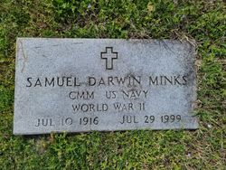
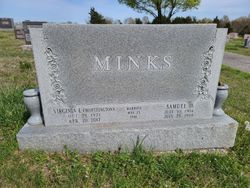
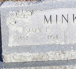
Samuel Darwin “POOD” Minks
| Birth | : | 10 Jul 1916 Collins, St. Clair County, Missouri, USA |
| Death | : | 29 Jul 1999 Collins, St. Clair County, Missouri, USA |
| Burial | : | St. Michael's Cemetery, Bath, Bath and North East Somerset Unitary Authority, England |
| Coordinate | : | 51.3859700, -2.3814500 |
| Description | : | From the bolivar Herald-Free Press July 1999 Obituary Archives. http://www.bolivarmonews.com/site/tab1.cfm?newsid=2146329&BRD=2841&PAG=461&dept_id=603515&rfi=6 Samuel D. Minks Samuel Darwin "Pood" Minks, 83, Collins, died at 1:35 p.m. Thursday, July 29, 1999, at Big Spring Care Center, Humansville. He was born July 10, 1916, near Collins, the son of Richard G. and Mary Estella Nance Minks. He grew up in Collins and graduated from Collins High School in 1935. When World War II began, he enlisted in the U.S. Navy. As a Navy Seabee, he saw service in Africa and the Pacific. On Okinawa, he was chief petty officer responsible for the heavy equipment used... Read More |
frequently asked questions (FAQ):
-
Where is Samuel Darwin “POOD” Minks's memorial?
Samuel Darwin “POOD” Minks's memorial is located at: St. Michael's Cemetery, Bath, Bath and North East Somerset Unitary Authority, England.
-
When did Samuel Darwin “POOD” Minks death?
Samuel Darwin “POOD” Minks death on 29 Jul 1999 in Collins, St. Clair County, Missouri, USA
-
Where are the coordinates of the Samuel Darwin “POOD” Minks's memorial?
Latitude: 51.3859700
Longitude: -2.3814500
Family Members:
Parent
Siblings
Nearby Cemetories:
1. St. Michael's Cemetery
Bath, Bath and North East Somerset Unitary Authority, England
Coordinate: 51.3859700, -2.3814500
2. Locksbrook Cemetery
Lower Weston, Bath and North East Somerset Unitary Authority, England
Coordinate: 51.3845180, -2.3850300
3. Locksbrook St Saviour's Cemetery
Bath and North East Somerset Unitary Authority, England
Coordinate: 51.3867880, -2.3863380
4. Moravian Burial Ground
Bath, Bath and North East Somerset Unitary Authority, England
Coordinate: 51.3894150, -2.3798150
5. Twerton Cemetery
Twerton, Bath and North East Somerset Unitary Authority, England
Coordinate: 51.3802500, -2.3836220
6. St. James' Cemetery
Bath, Bath and North East Somerset Unitary Authority, England
Coordinate: 51.3802000, -2.3722200
7. All Saints Churchyard
Weston, Bath and North East Somerset Unitary Authority, England
Coordinate: 51.3956850, -2.3881320
8. St Mary's Chapel, Queens Square
Bath, Bath and North East Somerset Unitary Authority, England
Coordinate: 51.3827790, -2.3649790
9. St Michael and All Angels Churchyard
Twerton, Bath and North East Somerset Unitary Authority, England
Coordinate: 51.3809000, -2.3981000
10. Countess of Huntingdon's Chapel
Walcot, Bath and North East Somerset Unitary Authority, England
Coordinate: 51.3967020, -2.3907434
11. Bath General Hospital Burial Ground
Bath and North East Somerset Unitary Authority, England
Coordinate: 51.3824715, -2.3614742
12. Quaker Meeting House
Bath, Bath and North East Somerset Unitary Authority, England
Coordinate: 51.3823280, -2.3604380
13. Ss Michael & Paul Churchyard
Bath, Bath and North East Somerset Unitary Authority, England
Coordinate: 51.3834970, -2.3596980
14. St. Michael's Burial Ground
Bath, Bath and North East Somerset Unitary Authority, England
Coordinate: 51.3838810, -2.3594090
15. St. Swithin Churchyard
Bath, Bath and North East Somerset Unitary Authority, England
Coordinate: 51.3885480, -2.3594500
16. St James Old Burial Ground
Bath, Bath and North East Somerset Unitary Authority, England
Coordinate: 51.3798600, -2.3610100
17. St. Mary de Stall Churchyard (Defunct)
Bath, Bath and North East Somerset Unitary Authority, England
Coordinate: 51.3813350, -2.3600353
18. St Mary Magdalen Chapel
Widcombe, Bath and North East Somerset Unitary Authority, England
Coordinate: 51.3760486, -2.3643405
19. Bath Abbey
Bath, Bath and North East Somerset Unitary Authority, England
Coordinate: 51.3815310, -2.3586640
20. Walcot Methodist Chapel Burial Ground
Bath, Bath and North East Somerset Unitary Authority, England
Coordinate: 51.3897080, -2.3579610
21. Old Orchard Street Catholic Burial Vault
Bath, Bath and North East Somerset Unitary Authority, England
Coordinate: 51.3800370, -2.3579910
22. St. John the Baptist Churchyard
Bathwick, Bath and North East Somerset Unitary Authority, England
Coordinate: 51.3886890, -2.3547030
23. Saint Mark's Churchyard
Widcombe, Bath and North East Somerset Unitary Authority, England
Coordinate: 51.3766660, -2.3588010
24. St. Mary's Churchyard
Bathwick, Bath and North East Somerset Unitary Authority, England
Coordinate: 51.3876120, -2.3543540

