


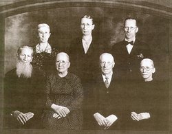
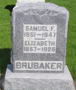
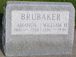
Samuel Frederick Brubaker
| Birth | : | 24 Sep 1851 Roanoke, Roanoke City, Virginia, USA |
| Death | : | 4 Feb 1947 Wabash, Wabash County, Indiana, USA |
| Burial | : | Hillside Cemetery, Osterville, Barnstable County, USA |
| Coordinate | : | 41.6316700, -70.3787100 |
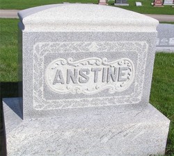
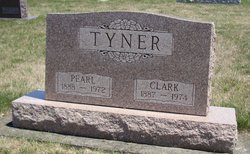
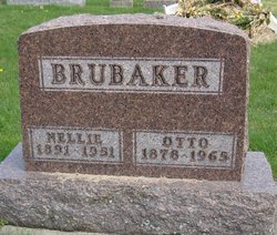
| Description | : | He married Elizabeth Anstine February 27th, 1879 in Wabash County, Indiana. He was also the father of Mary Ellen, John Edward, Pearl May, Nellie Irene, Frank W, and Ida Marie. |
frequently asked questions (FAQ):
-
Where is Samuel Frederick Brubaker's memorial?
Samuel Frederick Brubaker's memorial is located at: Hillside Cemetery, Osterville, Barnstable County, USA.
-
When did Samuel Frederick Brubaker death?
Samuel Frederick Brubaker death on 4 Feb 1947 in Wabash, Wabash County, Indiana, USA
-
Where are the coordinates of the Samuel Frederick Brubaker's memorial?
Latitude: 41.6316700
Longitude: -70.3787100
Family Members:
Parent

Spouse
Siblings

Children
Flowers:


Nearby Cemetories:
1. Hillside Cemetery
Osterville, Barnstable County, USA
Coordinate: 41.6316700, -70.3787100
2. Saint Peters Episcopal Church Memorial Garden
Barnstable, Barnstable County, USA
Coordinate: 41.6209700, -70.3735800
3. Congregational Cemetery
Barnstable, Barnstable County, USA
Coordinate: 41.6459007, -70.3461990
4. Beechwood Cemetery
Centerville, Barnstable County, USA
Coordinate: 41.6561012, -70.3491974
5. Centerville Ancient Cemetery
Centerville, Barnstable County, USA
Coordinate: 41.6547012, -70.3429031
6. Marstons Mills Cemetery
Marstons Mills, Barnstable County, USA
Coordinate: 41.6612015, -70.4080963
7. Mosswood Cemetery
Cotuit, Barnstable County, USA
Coordinate: 41.6279984, -70.4303970
8. Saint Francis Xavier Cemetery
Centerville, Barnstable County, USA
Coordinate: 41.6516991, -70.3331985
9. Saint Andrew's By The Sea Columbarium
Hyannis Port, Barnstable County, USA
Coordinate: 41.6306199, -70.3073859
10. Coombs Cemetery
Mashpee, Barnstable County, USA
Coordinate: 41.6417370, -70.4570980
11. Crocker Park Cemetery
Barnstable, Barnstable County, USA
Coordinate: 41.6959000, -70.3780975
12. South Street Cemetery
Hyannis, Barnstable County, USA
Coordinate: 41.6480300, -70.2920500
13. West Parish Burial Ground
West Barnstable, Barnstable County, USA
Coordinate: 41.6984200, -70.3842920
14. Oak Grove Cemetery
Hyannis, Barnstable County, USA
Coordinate: 41.6432991, -70.2889023
15. Oak Neck Cemetery
Hyannis, Barnstable County, USA
Coordinate: 41.6431007, -70.2861023
16. Baptist Church Cemetery
Hyannis, Barnstable County, USA
Coordinate: 41.6519699, -70.2873230
17. Sandy Street Cemetery
Barnstable, Barnstable County, USA
Coordinate: 41.6968994, -70.3401031
18. Mashpee Town Cemetery
Mashpee, Barnstable County, USA
Coordinate: 41.6242981, -70.4787979
19. Saint Patricks Cemetery
Hyannis, Barnstable County, USA
Coordinate: 41.6562996, -70.2835999
20. Universalist Cemetery
Hyannis, Barnstable County, USA
Coordinate: 41.6549100, -70.2822390
21. West Barnstable Cemetery
West Barnstable, Barnstable County, USA
Coordinate: 41.7080994, -70.3728027
22. Lakewood Cemetery
Mashpee, Barnstable County, USA
Coordinate: 41.6530991, -70.4783020
23. Boardley Road Cemetery
Sandwich, Barnstable County, USA
Coordinate: 41.6870003, -70.4559021
24. Percival Cemetery
Sandwich, Barnstable County, USA
Coordinate: 41.6883011, -70.4557037