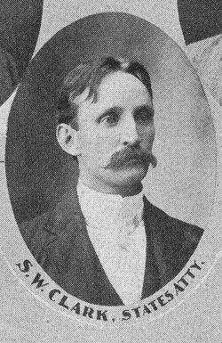
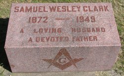
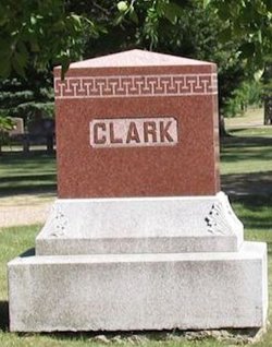
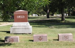
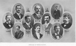
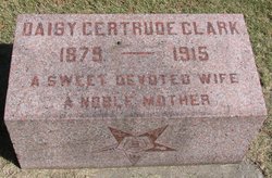
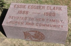
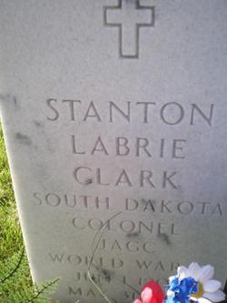
Samuel Wesley Clark
| Birth | : | 28 Dec 1872 Platteville, Grant County, Wisconsin, USA |
| Death | : | 5 Jan 1949 Spink County, South Dakota, USA |
| Burial | : | St. John Churchyard, Lockerley, Test Valley Borough, England |
| Coordinate | : | 51.0387300, -1.5757930 |
| Plot | : | Division B, Block 094, Grave 004 |
| Description | : | Republican. Lawyer; Spink County State's Attorney, 1900-04; South Dakota state attorney general, 1907-11; U.S. District Attorney for South Dakota, 1921-26. ================================= HON. S. WESLEY CLARK was born December 28th, 1872, at Plattville, Grant county, Wisconsin, of English ancestry. His father, Samuel P. Clark, was born in the state of Vermont, and his mother Lizzie O. (Hunting- ton) Clark was born at Liverpool, England. The family moved to Dakota Territory, in July, 1882, and located in township 118, range 66, in Faulk county There were only four other families in the... Read More |
frequently asked questions (FAQ):
-
Where is Samuel Wesley Clark's memorial?
Samuel Wesley Clark's memorial is located at: St. John Churchyard, Lockerley, Test Valley Borough, England.
-
When did Samuel Wesley Clark death?
Samuel Wesley Clark death on 5 Jan 1949 in Spink County, South Dakota, USA
-
Where are the coordinates of the Samuel Wesley Clark's memorial?
Latitude: 51.0387300
Longitude: -1.5757930
Family Members:
Parent
Spouse
Siblings
Children
Flowers:
Nearby Cemetories:
1. St. John Churchyard
Lockerley, Test Valley Borough, England
Coordinate: 51.0387300, -1.5757930
2. St Peter Churchyard
East Tytherley, Test Valley Borough, England
Coordinate: 51.0598230, -1.5843250
3. St. Winfrith Churchyard
East Dean, Test Valley Borough, England
Coordinate: 51.0393480, -1.6115260
4. St Andrew Churchyard
Mottisfont, Test Valley Borough, England
Coordinate: 51.0391010, -1.5367710
5. Mottisfont Abbey
Mottisfont, Test Valley Borough, England
Coordinate: 51.0412080, -1.5366290
6. St Andrew Church Cemetery
Mottisfont, Test Valley Borough, England
Coordinate: 51.0377320, -1.5363190
7. St. Peter's Churchyard
West Tytherley, Test Valley Borough, England
Coordinate: 51.0662240, -1.6100910
8. All Saints Churchyard
Awbridge, Test Valley Borough, England
Coordinate: 51.0095230, -1.5391870
9. St. Leonard Churchyard
Sherfield English, Test Valley Borough, England
Coordinate: 51.0001130, -1.5875130
10. St. Mary's Churchyard
Michelmersh, Test Valley Borough, England
Coordinate: 51.0378900, -1.5078630
11. St Andrew Churchyard
Timsbury, Test Valley Borough, England
Coordinate: 51.0193310, -1.5084530
12. St James Churchyard
Bossington, Test Valley Borough, England
Coordinate: 51.0766800, -1.5216400
13. St Margaret of Antioch Churchyard
East Wellow, Test Valley Borough, England
Coordinate: 50.9822010, -1.5699490
14. St Mary Churchyard
Broughton, Test Valley Borough, England
Coordinate: 51.0948390, -1.5599920
15. Broughton Cemetery
Broughton, Test Valley Borough, England
Coordinate: 51.0963729, -1.5671721
16. St Peter Churchyard
Plaitford, Test Valley Borough, England
Coordinate: 50.9815600, -1.6052890
17. All Saints Churchyard
Houghton, Test Valley Borough, England
Coordinate: 51.0921400, -1.5138700
18. St. Peter and St. Paul Churchyard
Kings Somborne, Test Valley Borough, England
Coordinate: 51.0770120, -1.4871030
19. Romsey Abbey
Romsey, Test Valley Borough, England
Coordinate: 50.9896510, -1.5012580
20. All Saints Churchyard
Braishfield, Test Valley Borough, England
Coordinate: 51.0271030, -1.4650780
21. King's Somborne New Cemetery
Kings Somborne, Test Valley Borough, England
Coordinate: 51.0808800, -1.4839600
22. Woodley Cemetery
Romsey, Test Valley Borough, England
Coordinate: 51.0075340, -1.4724670
23. Botley Road Cemetery
Romsey, Test Valley Borough, England
Coordinate: 50.9884090, -1.4784770
24. Broad Chalke Congregational Chapelyard
Broad Chalke, Wiltshire Unitary Authority, England
Coordinate: 51.0523805, -1.7071162

