
| Memorials | : | 0 |
| Location | : | Broad Chalke, Wiltshire Unitary Authority, England |
| Website | : | www.chalkevalleystores.co.uk/ |
| Coordinate | : | 51.0523805, -1.7071162 |
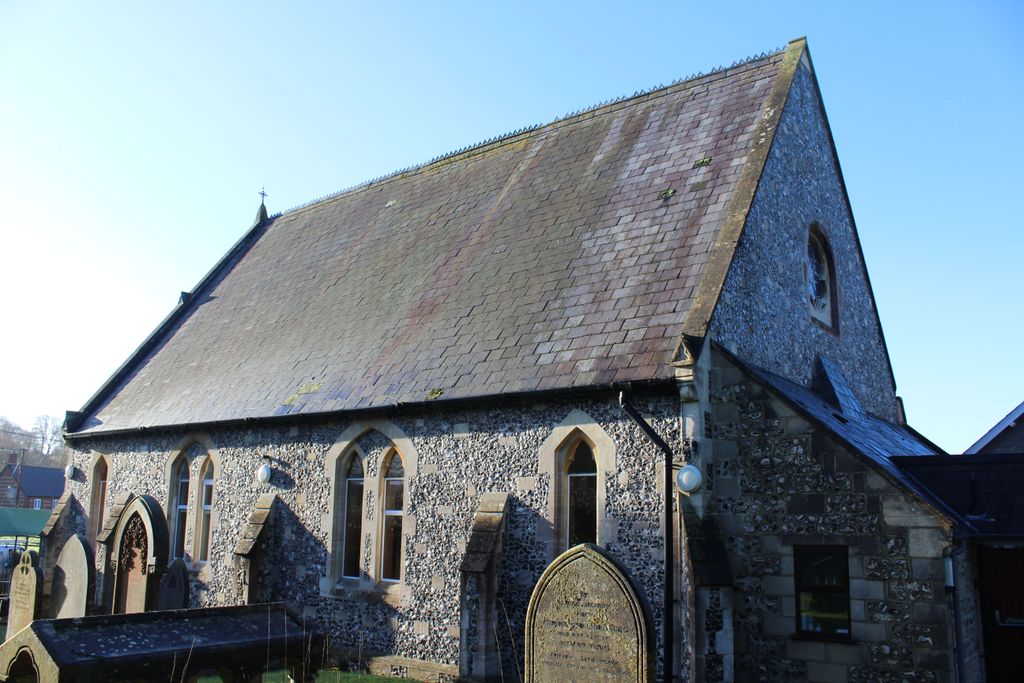
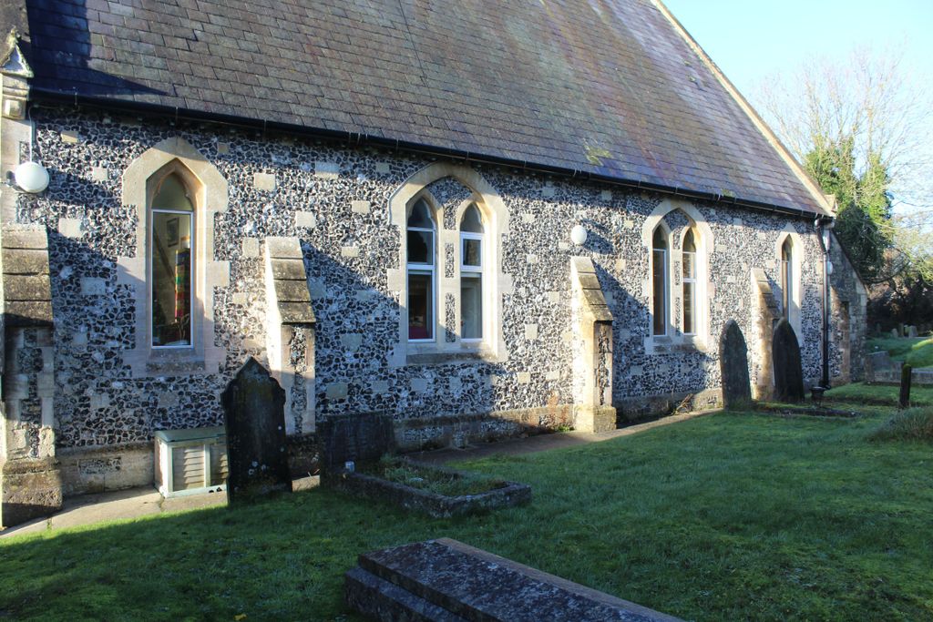
| Description | : | This is now Chalke Valley Stores though access is available to visit the gravestones. |
frequently asked questions (FAQ):
-
Where is Broad Chalke Congregational Chapelyard?
Broad Chalke Congregational Chapelyard is located at High Road, Broad Chalke Broad Chalke, Wiltshire Unitary Authority ,Wiltshire , SP5 5EHEngland.
-
Broad Chalke Congregational Chapelyard cemetery's updated grave count on graveviews.com?
0 memorials
-
Where are the coordinates of the Broad Chalke Congregational Chapelyard?
Latitude: 51.0523805
Longitude: -1.7071162
Nearby Cemetories:
1. St Mary's Churchyard
Alderbury, Wiltshire Unitary Authority, England
Coordinate: 51.0413780, -1.7413140
2. St. Peter's Churchyard
Britford, Wiltshire Unitary Authority, England
Coordinate: 51.0551650, -1.7689880
3. Church of St. Michael and All the Angels
Downton, Wiltshire Unitary Authority, England
Coordinate: 51.0106010, -1.7411390
4. St. Winfrith Churchyard
East Dean, Test Valley Borough, England
Coordinate: 51.0393480, -1.6115260
5. St. Peter's Churchyard
West Tytherley, Test Valley Borough, England
Coordinate: 51.0662240, -1.6100910
6. St Andrew Churchyard
Bemerton, Wiltshire Unitary Authority, England
Coordinate: 51.0740580, -1.8252960
7. St Peter Churchyard
East Tytherley, Test Valley Borough, England
Coordinate: 51.0598230, -1.5843250
8. Bemerton St John
Bemerton, Wiltshire Unitary Authority, England
Coordinate: 51.0759324, -1.8333699
9. St. John Churchyard
Lockerley, Test Valley Borough, England
Coordinate: 51.0387300, -1.5757930
10. St Mary Churchyard
Hale, New Forest District, England
Coordinate: 50.9670380, -1.7473110
11. St. Michael and All Angels Cemetery
Coombe Bissett, Wiltshire Unitary Authority, England
Coordinate: 51.0361120, -1.8473230
12. St. Leonard Churchyard
Sherfield English, Test Valley Borough, England
Coordinate: 51.0001130, -1.5875130
13. St Andrews Churchyard
Allington, Wiltshire Unitary Authority, England
Coordinate: 51.1459710, -1.7149400
14. St Peter Churchyard
Plaitford, Test Valley Borough, England
Coordinate: 50.9815600, -1.6052890
15. St. Mary's Churchyard
Breamore, New Forest District, England
Coordinate: 50.9687400, -1.7834000
16. Broughton Cemetery
Broughton, Test Valley Borough, England
Coordinate: 51.0963729, -1.5671721
17. St John the Baptist
Allington, Wiltshire Unitary Authority, England
Coordinate: 51.1533200, -1.7094250
18. St Mary Churchyard
Broughton, Test Valley Borough, England
Coordinate: 51.0948390, -1.5599920
19. Woodgreen Cemetery
Woodgreen, New Forest District, England
Coordinate: 50.9525032, -1.7574225
20. St. Leonard's Churchyard
Whitsbury, New Forest District, England
Coordinate: 50.9713900, -1.8176000
21. Mottisfont Abbey
Mottisfont, Test Valley Borough, England
Coordinate: 51.0412080, -1.5366290
22. St Andrew Churchyard
Mottisfont, Test Valley Borough, England
Coordinate: 51.0391010, -1.5367710
23. St Andrew Church Cemetery
Mottisfont, Test Valley Borough, England
Coordinate: 51.0377320, -1.5363190
24. St. John the Baptist Churchyard
Bishopstone (Salisbury), Wiltshire Unitary Authority, England
Coordinate: 51.0379160, -1.8812960