Sarah Elizabeth Cole Robey
| Birth | : | Aug 1850 Plattekill, Ulster County, New York, USA |
| Death | : | 1 Sep 1901 District of Columbia, USA |
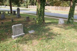
| Burial | : | Swartwood Cemetery, Longford, Clay County, USA |
| Coordinate | : | 39.1323200, -97.3431500 |
| Plot | : | Section B Lot 015 Site 3 |
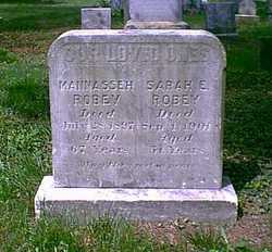
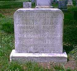
| Inscription | : | OUR LOVED ONES / MANNASSEH / ROBEY / Died / July 28, 1897 / Aged / 67 Years / SARAH E. / ROBEY / Died / Sep. 1, 1901 / Aged / 51 Years / May they rest in peace |
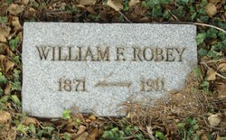
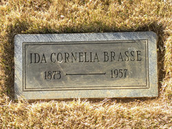
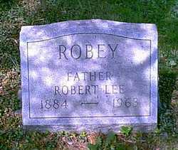
| Description | : | Additional information from Bob F (#47369998): Father: Daniel Cole 1815 – Mother: Catherine A. Dimsay 1815 – 1870 Husband: Mannasseh Robey 1833 – 1897 Children: William Franklin Robey 1871 – 1912 Ida C Robey 1873 – 1957 Sulbert Marcus Robey 1876 – 1945 Flora Ann Robey 1880 – 1961 Elizabeth May Robey 1882 – 1956 Robert Lee Robey 1884 – 1963 2nd Husband: John W Brasse 1832 – |
frequently asked questions (FAQ):
-
Where is Sarah Elizabeth Cole Robey's memorial?
Sarah Elizabeth Cole Robey's memorial is located at: Swartwood Cemetery, Longford, Clay County, USA.
-
When did Sarah Elizabeth Cole Robey death?
Sarah Elizabeth Cole Robey death on 1 Sep 1901 in District of Columbia, USA
-
Where are the coordinates of the Sarah Elizabeth Cole Robey's memorial?
Latitude: 39.1323200
Longitude: -97.3431500
Family Members:
Spouse
Children
Flowers:
Nearby Cemetories:
1. Keystone Cemetery
Manchester, Dickinson County, USA
Coordinate: 39.1185989, -97.2917023
2. White Cloud Cemetery
Manchester, Dickinson County, USA
Coordinate: 39.0744019, -97.3525009
3. Vine Creek Cemetery
Ottawa County, USA
Coordinate: 39.1194000, -97.4180984
4. Rose Meron Cemetery
Oak Hill, Clay County, USA
Coordinate: 39.2194700, -97.3338900
5. Prairiedale Cemetery
Talmage, Dickinson County, USA
Coordinate: 39.0471992, -97.2652969
6. Ackley Cemetery
Ottawa County, USA
Coordinate: 39.0893160, -97.4797040
7. Wesleyan Cemetery
Oak Hill, Clay County, USA
Coordinate: 39.2268982, -97.2572021
8. Pleasant Valley Cemetery
Oak Hill, Clay County, USA
Coordinate: 39.2468987, -97.2889023
9. Henry Cemetery
Buckeye, Dickinson County, USA
Coordinate: 39.0828018, -97.1857986
10. Mount Liberty Church Cemetery
Ottawa County, USA
Coordinate: 39.2489400, -97.4356200
11. Athelstane Cemetery
Athelstane Township, Clay County, USA
Coordinate: 39.1768990, -97.1753006
12. Zion Cemetery
Abilene, Dickinson County, USA
Coordinate: 39.0319240, -97.2045850
13. Greenridge Cemetery
Dickinson County, USA
Coordinate: 39.1199989, -97.1433029
14. Buckeye Cemetery
Buckeye, Dickinson County, USA
Coordinate: 39.0463070, -97.1665840
15. Union Cemetery
Buckeye, Dickinson County, USA
Coordinate: 39.0243988, -97.1856003
16. Greenville Cemetery
Niles, Ottawa County, USA
Coordinate: 38.9794006, -97.4646988
17. Mizpah Cemetery
Clay County, USA
Coordinate: 39.2057800, -97.1238500
18. Table Mound Cemetery
Idana, Clay County, USA
Coordinate: 39.3141300, -97.2792300
19. Shields Cemetery
Clay County, USA
Coordinate: 39.3208008, -97.3507996
20. Pleasant Ridge Cemetery
Clay County, USA
Coordinate: 39.2789001, -97.1841965
21. Heart Land Prairie Cemetery
Niles, Ottawa County, USA
Coordinate: 38.9693700, -97.4732900
22. Hebron Cemetery
Clay County, USA
Coordinate: 39.3213800, -97.2601400
23. Pleasant Hill Cemetery
Lamar, Ottawa County, USA
Coordinate: 39.2050018, -97.5832977
24. Jones Cemetery
Dickinson County, USA
Coordinate: 39.0703011, -97.0860977

