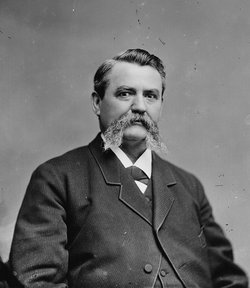
| Birth | : | 22 Jul 1823 Trough Creek, Huntingdon County, Pennsylvania, USA |
| Death | : | 13 Sep 1846 Jefferson County, Iowa, USA |
| Burial | : | Chillcott Family Cemetery, Jefferson County, USA |
| Coordinate | : | 41.0558000, -91.8286300 |
| Description | : | William Long |
frequently asked questions (FAQ):
-
Where is Sarah Miriam Chilcott Long's memorial?
Sarah Miriam Chilcott Long's memorial is located at: Chillcott Family Cemetery, Jefferson County, USA.
-
When did Sarah Miriam Chilcott Long death?
Sarah Miriam Chilcott Long death on 13 Sep 1846 in Jefferson County, Iowa, USA
-
Where are the coordinates of the Sarah Miriam Chilcott Long's memorial?
Latitude: 41.0558000
Longitude: -91.8286300
Family Members:
Parent
Siblings
Flowers:
Nearby Cemetories:
1. Chillcott Family Cemetery
Jefferson County, USA
Coordinate: 41.0558000, -91.8286300
2. Salina Cemetery
Salina, Jefferson County, USA
Coordinate: 41.0419006, -91.8330994
3. Peterson Cemetery
Lockridge, Jefferson County, USA
Coordinate: 41.0393982, -91.8075027
4. Lower Richwoods Cemetery
Salina, Jefferson County, USA
Coordinate: 41.0882000, -91.8085000
5. Upper Richwoods Cemetery
Salina, Jefferson County, USA
Coordinate: 41.0602989, -91.8807983
6. New Sweden Baptist Cemetery
Jefferson County, USA
Coordinate: 41.0242004, -91.7857971
7. New Sweden Lutheran Cemetery
Lockridge, Jefferson County, USA
Coordinate: 41.0238991, -91.7797012
8. New Sweden United Methodist Church Cemetery
Lockridge, Jefferson County, USA
Coordinate: 41.0247002, -91.7752991
9. Polishville Cemetery
East Pleasant Plain, Jefferson County, USA
Coordinate: 41.1116982, -91.8131027
10. Westenhaver Family Cemetery
Perlee, Jefferson County, USA
Coordinate: 41.0968240, -91.8829110
11. Perlee Cemetery
Perlee, Jefferson County, USA
Coordinate: 41.0805750, -91.8993380
12. Four Corners German Lutheran Cemetery
Lockridge, Jefferson County, USA
Coordinate: 41.0247002, -91.7605972
13. Switzer Cemetery
Fairfield, Jefferson County, USA
Coordinate: 41.0368996, -91.9096985
14. Hope Lutheran Cemetery
Germanville, Jefferson County, USA
Coordinate: 41.0943985, -91.7593994
15. New Swedish Methodist Church Cemetery
Jefferson County, USA
Coordinate: 41.0037384, -91.7763519
16. Bethesda Cemetery
Fairfield, Jefferson County, USA
Coordinate: 41.0019000, -91.8796000
17. Union Free Cemetery
Germanville, Jefferson County, USA
Coordinate: 41.0971000, -91.7585000
18. Saints Peter and Paul Catholic Cemetery
Jefferson County, USA
Coordinate: 41.1088982, -91.7731018
19. Union Cemetery
Lockridge Township, Jefferson County, USA
Coordinate: 40.9878000, -91.8266000
20. Wheeler Cemetery
Jefferson County, USA
Coordinate: 41.0797000, -91.9185500
21. Bonnifield Cemetery
Lockridge, Jefferson County, USA
Coordinate: 40.9874992, -91.7966995
22. Hopkirk Cemetery
Jefferson County, USA
Coordinate: 41.0029000, -91.7566000
23. Walnut Creek Friends Cemetery
Pleasant Plain, Jefferson County, USA
Coordinate: 41.1237500, -91.8747500
24. Antioch Cemetery
Fairfield, Jefferson County, USA
Coordinate: 41.1002998, -91.9147034


