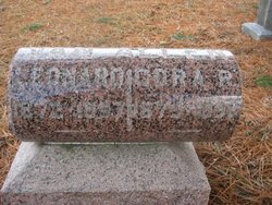
Solomon L. Brush
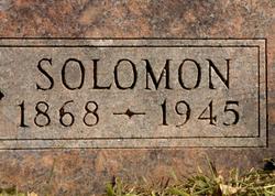
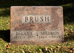
| Birth | : | 17 Apr 1868 Ferguson, Marshall County, Iowa, USA |
| Death | : | 19 Dec 1945 Fort Dodge, Webster County, Iowa, USA |
| Burial | : | Seddon Cemetery, Seddon, Marlborough District, New Zealand |
| Coordinate | : | -41.6831810, 174.0582210 |
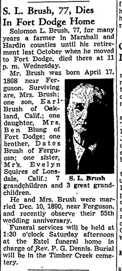
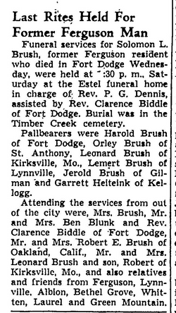
| Description | : | Solomon L. Brush, 77, for many years a farmer in Marshall and Hardin counties until his retirement last October when he moved to Fort Dodge, died there at 11 p.m. Wednesday. Mr. Brush was born April 17, 1868 near Ferguson. Surviving are Mrs. Brush, one son, Earl Brush of Oakland, Calif.; one daughter, Mrs. Ben Blunk of Fort Dodge; one brother, Dates Brush of Ferguson; one sister, Evelyn Squires of Lonsdale, Calif.; 7 grandchildren and 3 great grandchildren. He and Mrs. Brush were married Dec. 10, 1890 near Ferguson and recently observed their 55th wedding Anniversaty. Funeral services will be... Read More |
frequently asked questions (FAQ):
-
Where is Solomon L. Brush's memorial?
Solomon L. Brush's memorial is located at: Seddon Cemetery, Seddon, Marlborough District, New Zealand.
-
When did Solomon L. Brush death?
Solomon L. Brush death on 19 Dec 1945 in Fort Dodge, Webster County, Iowa, USA
-
Where are the coordinates of the Solomon L. Brush's memorial?
Latitude: -41.6831810
Longitude: 174.0582210
Family Members:
Parent
Spouse
Siblings
Children
Flowers:
Nearby Cemetories:
1. Seddon Cemetery
Seddon, Marlborough District, New Zealand
Coordinate: -41.6831810, 174.0582210
2. Taylor Pass Cemetery
Seddon, Marlborough District, New Zealand
Coordinate: -41.6706624, 173.9871644
3. Ward Flaxbourne Cemetery
Ward, Marlborough District, New Zealand
Coordinate: -41.8164648, 174.1400507
4. Altimarlock Station
Altimarlock, Marlborough District, New Zealand
Coordinate: -41.7387595, 173.8579141
5. Fidèle Crew Graves
Ward, Marlborough District, New Zealand
Coordinate: -41.7834471, 174.2287789
6. Cape Campbell Lighthouse Burial Site
Marlborough District, New Zealand
Coordinate: -41.7316008, 174.2731993
7. Omaka Cemetery
Blenheim, Marlborough District, New Zealand
Coordinate: -41.5381800, 173.9401100
8. Old Flaxbourne Graveyard
Ward, Marlborough District, New Zealand
Coordinate: -41.8335228, 174.1781740
9. Te Pokohiwi Urupā
Marlborough District, New Zealand
Coordinate: -41.5068950, 174.0612846
10. Wairau Bar Pilot House Graves
Spring Creek, Marlborough District, New Zealand
Coordinate: -41.4970923, 174.0582651
11. Fairhall Cemetery
Blenheim, Marlborough District, New Zealand
Coordinate: -41.5294100, 173.8677800
12. Māori Island Urupā Otamawahu
Grovetown, Marlborough District, New Zealand
Coordinate: -41.4729310, 173.9778908
13. Old Renwick Cemetery
Marlborough District, New Zealand
Coordinate: -41.5014030, 173.8909900
14. Sammy Palmer's Grave
Wharanui, Marlborough District, New Zealand
Coordinate: -41.9065258, 174.0104896
15. Pioneers Church Cemetery
Renwick, Marlborough District, New Zealand
Coordinate: -41.5091139, 173.8364765
16. Rapaura Anglican Cemetery
Rapaura, Marlborough District, New Zealand
Coordinate: -41.4719700, 173.9014700
17. Rapaura Community Churchyard
Rapaura, Marlborough District, New Zealand
Coordinate: -41.4724800, 173.8995800
18. Saint Oswald's Churchyard
Wharanui, Marlborough District, New Zealand
Coordinate: -41.9287622, 174.0855260
19. Upper Wairau Valley Cemetery
Blenheim, Marlborough District, New Zealand
Coordinate: -41.5171130, 173.7974110
20. Tuamarina Cemetery
Tuamarina, Marlborough District, New Zealand
Coordinate: -41.4280969, 173.9623665
21. Wairau Affray Graves
Tuamarina, Marlborough District, New Zealand
Coordinate: -41.4285146, 173.9597007
22. Ruakanakana Urupā
Kaituna, Marlborough District, New Zealand
Coordinate: -41.4463616, 173.8779400
23. Kaituna Cemetery
Kaituna, Marlborough District, New Zealand
Coordinate: -41.4694650, 173.8036590
24. Maher Family Cemetery
Kaituna, Marlborough District, New Zealand
Coordinate: -41.4682494, 173.7958289

