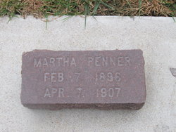
Sr Marie Penner
| Birth | : | 16 Oct 1882 At Sea |
| Death | : | 28 Nov 1952 |
| Burial | : | First Mennonite Church Cemetery, Beatrice, Gage County, USA |
| Coordinate | : | 40.2856800, -96.8120500 |
| Plot | : | L-62 |
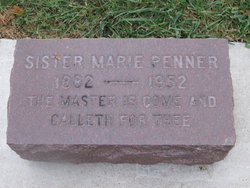
| Inscription | : | The Master is come, and calleth for thee. |
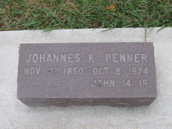
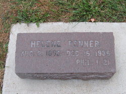
| Description | : | Sister Marie Penner,70 October 16, 1882 ~ November 28,1952 Sister Marie (a Deaconess in the Mennonite church, serving as a nurse in the Mennonite Deaconess Hospital in Beatrice, Nebraska) Penner, was born on the way to America to Rev. Johannes K and Helen (Jantzen) Penner. She remained single. Other Deaconesses, like my great-aunt Tante Eliza (Andreas) Ruth, did get married. ~~~~~~~~~~~~~~~~~~~~~~~~~ Source: personal family history, as well as Directory of the Mennonite Cemetery, Beatrice, Nebraska, compiled by Hilda and Carl Schmidt, 1993-1994 Note: Statuten für das Mennonitische Diakonissenhaus (Constitution for the Mennonite Deaconess Home and... Read More |
frequently asked questions (FAQ):
-
Where is Sr Marie Penner's memorial?
Sr Marie Penner's memorial is located at: First Mennonite Church Cemetery, Beatrice, Gage County, USA.
-
When did Sr Marie Penner death?
Sr Marie Penner death on 28 Nov 1952 in
-
Where are the coordinates of the Sr Marie Penner's memorial?
Latitude: 40.2856800
Longitude: -96.8120500
Family Members:
Parent
Siblings
Flowers:
Nearby Cemetories:
1. First Mennonite Church Cemetery
Beatrice, Gage County, USA
Coordinate: 40.2856800, -96.8120500
2. Homestead National Historical Park
Beatrice, Gage County, USA
Coordinate: 40.2864800, -96.8271100
3. Freeman Cemetery
Beatrice, Gage County, USA
Coordinate: 40.2966933, -96.8435666
4. Walnut Grove Pet Cemetery
Beatrice, Gage County, USA
Coordinate: 40.2613200, -96.7605920
5. Saint Joseph Cemetery
Beatrice, Gage County, USA
Coordinate: 40.3054700, -96.7460700
6. First Trinity Lutheran Cemetery
Beatrice, Gage County, USA
Coordinate: 40.3053600, -96.8794400
7. Dolen Cemetery
Gage County, USA
Coordinate: 40.3494950, -96.8225930
8. Beatrice Cemetery
Beatrice, Gage County, USA
Coordinate: 40.2625970, -96.7332670
9. Sparks Cemetery
Beatrice, Gage County, USA
Coordinate: 40.2485180, -96.8984970
10. Ellis Cemetery
Beatrice, Gage County, USA
Coordinate: 40.2260017, -96.8785019
11. Austin Creek Cemetery
Beatrice, Gage County, USA
Coordinate: 40.3282280, -96.7233020
12. Evergreen Home Cemetery
Beatrice, Gage County, USA
Coordinate: 40.2677994, -96.7052994
13. Kilpatrick Cemetery
Plymouth, Jefferson County, USA
Coordinate: 40.2919006, -96.9338989
14. Pleasant View Cemetery
Pickrell, Gage County, USA
Coordinate: 40.3493240, -96.7101000
15. Zion Lutheran Cemetery
Harbine, Jefferson County, USA
Coordinate: 40.2346610, -96.9350780
16. Immanuel Lutheran Cemetery
Plymouth, Jefferson County, USA
Coordinate: 40.3075430, -96.9529750
17. Rose Hill Cemetery
Gage County, USA
Coordinate: 40.3936005, -96.8553009
18. Emmanuel Lutheran Cemetery
Beatrice, Gage County, USA
Coordinate: 40.2934100, -96.6521900
19. Anyon Cemetery
Beatrice, Gage County, USA
Coordinate: 40.1548600, -96.8128800
20. Saint Paul's Lutheran Cemetery
Gage County, USA
Coordinate: 40.4186330, -96.8187780
21. Woodlawn Cemetery
Plymouth, Jefferson County, USA
Coordinate: 40.2991982, -96.9906006
22. Harbine Cemetery
Harbine, Jefferson County, USA
Coordinate: 40.2042007, -96.9717026
23. Hope Church Cemetery
Harbine, Jefferson County, USA
Coordinate: 40.1826480, -96.9540828
24. Saint Pauls Evangelical Lutheran Cemetery
Plymouth, Jefferson County, USA
Coordinate: 40.3074989, -97.0085983

