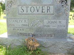
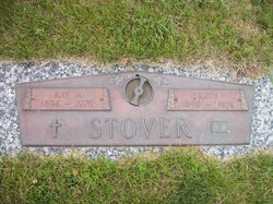
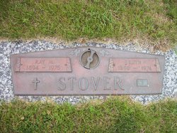
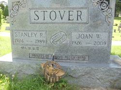
Stanley Ray “Stan” Stover
| Birth | : | 17 Sep 1924 Conrad, Grundy County, Iowa, USA |
| Death | : | 8 Nov 1989 Fairfield, Jefferson County, Iowa, USA |
| Burial | : | Evergreen Cemetery, Fairfield, Jefferson County, USA |
| Coordinate | : | 41.0138600, -91.9562100 |
| Plot | : | 2nd.105 |
| Description | : | Fairfield Ledger Thursday Nov. 9, 1989 Ex-extension director Stover dies Former Jefferson County Extension Service Director Stanley Ray Stover, 65, 803 W. Taylor Ave., died at 6:51 p.m. Wednesday, Nov. 8, 1989, at Jefferson County Hospital. Stover was born Sept. 17, 1924, in Conrad, the son of Ray M. and Ruth Gohner Stover. He grew up in Whitten and lived in Marshalltown before moving to Fairfield in August 1962. He graduated from Whitten Consolidated School in 1941 and from Iowa State University at Ames in 1950. He served as a Pharmacist's Mate 2nd Class... Read More |
frequently asked questions (FAQ):
-
Where is Stanley Ray “Stan” Stover's memorial?
Stanley Ray “Stan” Stover's memorial is located at: Evergreen Cemetery, Fairfield, Jefferson County, USA.
-
When did Stanley Ray “Stan” Stover death?
Stanley Ray “Stan” Stover death on 8 Nov 1989 in Fairfield, Jefferson County, Iowa, USA
-
Where are the coordinates of the Stanley Ray “Stan” Stover's memorial?
Latitude: 41.0138600
Longitude: -91.9562100
Family Members:
Parent
Spouse
Flowers:
Nearby Cemetories:
1. Evergreen Cemetery
Fairfield, Jefferson County, USA
Coordinate: 41.0138600, -91.9562100
2. Old Fairfield Cemetery
Fairfield, Jefferson County, USA
Coordinate: 41.0148000, -91.9598000
3. Memorial Lawn Cemetery
Fairfield, Jefferson County, USA
Coordinate: 41.0068000, -91.9805000
4. Switzer Cemetery
Fairfield, Jefferson County, USA
Coordinate: 41.0368996, -91.9096985
5. Bradshaw Cemetery
Jefferson County, USA
Coordinate: 40.9766998, -91.9032974
6. Roth Cemetery
Fairfield, Jefferson County, USA
Coordinate: 40.9589005, -91.9574966
7. Bethesda Cemetery
Fairfield, Jefferson County, USA
Coordinate: 41.0019000, -91.8796000
8. Smith Family Cemetery
Libertyville, Jefferson County, USA
Coordinate: 40.9972416, -92.0362857
9. Wheeler Cemetery
Jefferson County, USA
Coordinate: 41.0797000, -91.9185500
10. Galliher Cemetery
Glasgow, Jefferson County, USA
Coordinate: 40.9666892, -91.8835038
11. Upper Richwoods Cemetery
Salina, Jefferson County, USA
Coordinate: 41.0602989, -91.8807983
12. Jefferson County Poor Farm Cemetery
Libertyville, Jefferson County, USA
Coordinate: 40.9416900, -91.9996200
13. Perlee Cemetery
Perlee, Jefferson County, USA
Coordinate: 41.0805750, -91.8993380
14. Pattison Cemetery
Fairfield, Jefferson County, USA
Coordinate: 40.9444008, -91.9049988
15. Moorman Cemetery
Fairfield, Jefferson County, USA
Coordinate: 41.0452995, -92.0622025
16. Wright Cemetery
Fairfield, Jefferson County, USA
Coordinate: 40.9524000, -91.8728000
17. Antioch Cemetery
Fairfield, Jefferson County, USA
Coordinate: 41.1002998, -91.9147034
18. Moyer Cemetery
Fairfield, Jefferson County, USA
Coordinate: 41.1046982, -91.9330978
19. Cumberland Cemetery
Jefferson County, USA
Coordinate: 40.9248000, -91.9903000
20. Gregg Cemetery
Jefferson County, USA
Coordinate: 41.0078011, -92.0811005
21. Salina Cemetery
Salina, Jefferson County, USA
Coordinate: 41.0419006, -91.8330994
22. McCleary Cemetery
Jefferson County, USA
Coordinate: 40.9892006, -92.0805969
23. Brooks Cemetery
Jefferson County, USA
Coordinate: 41.0635986, -92.0693970
24. Thompson Cemetery
Jefferson County, USA
Coordinate: 40.9155998, -91.9772034


