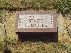
Stazie A. Pytlicek Holoubek
| Birth | : | 27 Mar 1893 Nebraska, USA |
| Death | : | Jan 1976 Schuyler, Colfax County, Nebraska, USA |
| Burial | : | Waterton Cemetery, Eiffelton, Ashburton District, New Zealand |
| Coordinate | : | -44.0640000, 171.7260000 |
| Plot | : | Sec 45, row 1, south to north |
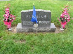
| Description | : | Columbus Telegram - Thursday, 15 January 1976 Mrs. Holoubek died unexpectedly at her home. Mrs. Holoubek was born March 27, 1893 at Elm Creek to Louis and Frances Barta Pytilcek. She married Joseph Holoubek on May 27, 1908 at Elm Creek. He died in 1932. She was a member of the Christ United Methodist Church, Methodist Church Women's Society, American Legion Auxiliary, VFW Auxiliary, Pythian Sisters, 40 et 8 and an extension club. Survivors include four daughters, Mrs. Pauline Freeman and Mrs. Paul (Edith)Bogner, both of Schuyler, Mrs. Earl (Louise) Meridith, Boone and Mrs. Mildred McCormick, Fremont, 13 grandchildren and 15 great-grandchildren. Her... Read More |
frequently asked questions (FAQ):
-
Where is Stazie A. Pytlicek Holoubek's memorial?
Stazie A. Pytlicek Holoubek's memorial is located at: Waterton Cemetery, Eiffelton, Ashburton District, New Zealand.
-
When did Stazie A. Pytlicek Holoubek death?
Stazie A. Pytlicek Holoubek death on Jan 1976 in Schuyler, Colfax County, Nebraska, USA
-
Where are the coordinates of the Stazie A. Pytlicek Holoubek's memorial?
Latitude: -44.0640000
Longitude: 171.7260000
Family Members:
Parent
Spouse
Siblings
Children
Flowers:
Nearby Cemetories:
1. Waterton Cemetery
Eiffelton, Ashburton District, New Zealand
Coordinate: -44.0640000, 171.7260000
2. Longbeach Estate Chapel
Longbeach, Ashburton District, New Zealand
Coordinate: -44.0941090, 171.6884504
3. Windermere Cemetery
Windermere, Ashburton District, New Zealand
Coordinate: -43.9874945, 171.6232358
4. Winslow Cemetery
Winslow, Ashburton District, New Zealand
Coordinate: -43.9576290, 171.6522810
5. Hinds Cemetery
Hinds, Ashburton District, New Zealand
Coordinate: -44.0075580, 171.5735400
6. Pioneer Park Memorial
Ashburton, Ashburton District, New Zealand
Coordinate: -43.9106400, 171.7485300
7. Ashburton Public Cemetery
Ashburton, Ashburton District, New Zealand
Coordinate: -43.8903240, 171.7702810
8. Westerfield Cemetery
Westerfield, Ashburton District, New Zealand
Coordinate: -43.8324380, 171.5806230
9. Chertsey Cemetery
Chertsey, Ashburton District, New Zealand
Coordinate: -43.8030500, 171.9319400
10. Kyle Cemetery
Dorie, Ashburton District, New Zealand
Coordinate: -43.9193236, 172.0979192
11. Dorie Cemetery
Dorie, Ashburton District, New Zealand
Coordinate: -43.8772900, 172.0862500
12. Arundel Cemetery
Arundel, Timaru District, New Zealand
Coordinate: -43.9785690, 171.2838900
13. Cracroft Cemetery
Ruapuna, Ashburton District, New Zealand
Coordinate: -43.9341900, 171.2989500
14. Ruapuna Cemetery
Ruapuna, Ashburton District, New Zealand
Coordinate: -43.8436110, 171.3680400
15. Geraldine Cemetery
Geraldine, Timaru District, New Zealand
Coordinate: -44.0982600, 171.2407000
16. Temuka Cemetery
Temuka, Timaru District, New Zealand
Coordinate: -44.2499010, 171.3014390
17. Rakaia Cemetery
Rakaia, Ashburton District, New Zealand
Coordinate: -43.7548910, 171.9939270
18. Woodbury Cemetery
Woodbury, Timaru District, New Zealand
Coordinate: -44.0360900, 171.2127000
19. Whareki Cemetery
Temuka, Timaru District, New Zealand
Coordinate: -44.2558600, 171.2734500
20. St. Anne's Churchyard
Geraldine, Timaru District, New Zealand
Coordinate: -44.0836111, 171.1994444
21. Barrhill Cemetery
Barrhill, Ashburton District, New Zealand
Coordinate: -43.6756950, 171.8480790
22. Church of the Holy Innocents Churchyard
Peel Forest, Timaru District, New Zealand
Coordinate: -43.8398520, 171.2471820
23. Mount Somers Cemetery
Mount Somers, Ashburton District, New Zealand
Coordinate: -43.7093900, 171.3962830
24. Mt Somers Old Cemetery
Mount Somers, Ashburton District, New Zealand
Coordinate: -43.7050700, 171.3969000

