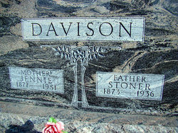
Stoner Davison
| Birth | : | 21 May 1873 |
| Death | : | 31 Mar 1936 Jefferson County, Iowa, USA |
| Burial | : | McDowell Cemetery, Fairfield, Jefferson County, USA |
| Coordinate | : | 41.1380997, -91.9460983 |
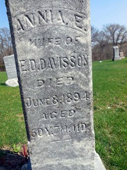
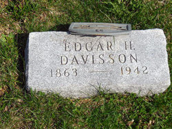
| Description | : | Contirbutor note: Stoner Davison died as a result of trying to seek help for his wife, who had fallen. The exertion and stress of the incident caused Stoner to have a heart attack. The obituaries noted below tended to have very graphic details of Stoner's death, so they are presented below in a somewhat edited version. Full copies of the obituaries are available in microfilm records at the Fairfield Public Library, Fairfield, Iowa. The family surname of "Davison" turns up as "Davisson" in some of the family obituaries. Those errors are noted where need be. ----------- Fairfield Ledger Tues.,... Read More |
frequently asked questions (FAQ):
-
Where is Stoner Davison's memorial?
Stoner Davison's memorial is located at: McDowell Cemetery, Fairfield, Jefferson County, USA.
-
When did Stoner Davison death?
Stoner Davison death on 31 Mar 1936 in Jefferson County, Iowa, USA
-
Where are the coordinates of the Stoner Davison's memorial?
Latitude: 41.1380997
Longitude: -91.9460983
Family Members:
Parent
Siblings
Children
Flowers:
Nearby Cemetories:
1. McDowell Cemetery
Fairfield, Jefferson County, USA
Coordinate: 41.1380997, -91.9460983
2. Howard Grove Cemetery
Jefferson County, USA
Coordinate: 41.1488991, -91.9419022
3. Moyer Cemetery
Fairfield, Jefferson County, USA
Coordinate: 41.1046982, -91.9330978
4. Antioch Cemetery
Fairfield, Jefferson County, USA
Coordinate: 41.1002998, -91.9147034
5. Clay Cemetery
Rubio, Washington County, USA
Coordinate: 41.1857986, -91.9218979
6. Walnut Creek Friends Cemetery
Pleasant Plain, Jefferson County, USA
Coordinate: 41.1237500, -91.8747500
7. Laux Park Family Cemetery
Brighton, Washington County, USA
Coordinate: 41.1913920, -91.9098620
8. Blue Point Cemetery
Jefferson County, USA
Coordinate: 41.1618996, -92.0218964
9. Wheeler Cemetery
Jefferson County, USA
Coordinate: 41.0797000, -91.9185500
10. Friends Cemetery
Pleasant Plain, Jefferson County, USA
Coordinate: 41.1478004, -91.8636017
11. Westenhaver Family Cemetery
Perlee, Jefferson County, USA
Coordinate: 41.0968240, -91.8829110
12. Friends Cemetery
Richland, Keokuk County, USA
Coordinate: 41.1917000, -91.9953003
13. Perlee Cemetery
Perlee, Jefferson County, USA
Coordinate: 41.0805750, -91.8993380
14. Rocky Run Cemetery
Richland, Keokuk County, USA
Coordinate: 41.2055707, -91.9473964
15. Highland Cemetery
Richland, Keokuk County, USA
Coordinate: 41.1949997, -91.9985962
16. Old Methodist Cemetery
Richland, Keokuk County, USA
Coordinate: 41.1948000, -92.0002000
17. Ann Gowey Cemetery
Brighton, Washington County, USA
Coordinate: 41.1999642, -91.8974728
18. Saint Josephs Cemetery
Pleasant Plain, Jefferson County, USA
Coordinate: 41.1357994, -91.8463974
19. Evergreen Cemetery
Rubio, Washington County, USA
Coordinate: 41.2139015, -91.9328003
20. Summit Cemetery
Richland, Keokuk County, USA
Coordinate: 41.1897011, -92.0291977
21. Upper Richwoods Cemetery
Salina, Jefferson County, USA
Coordinate: 41.0602989, -91.8807983
22. Halferty Cemetery
Ollie, Keokuk County, USA
Coordinate: 41.1917000, -92.0539017
23. Altman Cemetery
Ollie, Keokuk County, USA
Coordinate: 41.1747017, -92.0733032
24. Polishville Cemetery
East Pleasant Plain, Jefferson County, USA
Coordinate: 41.1116982, -91.8131027

