| Birth | : | 6 Jul 1846 USA |
| Death | : | 19 Aug 1915 Logan, Harrison County, Iowa, USA |
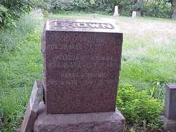
| Burial | : | St. Peter's Churchyard, Newton-le-Willows, Metropolitan Borough of St Helens, England |
| Coordinate | : | 53.4559330, -2.6143730 |
| Plot | : | Sec. 5 Row 2 |
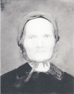
| Description | : | From Harrison County Democrat August 26, 1915 "Mrs. J. N. Young Passes Away Mrs. J. N. Young died Thursday night, August 19, at her home in Logan, after a long illness, aged 69 years, 1 month and 13 days. Susan J. Brown was born July 6, 1846, in Rock Island County, Illinois, and on May 11, 1869, was united in marriage to J. N. Young. Shortly after their marriage, Mr. and Mrs. Young moved to Iowa. The greater part of the time, they have lived in Logan or vicinity. Mrs. Young's acquaintance was a very large one, and she was especially loved by... Read More |
frequently asked questions (FAQ):
-
Where is Susan J Brown Young's memorial?
Susan J Brown Young's memorial is located at: St. Peter's Churchyard, Newton-le-Willows, Metropolitan Borough of St Helens, England.
-
When did Susan J Brown Young death?
Susan J Brown Young death on 19 Aug 1915 in Logan, Harrison County, Iowa, USA
-
Where are the coordinates of the Susan J Brown Young's memorial?
Latitude: 53.4559330
Longitude: -2.6143730
Family Members:
Parent
Spouse
Siblings
Flowers:
Nearby Cemetories:
1. St. Peter's Churchyard
Newton-le-Willows, Metropolitan Borough of St Helens, England
Coordinate: 53.4559330, -2.6143730
2. Newton-le-Willows Cemetery
Newton-le-Willows, Metropolitan Borough of St Helens, England
Coordinate: 53.4471970, -2.6217090
3. St. Mary and St. John RC Churchyard
Newton-le-Willows, Metropolitan Borough of St Helens, England
Coordinate: 53.4559410, -2.6323930
4. Emmanuel Wargrave
Newton-le-Willows, Metropolitan Borough of St Helens, England
Coordinate: 53.4454500, -2.6277060
5. All Saints Roman Catholic Churchyard
Golborne, Metropolitan Borough of Wigan, England
Coordinate: 53.4745130, -2.5991750
6. St. Oswald Churchyard
Winwick, Warrington Unitary Authority, England
Coordinate: 53.4309200, -2.5972200
7. St. Luke's Churchyard
Lowton Common, Metropolitan Borough of Wigan, England
Coordinate: 53.4752100, -2.5805770
8. St James' Churchyard
Haydock, Metropolitan Borough of St Helens, England
Coordinate: 53.4679080, -2.6596350
9. Winwick Hospital Churchyard
Warrington Unitary Authority, England
Coordinate: 53.4265000, -2.6050000
10. St. Thomas' Churchyard
Golborne, Metropolitan Borough of Wigan, England
Coordinate: 53.4837560, -2.5917430
11. St Thomas' Churchyard (Heath Road Extension)
Ashton-In-Makerfield, Metropolitan Borough of Wigan, England
Coordinate: 53.4850470, -2.6345810
12. St Thomas Churchyard
Ashton-In-Makerfield, Metropolitan Borough of Wigan, England
Coordinate: 53.4856362, -2.6402671
13. St. Mary's Parish Churchyard
Lowton St Mary's, Metropolitan Borough of Wigan, England
Coordinate: 53.4763450, -2.5512350
14. St Mark Churchyard
Haydock, Metropolitan Borough of St Helens, England
Coordinate: 53.4658540, -2.6892980
15. Christ Church Churchyard
Warrington, Warrington Unitary Authority, England
Coordinate: 53.4376659, -2.5428132
16. Unitarian Chapel
Croft, Warrington Unitary Authority, England
Coordinate: 53.4345995, -2.5440079
17. St Peter's of Parr Churchyard
Parr, Metropolitan Borough of St Helens, England
Coordinate: 53.4543745, -2.7009772
18. Holy Trinity Churchyard
Ashton-In-Makerfield, Metropolitan Borough of Wigan, England
Coordinate: 53.4989280, -2.6688000
19. St. John the Evangelist Churchyard
Abram, Metropolitan Borough of Wigan, England
Coordinate: 53.5090290, -2.5941470
20. Risley Presbyterian Church Churchyard
Warrington Unitary Authority, England
Coordinate: 53.4322500, -2.5283880
21. Christ Church Graveyard
Padgate, Warrington Unitary Authority, England
Coordinate: 53.4072619, -2.5565873
22. St. Anne and Blessed Dominic Churchyard
St Helens, Metropolitan Borough of St Helens, England
Coordinate: 53.4330960, -2.7083700
23. Newchurch Parish Church
Culcheth, Warrington Unitary Authority, England
Coordinate: 53.4505900, -2.5105500
24. St. Barnabas Churchyard
Warrington Unitary Authority, England
Coordinate: 53.3920038, -2.6121106


