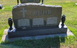
Susan L. “Susie” Hilgenkamp Buhr
| Birth | : | 29 Jun 1967 Arlington, Washington County, Nebraska, USA |
| Death | : | 27 Jun 2004 Lincoln, Lancaster County, Nebraska, USA |
| Burial | : | St Paul's, Blackburn, Blackburn with Darwen Unitary Authority, England |
| Coordinate | : | 53.7491222, -2.4891266 |
| Plot | : | Block 30 Lot 5 |
| Description | : | Daughter of Ronald and Elaine Hilgenkamp. 1985 graduate of Arlington High School. Wife of Galen Buhr. 5 children. Cause of death was a car accident which claimed the life of her son, Tayten, as well. Rest in peace. Buhr, Susan L. "Susie" (Hilgenkamp) 6/27/2004 #1-Printed in the Arlington Citizen, Arlington, Nebraska (no date) Arlington native Susan L. Buhr, 36, of Filley, died Sunday, June 27, 2004, at Bryan LGH West Hospital in Lincoln as a result of injuries from a car accident. Funeral services will be 10 a.m. Friday, July 2,... Read More |
frequently asked questions (FAQ):
-
Where is Susan L. “Susie” Hilgenkamp Buhr's memorial?
Susan L. “Susie” Hilgenkamp Buhr's memorial is located at: St Paul's, Blackburn, Blackburn with Darwen Unitary Authority, England.
-
When did Susan L. “Susie” Hilgenkamp Buhr death?
Susan L. “Susie” Hilgenkamp Buhr death on 27 Jun 2004 in Lincoln, Lancaster County, Nebraska, USA
-
Where are the coordinates of the Susan L. “Susie” Hilgenkamp Buhr's memorial?
Latitude: 53.7491222
Longitude: -2.4891266
Family Members:
Parent
Children
Flowers:
Nearby Cemetories:
1. St Paul's
Blackburn, Blackburn with Darwen Unitary Authority, England
Coordinate: 53.7491222, -2.4891266
2. Wesleyan Methodist Chapel Chapelyard
Blackburn, Blackburn with Darwen Unitary Authority, England
Coordinate: 53.7464910, -2.4848380
3. Independent Chapel Churchyard
Blackburn, Blackburn with Darwen Unitary Authority, England
Coordinate: 53.7454960, -2.4864460
4. St. Peter's Churchyard
Blackburn, Blackburn with Darwen Unitary Authority, England
Coordinate: 53.7448110, -2.4865070
5. Blackburn Cathedral
Blackburn, Blackburn with Darwen Unitary Authority, England
Coordinate: 53.7472960, -2.4820020
6. Mount St Presbyterian Chapelyard
Blackburn, Blackburn with Darwen Unitary Authority, England
Coordinate: 53.7478000, -2.4775000
7. Holy Trinity Church
Blackburn with Darwen Unitary Authority, England
Coordinate: 53.7511727, -2.4747178
8. St Alban's Churchyard
Blackburn, Blackburn with Darwen Unitary Authority, England
Coordinate: 53.7530090, -2.4748540
9. Blackburn Cemetery
Blackburn, Blackburn with Darwen Unitary Authority, England
Coordinate: 53.7662430, -2.4726050
10. St James Churchyard
Lower Darwen, Blackburn with Darwen Unitary Authority, England
Coordinate: 53.7245510, -2.4634700
11. New Row Methodist Church
Blackburn with Darwen Unitary Authority, England
Coordinate: 53.7208950, -2.5023720
12. Pleasington Cemetery and Crematorium
Blackburn, Blackburn with Darwen Unitary Authority, England
Coordinate: 53.7388880, -2.5368710
13. Mellor Methodist Churchyard
Blackburn, Blackburn with Darwen Unitary Authority, England
Coordinate: 53.7742950, -2.5255060
14. St. Mary's Churchyard
Mellor, Ribble Valley Borough, England
Coordinate: 53.7728600, -2.5312400
15. Pleasington Priory
Pleasington, Blackburn with Darwen Unitary Authority, England
Coordinate: 53.7348590, -2.5433060
16. St Mary's R.C. Church Cemetery
Osbaldeston, Ribble Valley Borough, England
Coordinate: 53.7816970, -2.5350240
17. St Peter Churchyard
Salesbury, Ribble Valley Borough, England
Coordinate: 53.7915000, -2.4859100
18. St Stephen Churchyard
Tockholes, Blackburn with Darwen Unitary Authority, England
Coordinate: 53.7058350, -2.5169320
19. New Lane Baptist Chapel Chapelyard
Oswaldwistle, Hyndburn Borough, England
Coordinate: 53.7381100, -2.4049500
20. Immanuel Churchyard
Oswaldwistle, Hyndburn Borough, England
Coordinate: 53.7358300, -2.4056200
21. St Peters Churchyard
Darwen, Blackburn with Darwen Unitary Authority, England
Coordinate: 53.6955520, -2.4648090
22. St Leonard Churchyard
Balderstone, Ribble Valley Borough, England
Coordinate: 53.7860070, -2.5609380
23. Great Harwood Cemetery
Great Harwood, Hyndburn Borough, England
Coordinate: 53.7796190, -2.4091680
24. St James Churchyard
Church, Hyndburn Borough, England
Coordinate: 53.7574640, -2.3942660


