
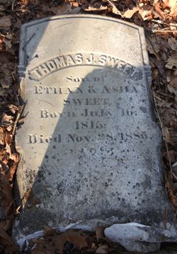
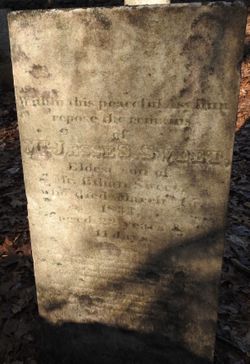
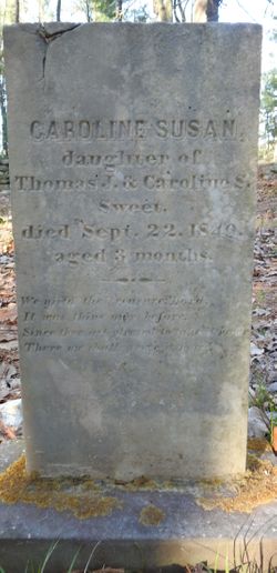
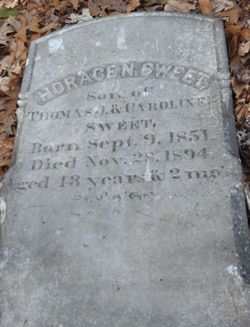
Thomas J. Sweet
| Birth | : | 16 Jul 1815 Smithfield, Providence County, Rhode Island, USA |
| Death | : | 28 Nov 1885 Smithfield, Polk County, Oregon, USA |
| Burial | : | Saint Peter Greenfield Cemetery, Vermillion, Clay County, USA |
| Coordinate | : | 42.8608017, -96.8644028 |
frequently asked questions (FAQ):
-
Where is Thomas J. Sweet's memorial?
Thomas J. Sweet's memorial is located at: Saint Peter Greenfield Cemetery, Vermillion, Clay County, USA.
-
When did Thomas J. Sweet death?
Thomas J. Sweet death on 28 Nov 1885 in Smithfield, Polk County, Oregon, USA
-
Where are the coordinates of the Thomas J. Sweet's memorial?
Latitude: 42.8608017
Longitude: -96.8644028
Family Members:
Parent
Siblings

Children


Nearby Cemetories:
1. Saint Peter Greenfield Cemetery
Vermillion, Clay County, USA
Coordinate: 42.8608017, -96.8644028
2. Clay Point Cemetery
Prairie Center Township, Clay County, USA
Coordinate: 42.8987700, -96.9065600
3. Saint Mary Cemetery
Union County, USA
Coordinate: 42.8520584, -96.7877502
4. Spirit Mound Cemetery
Clay County, USA
Coordinate: 42.8885994, -96.9424973
5. Saint Agnes Cemetery
Vermillion, Clay County, USA
Coordinate: 42.7872009, -96.8499985
6. Rockfield Cemetery
Clay County, USA
Coordinate: 42.9397011, -96.8302994
7. Clay Creek Cemetery
Clay County, USA
Coordinate: 42.8516998, -96.9788971
8. Ahlsborg Lutheran Cemetery
Union County, USA
Coordinate: 42.8228000, -96.7612000
9. Dalesburg Lutheran Cemetery
Vermillion, Clay County, USA
Coordinate: 42.9389424, -96.9242594
10. Dowlin Cemetery
Burbank, Clay County, USA
Coordinate: 42.7789001, -96.8107986
11. Bluff View Cemetery
Vermillion, Clay County, USA
Coordinate: 42.7714000, -96.9056000
12. Saint Agnes Calvary Cemetery
Vermillion, Clay County, USA
Coordinate: 42.7715900, -96.9072100
13. Brule Creek Cemetery
Spink Township, Union County, USA
Coordinate: 42.8346510, -96.7324350
14. Pleasant Hill Cemetery Old
Spink, Union County, USA
Coordinate: 42.8588462, -96.7215592
15. Olbue Lerseth Cemetery
Beresford, Union County, USA
Coordinate: 42.9281100, -96.7516100
16. Roseni Lutheran Church Cemetery
Beresford, Union County, USA
Coordinate: 42.9388000, -96.7639000
17. Dalesburg Baptist Cemetery
Dalesburg, Clay County, USA
Coordinate: 42.9675102, -96.8850403
18. Mortvedt Cemetery
Clay County, USA
Coordinate: 42.9169006, -97.0028000
19. Pleasant Valley Cemetery
Westerville, Clay County, USA
Coordinate: 42.9247017, -97.0124969
20. Pleasant Hill Cemetery
Spink, Union County, USA
Coordinate: 42.8741000, -96.6876000
21. First Brule Creek Cemetery
Elk Point, Union County, USA
Coordinate: 42.7943993, -96.7069016
22. Nora Cemetery
Union County, USA
Coordinate: 42.9314003, -96.7061005
23. Old Lodi Cemetery
Lodi, Clay County, USA
Coordinate: 42.9757996, -96.9907990
24. Union County Poor Farm Cemetery
Union County, USA
Coordinate: 42.7649210, -96.7077580