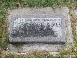
| Birth | : | 19 May 1917 Manhattan, Gallatin County, Montana, USA |
| Death | : | 19 Jul 1936 Gallatin County, Montana, USA |
| Burial | : | Spur Cemetery, Spur, Dickens County, USA |
| Coordinate | : | 33.4774704, -100.8379898 |
| Description | : | Unable to swim when he stepped into a deep hole in the Gallatin River Sunday afternoon, Thomas Wallace Campbell, 19, preliminary fighter from near Manhattan, drowned before he could be rescued. Campbell, one of several at a picnic on the east side of the Gallatin a short distance above the Cameron Bridge, was wading in the stream for coolness. He was unable to swim and apparently did not know of the hole formed in the main channel by the entrance of a side channel when water is high. There is no water in the side channel at the present... Read More |
frequently asked questions (FAQ):
-
Where is Thomas Wallace “Tommy” Campbell's memorial?
Thomas Wallace “Tommy” Campbell's memorial is located at: Spur Cemetery, Spur, Dickens County, USA.
-
When did Thomas Wallace “Tommy” Campbell death?
Thomas Wallace “Tommy” Campbell death on 19 Jul 1936 in Gallatin County, Montana, USA
-
Where are the coordinates of the Thomas Wallace “Tommy” Campbell's memorial?
Latitude: 33.4774704
Longitude: -100.8379898
Family Members:
Parent
Siblings
Flowers:
Nearby Cemetories:
1. Spur Cemetery
Spur, Dickens County, USA
Coordinate: 33.4774704, -100.8379898
2. Steele Hill Cemetery
Spur, Dickens County, USA
Coordinate: 33.4211390, -100.7882370
3. Espuela Cemetery
Dickens County, USA
Coordinate: 33.5750008, -100.8949966
4. Red Mud Cemetery
Spur, Dickens County, USA
Coordinate: 33.4265120, -100.9987710
5. Dickens Cemetery
Dickens, Dickens County, USA
Coordinate: 33.6236550, -100.8214260
6. Mayo Cemetery
Dickens, Dickens County, USA
Coordinate: 33.5970250, -100.7127960
7. Amity Cemetery
Dickens County, USA
Coordinate: 33.7193985, -100.8242035
8. Afton Cemetery
Afton, Dickens County, USA
Coordinate: 33.7658310, -100.8059050
9. McAdoo Cemetery
McAdoo, Dickens County, USA
Coordinate: 33.7252998, -101.0214005
10. Mount Zion Cemetery
Crosby County, USA
Coordinate: 33.6533700, -101.1922100
11. Crosbyton Cemetery
Crosbyton, Crosby County, USA
Coordinate: 33.6577988, -101.2099991
12. Cross H Ranch Cemetery
Post, Garza County, USA
Coordinate: 33.1996620, -101.2539300
13. Antelope Cemetery
Floyd County, USA
Coordinate: 33.8692017, -101.0980988
14. Rock House Cemetery
Mount Blanco, Crosby County, USA
Coordinate: 33.8016080, -101.2487020
15. Emma Cemetery
Crosby County, USA
Coordinate: 33.6114970, -101.4123950
16. Ralls Cemetery
Ralls, Crosby County, USA
Coordinate: 33.6732521, -101.4008408
17. Dougherty Cemetery
Dougherty, Floyd County, USA
Coordinate: 33.9503070, -101.0851670
18. Terrace Cemetery
Post, Garza County, USA
Coordinate: 33.1903000, -101.3544006
19. Justiceburg Cemetery
Garza County, USA
Coordinate: 33.0453260, -101.1963540
20. Lakeview Cemetery
Floyd County, USA
Coordinate: 33.8741989, -101.2577972
21. Kate McCommis Grave
Post, Garza County, USA
Coordinate: 33.1663990, -101.4130770
22. Cone Cemetery
Cone, Crosby County, USA
Coordinate: 33.7971992, -101.4216995
23. Buck Creek Cemetery
Paducah, Cottle County, USA
Coordinate: 33.9322380, -100.3640400
24. Resthaven Cemetery
Southland, Garza County, USA
Coordinate: 33.3527985, -101.5541992


