
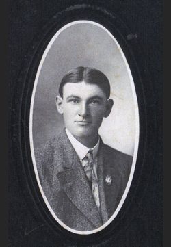
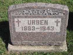
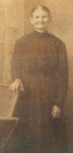
Urben Goracke
| Birth | : | 5 Aug 1883 Nebraska, USA |
| Death | : | 15 Oct 1943 Tecumseh, Johnson County, Nebraska, USA |
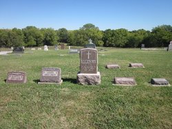
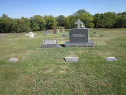
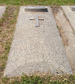
| Burial | : | Smith Chapel Cemetery, Prunty, Ritchie County, USA |
| Coordinate | : | 39.1121700, -80.9995900 |
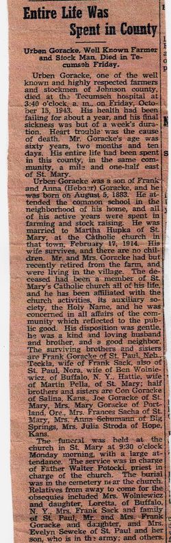
| Description | : | Entire Life Was Spent in County Urban Goracke, Well Known Farmer and Stock Man, Died In Tucumseh Friday. Urben Goracke, one of the well known and highly respected farmers and stockmen of Johnson County, died at the Tecumseh hospital at 3:40 o'clock a.m. on Friday, October 15, 1943. His health had been failing for about a year, and his final sickness was but of a week's duration. Heart trouble was the cause of death. Mr. Goracke's age was sixty years, two months and ten days. His entire life had been spent in this county, in the same community,... Read More |
frequently asked questions (FAQ):
-
Where is Urben Goracke's memorial?
Urben Goracke's memorial is located at: Smith Chapel Cemetery, Prunty, Ritchie County, USA.
-
When did Urben Goracke death?
Urben Goracke death on 15 Oct 1943 in Tecumseh, Johnson County, Nebraska, USA
-
Where are the coordinates of the Urben Goracke's memorial?
Latitude: 39.1121700
Longitude: -80.9995900
Family Members:
Parent
Spouse

Siblings
Flowers:


Nearby Cemetories:
1. Bethany Cemetery
Harrisville, Ritchie County, USA
Coordinate: 39.0956700, -81.0219500
2. Pleasant Hill Cemetery
Berea, Ritchie County, USA
Coordinate: 39.1162100, -80.9682300
3. Hazelgreen Cemetery
Ritchie County, USA
Coordinate: 39.0853004, -81.0021973
4. Britton Cemetery
Hazelgreen, Ritchie County, USA
Coordinate: 39.0841500, -80.9894000
5. Reeves Cemetery
Goffs, Ritchie County, USA
Coordinate: 39.0882988, -81.0246964
6. Pine Low Gap Cemetery
Burnt House, Ritchie County, USA
Coordinate: 39.1006400, -80.9562200
7. Hatfield Cemetery
Ritchie County, USA
Coordinate: 39.0853004, -81.0302963
8. Lloyd Brydie Family Cemetery
Harrisville, Ritchie County, USA
Coordinate: 39.1315200, -81.0416200
9. Mount Zion United Brethren Church Cemetery
Five Forks, Ritchie County, USA
Coordinate: 39.1544000, -80.9971300
10. Chevauxdefrise Cemetery
Ritchie County, USA
Coordinate: 39.1584100, -81.0192600
11. King Knob Cemetery
Ritchie County, USA
Coordinate: 39.1244011, -81.0639038
12. Pine Grove Cemetery
Berea, Ritchie County, USA
Coordinate: 39.1314011, -80.9321976
13. Frederick Cemetery
Fonzo, Ritchie County, USA
Coordinate: 39.0766983, -81.0560989
14. N.H. Frederick Cemetery
Burnt House, Ritchie County, USA
Coordinate: 39.0525520, -81.0169120
15. Burnt House United Methodist Church Cemetery
Burnt House, Ritchie County, USA
Coordinate: 39.0487301, -80.9904470
16. Cunningham Cemetery
Ritchie County, USA
Coordinate: 39.0856018, -81.0761032
17. Hardman Chapel Cemetery
Harrisville, Ritchie County, USA
Coordinate: 39.0582000, -81.0517400
18. Peter Moyers Cemetery
Harrisville, Ritchie County, USA
Coordinate: 39.1731580, -81.0427350
19. Moyers Cemetery
Ritchie County, USA
Coordinate: 39.1631012, -81.0674973
20. Spruce Creek Cemetery
Auburn, Ritchie County, USA
Coordinate: 39.0807300, -80.9083700
21. Goff Cemetery
Burnt House, Ritchie County, USA
Coordinate: 39.0361530, -80.9774200
22. Smith Cemetery
Mahone, Ritchie County, USA
Coordinate: 39.0956700, -81.1012600
23. Mount Olive Cemetery
Burnt House, Ritchie County, USA
Coordinate: 39.0531006, -80.9257965
24. Toothman Cemetery
Pullman, Ritchie County, USA
Coordinate: 39.1666680, -80.9175640