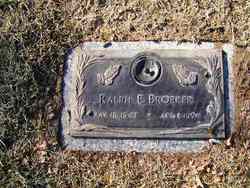
Vincent Herman Broeker
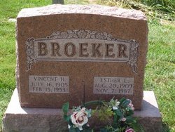
| Birth | : | 16 Jul 1905 Orchard Farm, St. Charles County, Missouri, USA |
| Death | : | 15 Feb 1953 Orchard Farm, St. Charles County, Missouri, USA |
| Burial | : | Evergreen Cemetery, Menomonie, Dunn County, USA |
| Coordinate | : | 44.8888000, -91.9122000 |
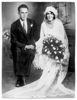
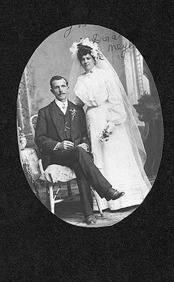
| Description | : | Vincent was the son of Henry H Broeker and Dora Dorothea A Meyer. Spouse: Esther L Kneemiller. Children: David C, Wayne E, Stanley C, Ralph E, and Paul Broeker. Vincent was caretaker for Marias Temp Claire Duck Club and a Postman. He loved hunting and the outdoors. |
frequently asked questions (FAQ):
-
Where is Vincent Herman Broeker's memorial?
Vincent Herman Broeker's memorial is located at: Evergreen Cemetery, Menomonie, Dunn County, USA.
-
When did Vincent Herman Broeker death?
Vincent Herman Broeker death on 15 Feb 1953 in Orchard Farm, St. Charles County, Missouri, USA
-
Where are the coordinates of the Vincent Herman Broeker's memorial?
Latitude: 44.8888000
Longitude: -91.9122000
Family Members:
Parent
Spouse
Siblings
Children
Flowers:
Nearby Cemetories:
1. Evergreen Cemetery
Menomonie, Dunn County, USA
Coordinate: 44.8888000, -91.9122000
2. Saint Josephs Cemetery
Menomonie, Dunn County, USA
Coordinate: 44.8835983, -91.9150009
3. First Congregational UCC Columbarium
Menomonie, Dunn County, USA
Coordinate: 44.8752100, -91.9249900
4. Christ Lutheran Halvorson Cemetery
Menomonie, Dunn County, USA
Coordinate: 44.9127998, -91.9297028
5. Potters Field Cemetery
Menomonie, Dunn County, USA
Coordinate: 44.8898900, -91.8701000
6. Faith Church Cemetery
Menomonie, Dunn County, USA
Coordinate: 44.9196050, -91.8974710
7. Saint Pauls Cemetery
Menomonie, Dunn County, USA
Coordinate: 44.8532982, -91.9199982
8. Highland Cemetery
Menomonie, Dunn County, USA
Coordinate: 44.9235992, -91.9347000
9. Peace Lutheran Cemetery
Menomonie, Dunn County, USA
Coordinate: 44.8502998, -91.9152985
10. Ford Cemetery
Menomonie, Dunn County, USA
Coordinate: 44.8718987, -91.9753036
11. Cedar Falls Cemetery
Cedar Falls, Dunn County, USA
Coordinate: 44.9247017, -91.8656006
12. Ridgeroad Cemetery
Menomonie, Dunn County, USA
Coordinate: 44.8638992, -91.9863968
13. Froens Cemetery
Menomonie, Dunn County, USA
Coordinate: 44.8288994, -91.8728027
14. Mamre Cemetery
Menomonie, Dunn County, USA
Coordinate: 44.8796997, -92.0049973
15. Tramway Cemetery
Menomonie, Dunn County, USA
Coordinate: 44.9296989, -92.0006027
16. Irvine Creek Cemetery
Irvington, Dunn County, USA
Coordinate: 44.8513985, -92.0061035
17. Little Elk Creek Cemetery
Downsville, Dunn County, USA
Coordinate: 44.8101000, -91.8726000
18. Saint Johns Lutheran Cemetery
Menomonie, Dunn County, USA
Coordinate: 44.8568993, -91.8022003
19. Saint Johns Cemetery
Irvington, Dunn County, USA
Coordinate: 44.8182983, -91.9832993
20. Beyer Settlement Cemetery
Red Cedar, Dunn County, USA
Coordinate: 44.9161110, -91.7925520
21. Grandview Cemetery
Menomonie, Dunn County, USA
Coordinate: 44.8036003, -91.9677963
22. Teegarden Cemetery
Knapp, Dunn County, USA
Coordinate: 44.9406013, -92.0242004
23. Tainter Church Cemetery
Cedar Falls, Dunn County, USA
Coordinate: 44.9542800, -91.8130100
24. Iron Creek Cemetery
Spring Brook, Dunn County, USA
Coordinate: 44.8527985, -91.7786026

