Viola M. Rodaway Maloy
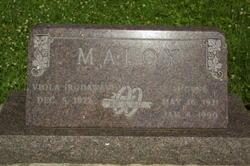
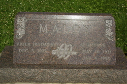
| Birth | : | 5 Dec 1922 Unadilla, Otoe County, Nebraska, USA |
| Death | : | 13 May 2010 Unadilla, Otoe County, Nebraska, USA |
| Burial | : | Sunset Cemetery, Galloway, Franklin County, USA |
| Coordinate | : | 39.9460983, -83.1847000 |
| Plot | : | 010FA plot 1 |
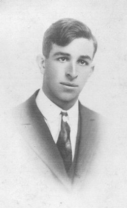
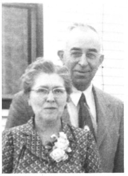
| Description | : | Viola was born December 5, 1922, to Floyd & Flossie (Luff) Rodaway. She passed away at St. Elizabeth Regional Medical Center, in Lincoln, Nebraska, at the age of 87 years, 5 months, and 8 days. Viola married Harold Eugene Maloy, on May 21, 1942, in the Paisley Congregational Church, in the Paisley Community (1st couple to be married in the newly built Church). To this union they raised Ralph, and Rose. She taught School for 35 years, in various Country Schools and finished her career in the Elmwood Public Schools. Viola was a member of Unadilla Methodist Church, Methodist Women, NEA,... Read More |
frequently asked questions (FAQ):
-
Where is Viola M. Rodaway Maloy's memorial?
Viola M. Rodaway Maloy's memorial is located at: Sunset Cemetery, Galloway, Franklin County, USA.
-
When did Viola M. Rodaway Maloy death?
Viola M. Rodaway Maloy death on 13 May 2010 in Unadilla, Otoe County, Nebraska, USA
-
Where are the coordinates of the Viola M. Rodaway Maloy's memorial?
Latitude: 39.9460983
Longitude: -83.1847000
Family Members:
Parent
Spouse
Flowers:
Nearby Cemetories:
1. Sunset Cemetery
Galloway, Franklin County, USA
Coordinate: 39.9460983, -83.1847000
2. Alton Methodist Episcopal Church Cemetery
Franklin County, USA
Coordinate: 39.9494362, -83.1728592
3. Alton Cemetery
Alton, Franklin County, USA
Coordinate: 39.9547005, -83.1682968
4. Clover Cemetery
Alton, Franklin County, USA
Coordinate: 39.9619751, -83.1682434
5. Postle Cemetery
Galloway, Franklin County, USA
Coordinate: 39.9427986, -83.1438980
6. Galloway Cemetery
Galloway, Franklin County, USA
Coordinate: 39.9091988, -83.1613998
7. Saint James Lutheran Church Cemetery
Hilliard, Franklin County, USA
Coordinate: 39.9807358, -83.1494675
8. Oak Grove Cemetery
Georgesville, Franklin County, USA
Coordinate: 39.8944016, -83.2130966
9. Gardner Cemetery
Georgesville, Franklin County, USA
Coordinate: 39.8952179, -83.2169724
10. Ebenezer Cemetery
Franklin County, USA
Coordinate: 39.8913994, -83.1613998
11. Peters Cemetery #2
Columbus, Franklin County, USA
Coordinate: 39.9325560, -83.1069740
12. Hampton Cemetery
West Jefferson, Madison County, USA
Coordinate: 39.9397011, -83.2692032
13. Gundy Cemetery
Grove City, Franklin County, USA
Coordinate: 39.8828011, -83.1557999
14. Salem Cemetery
Franklin County, USA
Coordinate: 39.9141159, -83.1077042
15. Clime Cemetery
Columbus, Franklin County, USA
Coordinate: 39.9288902, -83.0986404
16. Mount Calvary Cemetery
West Jefferson, Madison County, USA
Coordinate: 39.9364014, -83.2769012
17. Pleasant Hill Cemetery
West Jefferson, Madison County, USA
Coordinate: 39.9444008, -83.2844009
18. Foster Chapel Cemetery
West Jefferson, Madison County, USA
Coordinate: 39.9956017, -83.2630997
19. Lilly-Dyer Cemetery
Franklin County, USA
Coordinate: 39.8650017, -83.1959991
20. Camp Chase Confederate Cemetery
Columbus, Franklin County, USA
Coordinate: 39.9439011, -83.0761032
21. Grove City Cemetery West
Grove City, Franklin County, USA
Coordinate: 39.8820381, -83.1093750
22. Campbell Memorial Park
Franklin County, USA
Coordinate: 39.9897003, -83.0808029
23. Hart Cemetery
Hilliard, Franklin County, USA
Coordinate: 40.0273666, -83.1295013
24. Saint John's Lutheran Church Cemetery
Grove City, Franklin County, USA
Coordinate: 39.8807678, -83.1001129


